 Today's Route: https://www.strava.com/activities/747972261
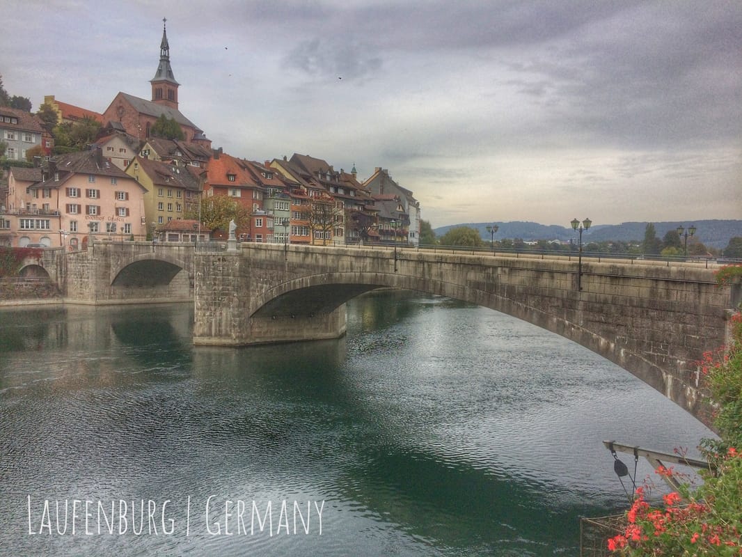
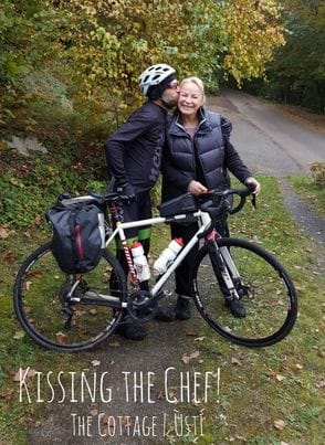 Given that day twelve of my autumn tour didn't conclude until five ante meridiem on day thirteen, I experienced, literally, one very long 48-hour day. And that's about how I felt, too, when I awoke and prepared to start day thirteen at 9:30 this morning. But if that's the price I'll have to pay each time I visit David, Jana, and Vašek at "the cottage", as David calls he and Jana's wonderful home above the Elbe in Ústí nad Labem in the Czech Republic, then I'll do so willingly and with great haste! The food, company, and conversation were the very best. And the view the next morning, despite low clouds, was exceptional. As implied, the cottage is a special place, inside and out, including all of the personalities that roam its open spaces, two cats included. Breakfast was served at about 10:15 with plenty of coffee. And the leftovers were generously transformed into a cyclist's lunch-to-go by Jana. The first sandwich didn't make it out of Bohemian Switzerland National Park (Národní park České Švýcarsko), a park with an eccentric English translation. Established in 2000, it is the Czech Republic's youngest national park. More on this park, and other details, in a moment. The second sandwich provided the fuel that I needed on the night portion of my ride that began at the witching hour in Meissen, overlooking Albrechtsburg Castle and Meissen Cathedral on the opposite bank of the Elbe, and concluded in Torgau about three hours later with only moonlight to guide me. Torgau is famous for at least one event in history, it's the place where the red army first encountered the green, US, army in 1945. It also sports a 16th century castle on a 10th century foundation, well preserved, above the Elbe. And in general, it's a poster village, cobble stone streets, a fountain in the middle, and all the architecture that you might anticipate filling-in the scene. Thick cloud cover remained the status quo throughout day thirteen of my cycle tour, not ideal for a human being wearing lightly tinted Native Sunglasses that was hoping to establish memories of a landscape celebrated for its natural beauty. More importantly for anyone following my tour on Facebook, capturing details in a digital photo was difficult, to say the least, given that one of the primary effects of such cloud cover is the complete removal of shadows. Nonetheless, so not to disappoint my mother, Evelyn Breton, or the leader of my fan club in Iserlohn, Germany, Brigitte Knorr, I did my best to record the day's scenery with a few photos, which I took the liberty to improve using Snapseed from Google. On my cycle tour, Snapseed has proven itself to be an effective and easy to use photo editing app for optimizing images intended (my suggestion) for small screen viewing, such as Apple's iPhones and iPads. The app has been my primary resource for improving photos and I anticipate that I'll continue to use the app well after my Autumn Tour concludes. Two national parks, one overseen by Germany, Saxon Switzerland National Park, and the other by the Czech Republic, Bohemian Switzerland National Park, meet at the border of the two countries about halfway between Dresden and Ústí. The conjoined parks are bisected by the Elbe. With no private lands between them, the result, for biodiversity, is a two-nation national park on an impressive European scale, a combined 172 sqaure kilometers (66.5 mi²) of land set-aside for life other than the human form. Respectful human recreation is, of course, encouraged, as in other national parks, by bike, boot, and, for these parks which contain part of the Elbe River watershed, by boat too. In the order that I experienced the parks, the area known as Bohemian Switzerland in the Czech Republic was placed under some form of protection as early as 1972, a year after I was born to Evelyn and Rodney Breton, my parents, somewhere in Norwood Hospital in Massachusetts, a state named for a Native American tribe from the Boston area that succumbed to European diseases. Following the establishment of Saxon Switzerland National Park in 1990 by the German government, "efforts were stepped-up to place the Bohemian part of the Elbe Sandstone Mountains under national park protection." Despite heated opposition from hunting organizations and the forestry industry, Bohemian Switzerland National Park was formerly set-aside for all to enjoy, rather than a few to profit from and depreciate, in 2000. Saxon Switzerland National Park (Nationalpark Sächsische Schweiz) was established before the post-WWII reunification of Germany, a statement that alludes to the scenic splendor of the region and it's recreational importance for the many visitors that the region attracts annually. Like it's neighoring park to the south. part of the name of this German national park, "Switzerland", was inspired by the Elbe Sandstone Mountains. and their similarity to the dolomitic (I assume) region of the Alps. The sandstone in particular and the impression of mountains that the Cretaceous rock formation provides in general, on a backdrop reaching high above the peaceful and scenic Elbe River, are the primary sources of inspiration for visitors that recreate in this part of Germany and Czechia. Naturally, a popular recreational activity in both parks is climbing, free-climbing is the only form allowed in Saxon Switzerland: "... characterized by its sandstone rocks which draw many rock climbers there are some 14,000 climbing routes on over 1,100 rock pinnacles. Ropes and bolts may only be used for safety but never as a means of climbing. The use of chalk and common means of protection such as nuts and friends is also not permitted; instead knotted nylon slings are used." The Elbe Sandstone Mountains, locally referred to "as Saxon Switzerland and Bohemian Switzerland in German and Czech", came about because of erosion rather than a mountain building event involving plate tectonics (an orogeny). Like the Catskills of New York or the Ozarks of Missouri, the cliffs and valleys of the Elbe Sandstone Mountains were made possible first when the land uplifted; and subsequently, over geologic time, by the natural demolition of that uplifted landscape by flowing water and other forms of erosion. The Grand Canyon of the United States, in Arizona, also demonstrates the result of uplift followed by erosion, principally by water. And I suspect the grandest canyon in our solar system, considerably grander than our celebrated Grand Canyon on Planet Earth, Valles Marineris on Mars resulted from the same processes. The Elbe Sandstone Mountains are composed, primarily, of a massive sandstone formation that formed from sand and other debris deposited by rivers in a Cretaceous sea that once covered a large portion of the European continent. These deposits were subsequently compressed, compacted, and cemented due to massive, Earth scale, overburden throughout geological ages before they were exhumed by uplift and erosion ultimately taking their present form in relatively recent time. The Cretaceous "was a period with a relatively warm climate, resulting in high eustatic sea levels that created numerous shallow inland seas [, including a massive inland sea that covered all of today's Great Plains in the heart of the North American continent]. These oceans and seas were populated with now-extinct marine [organisms] while dinosaurs continued to dominate on land. During this time, new groups of mammals and birds, as well as flowering plants, appeared. The Cretaceous [famously] ended with a large mass extinction, non-avian dinosaurs, pterosaurs and large marine reptiles, [among many other species], died out." The Elbe has cut deeper into Cretaceous formations than any other river in Europe. No doubt mined from the local sandstone and perhaps containing fossilized fragments of extinct flora and fauna, I encountered what was by far the roughest, cruelest you might say, cobble stone road on my cycle route along the Elbe today whilst riding through the German national park. Fortunately the section was less than 2-3 kilometers and the apple that I had begun eating a moment before did not dislodge from my verklemt jaw as I awaited a kinder moment to devour it. Shortly after the cobble stone flogging, I neglected my instincts and as a result came to the end of a paved cycle route. Making matters worse, or better, depending on how you conclude, I overcame my instincts one more time as I plunged onto single track and rode into the forest not far away from the east bank of the Elbe. Before it was over, I had biked, mostly hiked, and literally climbed, a set of near-vertical stairs (see the two-pointed spire on the elevation profile at the end of the blog), to the top of the aforementioned sandstone formation where I had the pleasure, a welcomed turn-of events, to overlook the countryside, river, and villages below. As this implies, it was a happy ending but the slog to that end was certainly not something you could sell in a cyclists tourist brochure. Unless, of course, that was directed at mountain bikers carrying no gear, but mountain bikes are not allowed in the park. Cobble tracks and hikes on an otherwise "cycle tour" through a national park aside, foremost from the days memories will always be my night journey to Torgau. Just as the last wisps of light were fading on the French horizon, I was enjoying a relaxing pee overlooking the beautiful River Elbe and the lights from the village of Meissen, Germany. The lights illuminated Albrechtsburg castle and Meissen Cathedral, two notably historic buildings whose construction dates back to the 10th century. As the golden stream flowed deliciously into the green Earth, I began my mental preparation for a final push, in the dark, to Torgau. Shortly after leaving Meissen I rolled over an undetected and unfriendly pointy, I assume, object that released the pressure, and most of the sealant, from my rear tire with the force of 85 pounds per square inch. Wishing for a miracle, as cyclists often do during these moments of despair, I nonetheless rode on for a short distance as the last whisps of air audibly departed my Hutchinson Sector 28 mm tire. Much to my jubilee, nearly on the last rotating gasp, what remained of the Stan's NoTubes Sealent sealed the offending hole! After a short stop to replace the air that had escaped, I was satisfied and rode on. About an hour before I rolled into Torgau, two hours into my evening asault on what remained of my hangover, my primary headlight ran out of power. It seems that the battery realized only about 20% of its expected life, it's no longer charging close to capacity. I doned my headlamp in the meantime, but unfortunately within 20 minutes that light died as well. From this point to Wolfgang's AirBnB, I occasionally salvaged a bit of light from my bike light (battery recharges a little when it's off) but otherwise navigated by moonlight. Fortunately, the road that remained was nearly abandoned this time of night. I easily avoided the few cars and lorries that passed by. Finally, at about 10 pm, exhausted beyond memory, I settled arrived to Wolfgang's charming AirBnB and Knackered as I was, the following morning I managed to sleep through my scheduled breakfast! Wolfgang was patient throughout as he was when I arrived late the night before due to my flat tire. What a way to conclude a 48 hour day. But I would still, the whole show withstanding, say it was one of my best adventures to date, certainly inspiration to tempt another tale. As my long blog entry implies, it's been an exceptional day of exploring exceptional places. Nonetheless, all I can anticipate at this moment is a long, much needed, rest. Until the conclusion of that sleep, I bid you a Guten Nacht from the west bank of the Elbe in a town that "fell under the rule of the Holy Roman Emperors in the 10th century. [At that time], a stone castle was built, round which the settlement congregated." I'm looking forward to a quick tour of Torgau in the morning. 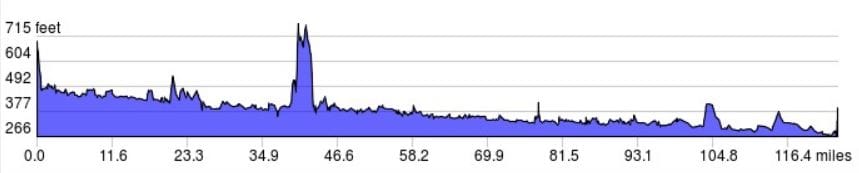 The days elevation profile courtesy of ridewithgps.com. The double-headed penis in the middle is my hike through the national park! 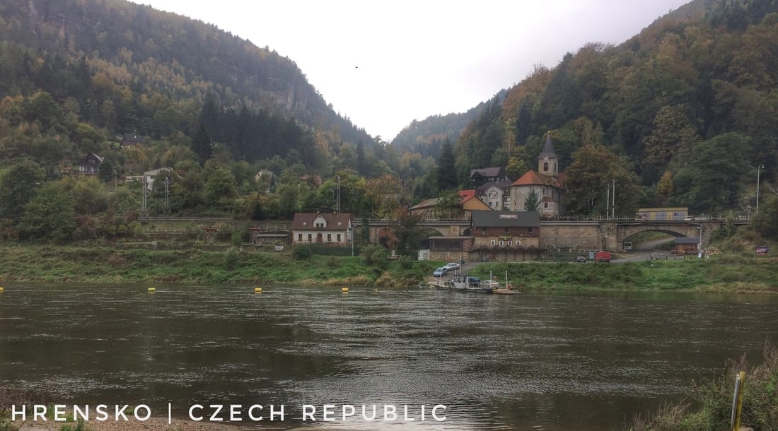 Formerly a German village on the Elbe, today it hosts the oldest ferry (dilapidated) that I encountered on the tour. 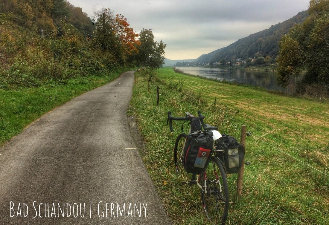 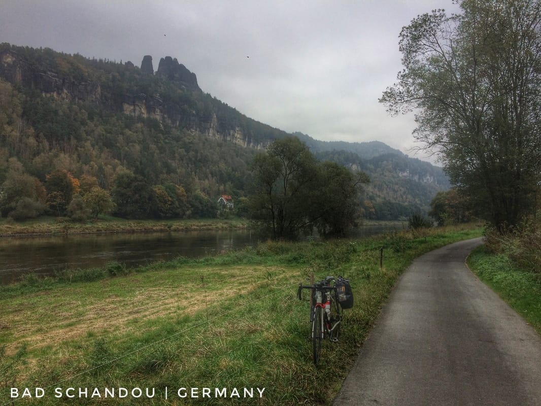 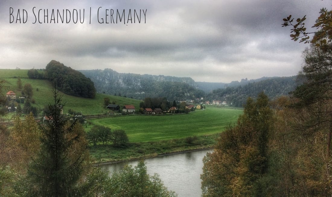
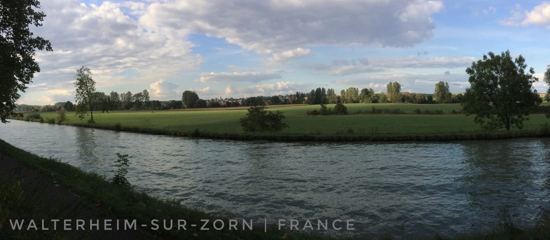
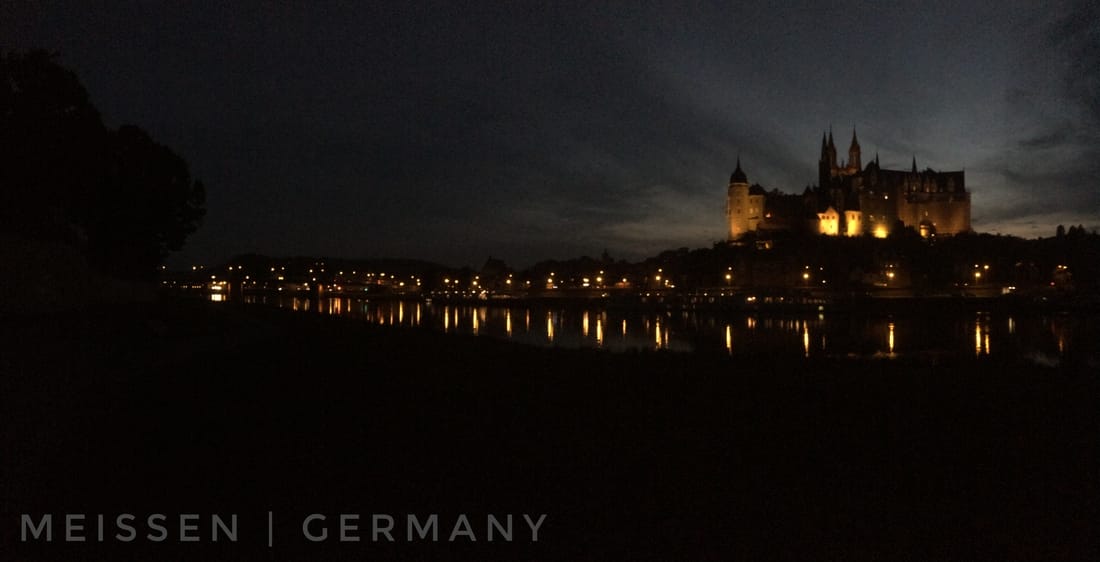 Not a bad place to stop for a pee, clip on my lights, and begin a long night ride to Torgau. On the opposite bank of the Elbe, Albrechtsburg Castle and, in the background, Meissen Cathedral. 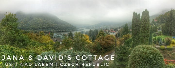 Sinsheim: https://www.strava.com/activities/746058677 Ústí: https://www.strava.com/activities/746965408 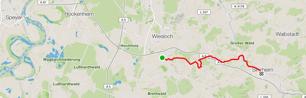 My short communte from Maik's AirBnB in Rauenberg to the bahnhof station in Sinsheim.
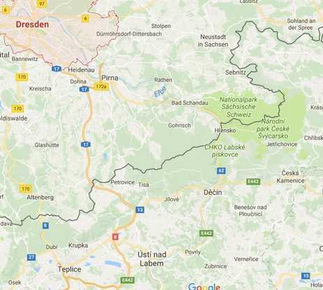 Usti is bottom-middle, national parks bisected by the Elbe River Cycle Route are middle-right, Dresden, also on the Elbe, is top-left. Map provided by Google. Usti is bottom-middle, national parks bisected by the Elbe River Cycle Route are middle-right, Dresden, also on the Elbe, is top-left. Map provided by Google. Trains were always part of what I considered possible during this trip, especially a long or short train ride back to Hamburg if my body decided it was finished. I'm feeling better than anticipated on the bike, despite many long days, and fatigue between rides has also been less than anticipated. This likely means no bail-out by train. But bail-outs aside, I have considered, before my departure from Hamburg and during my tour, other possibilities involving trains. One scenario in particular became more and more attractive as I diverged, grandiosely, from my original itinerary on day six, a decision motivated by the allure of auto-free bike trails, a random encounter outside of Metz (France) with a 70-something cyclist named "eh-mo" (Herman), the historic city of Strasbourg (France), and the possibility of exploring the famous Rhine Cycle Route between Strasbourg and Switzerland. Of course, the unplanned divergences that followed, collectively hundreds of saddle miles, had implications. Foremost, I delved into a significant proportion of the '16 days' I had comfortably allocated to the entire cycle tour when I departed Hamburg on 5 October. The idea that's been on my mind involves a giant leap, a "bishop's move" as my friend David Conlin called my idea, to the city of Dresden on the Elbe River in east Germany from a train station somewhere in the vicinity of Frankfurt. With Clarissa's help, a chessic collaboration begun yesterday well before I reached the Speyer bridge, this morning the "bishop's move" became a plan, hatched this morning, and then revised le long du chemin from the comfort of one of my comfortable, wind and rain free, carriage seats. Given that I was en route to Dresden by bahnhof, I thought "why not get in touch with a friend that lives close by?" I knew that David was roughly one hour south by train from Dresden. And conveniently, since I was planning to follow the Elbe River Cycle Route all the way to Hamburg, his cottage was high-up on the east bank of the Elbe in (bonus) the city of Ústí nad Labem in the Czech Republic. If the plan was successful, then I would visit the Czech Republic after all, part of my original plan, despite the time I spent riding to and from Switzerland along the Rhine. After a massive day by train across the German heartland, from Sinsheim to Hof to Dresden then south to Usti, involving five connections and two short bike rides along the way, I found myself well inside of the Czech Border, in the village of Ústí nad Labem, about 70 km south of Dresden. It was close to eight pm when I stepped off of the train in Usti into the darkness, among strangers, in a strange land. A short ride, 15-20 minutes followed, lights blazing off the bike, despite the long day I smiled all the way to my core, my next adventure was underway. At the cottage I was greeted with shouts, maybe some clapping, hugs and other greetings from Jana, Vašek, and David. A moment later I was holding a Czech beer. A long night celebrating new and old friendships followed, and followed, and followed, until it was nearly 5 o'clock ante meridiem. Well before this time, Vašek, a local golf pro (David's instructor) and a fabulous guy, had sensibly gone to bed. Food, libations, and enviable conversation were all on the five course menu this evening, a festival of laughter and happy taste buds that started as soon as I arrived to David and Jana's cottage high above the Elbe River about one hour after arriving by bahnhof to Usti. So here it is, nearly 5 am and I've not closed my eyes despite starting my day at 5:30 am in Rauenberg, Germany, the day before. My hosts, David and Jana, really rolled-out an exceptional evening, German Riesling, Czech Rosé courtesy of Vašek Froněk, that five course meal I mentioned, and much more. Thanks to their generosity, I'm stuffed, completely exhausted, and full of the excitement and refreshing comfort that an evening with good friends delivers after a long period of solo, introverted, travel. Sunrise is less than three hours away. That gives me some hesitation after so much Riesling, but I'm nonetheless committed to starting my last push, towards Hamburg, by noon-time. The final stage of my trip will begin with a cycle tour through two national parks that are bisected by the Elbe River Cycle Route. The parks converge at the Czech-German border (see map on the right). The Elbe River Cycle Route will be my guide all of the way back to Hamburg, that's my plan anyway. The section of the Elbe River Cycle Route that I intend to ride is over 300 linear miles (480 km), considerably longer than a rook might fly if she was to fly directly from Usti to Hamburg. As this implies, by committing to the Elbe River Cycle Route I'll also be committing to the very convoluted and scenic route. If I depart tomorrow, with what will for sure be a significant hangover, I should be in Dresden within three hours and hopefully three hours farther north by four post meridiem, perhaps even as far as Torgau where on "April 25, 1945, Soviet and American troops met at the Elbe River, marking an important step toward the end of World War II in Europe. This contact between the Soviets, advancing from the East, and the Americans, advancing from the West, meant that the two powers had effectively cut Germany in two." I want to thank my friend David for making that bit of history known to me, among others. There is much more to say about a very unusual day, evening, and morning, but I'm not up to the task at the moment. I must surrender to the pillow and my bed before the sun makes its next debut on the horizon. I'll provide more details tomorrow. Until then, Guten Nacht from the Czech Republic, a country that "ranks 27th [on the list of] most environmentally conscious countries in the world [by the] Environmental Performance Index. The Czech Republic [has] four National Parks and 25 Protected Landscape Areas." 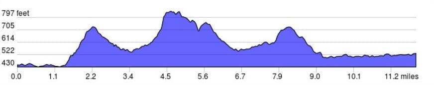 Elevation profile Rauenberg to Sinsheim (ridewithgps.com).  Elevation profile Usti to David's cottage (ridewithgps.com). 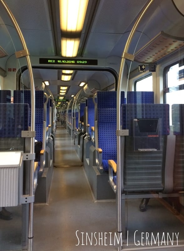
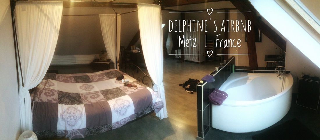
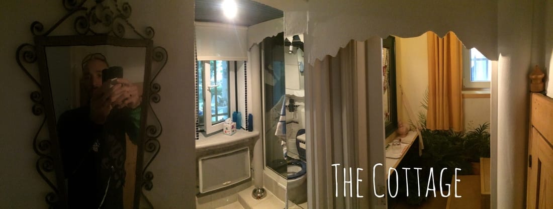 If you're lucky, then a visit to "the cottage" means that you get your own private mini-apartment, a space integrated into the main house. This photo and the next capture most of this guest space. 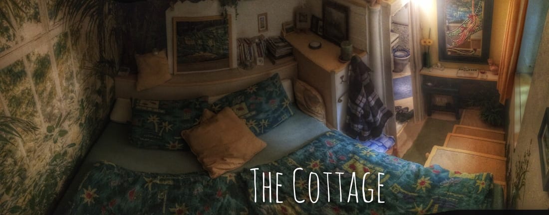 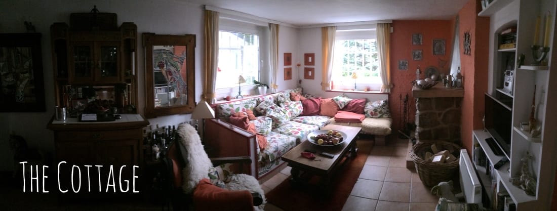 One of the common areas in the cottage. 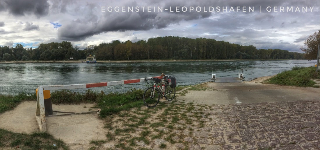 Today's Route: https://www.strava.com/activities/745583189
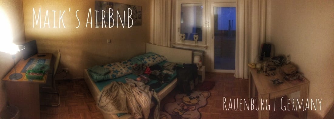
Last night I laid my head onto the pillow at about 9:45 pm, was asleep by 9:50, and woke at 4:30 feeling rested. It seems I needed some rest after yesterday's three cul-de-sacs and more, including just under 130 miles on the saddle. I rolled-out of Offenburg, "a city with about 57,000 inhabitants", at about nine o'clock, roughly two hours after I exited the misery frame. Right away, within a kilometer, freelancing led to two flights of stairs; I was happy to climb and then descend them, on foot, respectively. Shortly thereafter, I found myself in rolling foothills, mostly furbished by apple orchards and grape vines, on an enviable one lane road which was sometimes deeply entrenched, so much so that you could lean your bike, nearly vertical, on either road bank. As always, I cherished the country setting. The air was warm relative to most of the mornings I've experienced on the tour. And even better, by noon the sun was shining through partly cloudy skies. After roughly 20 country miles, first northward and then (most of the miles) westward, I was again approaching the Rhine, my companion for the last few days. At the east bank, I turned right, to the north, and resumed my commitment to the Rhine Cycle Route. It was often fast and smooth, but just as often convoluted, resulting in a grand tour of the region. Which is excellent unless you're hoping to bag many miles in a day. These and other circumstances led to a switch from river bank right (east) to left (west), by ferry, and soon I was rolling along at 18-22 mph on smooth pavement where naughty cars are not allowed. Ferry crossings have been an important part of my trip, as they were when I was undertaking the bulk of my North America touring, from about 1996 to 2005, by motorcycle in my 20s and early 30s. A decade of off-and-on-again touring, including five major tours (one of these covered 24 states, 16,000 miles, and 6 months) and many smaller tours. Along the way, I explored all of the lower 48 states and Canadian Provinces east of Manitoba including Newfoundland and Labrador. My preferred lodging in those days was always, exclusively, a tent! Most of the touring was from the perspective of a 1982 CX 500 Honda motorcycle which I purchased for 250$ from a family friend. The bulk of the total mileage was absorbed by this very reliable motorcycle, close to 80,000 miles (128,000 kilometers). In my 30s I acquired, for a short time, a 1983 GL650 Honda Silverwing on which I continued to tour by motorcycle. My last purchase of a motorized two-wheeler was in my 40s, a 2004 GSA 1150 BMW. During my years of touring by motorcycle, I discovered that the path less followed was always best, and sometimes, to avoid major bridges, those paths led to relatively sleepy auto and passenger ferries across North America's most famous rivers including the Ohio and Mississippi. I've carried-over my fascination with rivers and ferries, developed as a motorized touring adventurer, into my latest passion, light bicycle touring. So far, on my first bicycle tour of Europe, I've used ferries, a convenient and inexpensive option, to cross three culturally, economically, and historically significant rivers: on day one I crossed the Weser River at Sandstedt, Germany; day three I crossed the Meuse River on my way to lodging in Baarlo, Holland; and today I crossed the Rhine close to Leimersheim in Germany. The Weser "River is the longest river whose course reaches the sea and lies entirely within German national territory ... eight hydroelectric dams stand along its length (744 kilometres [462 mi])." The Upper Meuse River "from 1301 roughly marked the western border of the Holy Roman Empire with the Kingdom of France. The Meuse and its crossings were a key objective of the last major German WWII counter-offensive on the Western Front, the Battle of the Bulge in the winter of 1944/45." And regarding the Rhine, "The Rhine and the Danube formed most of the northern inland frontier of the Roman Empire and, since those days, the Rhine has been a vital and navigable waterway carrying trade and goods deep inland." Of course, this brief lesson in history from Wikipedia is just, the tip of the East Antarctic Ice Sheet. On either bank of Europe's major rivers, access to ferry crossings are not uncommon and hours of operation easily accommodate a traveler that can never be certain when they might arrive to the loading area. And beyond convenience, cost, and other practical reasons, crossing a river an a small auto and passenger ferry is a wonderful way to experience a river. You'll be forced to get off of your bicycle, or motorbike as I was in my youth, breath the air rising-off of the river and adjacent wetlands, listen to the sounds, and perhaps even have a short conversation with another traveler that might lead to previously unknown opportunities down the road. From Leimersheim, on the west bank of the Rhine, I maintained a comfortable, unimpeded, light cycle touring pace north to Speyer. At Speyer, a town inscribed as "Noviomagus on the world map of the Greek geographer Ptolemy [in AD 150]", I climbed a set of stairs, attached to the southwest quarter of the Speyer bridge. This unconventional cycle touring move gave me access to a route over the Rhine, to the east bank, and beyond into the foothills of the Alps in this part of southern Germany. After a successful search for lodging using the AirBnB app, as I was clipping each shoe into my RLT 9 Steel bicycle, I found myself feeling a little sad as I looked down, over my right shoulder, on my ageless friend for what I knew would be the last time on this trip. The Rhine, despite centuries of manipulation, easily inspires. Even in its modern form the river remains worthy of everyone's bucket list. No doubt, I'll reflect, with fondness, on my experiences along this historic river well into my old age, whatever "old age" that happens to be. As I rolled off the bridge, towards the east, I began what was some hasty, to avoid darkness, navigation to a supermarket followed by the same to my resting place for the evening in the village of Rauenberg, 15 km south of Heidelberg. I arrived just as the sun was dipping below the horizon, early enough for a few photos of St. Peter and Paul Church in the village center. Any time I'm forced to slow down in a village, and even better, to sleep there, I'm thrilled. For the most part, I've had enough of navigating through cities on this trip, though those experiences have not been wasted either. Anyone following my blog entries should anticipate a big surprise tomorrow, a "bishop's move" that will completely change my perspective, and yours. In the meantime, this evening I'm settled-into Maik's AirBnB, a gem of an AirBnB lodging option. Maik offers, for 56$, a spacious room, covered area to stash your bike, and a home made breakfast including brotchen picked-up fresh in the morning at one of the village bakeries. Maik, his two daughters, and his wife are open, friendly, a joy to visit and talk with. And if you forget anything, Maik has you covered: beer; wine; tooth paste; and more. Just outside my door the voices of excited youngsters are contagious. From this enviable perspective, I bid you a Guten Nacht from a village in the foothills of the Alps "first mentioned in 1303 ... where in the Middle Ages there were two settlements, Wederswilre and Ruhenberg." 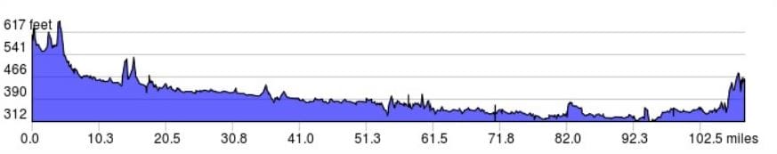 Elevation profile courtesy of ridewithgps.com.
  Note, the village should be spelled RauenBERG not RauenBURG ... 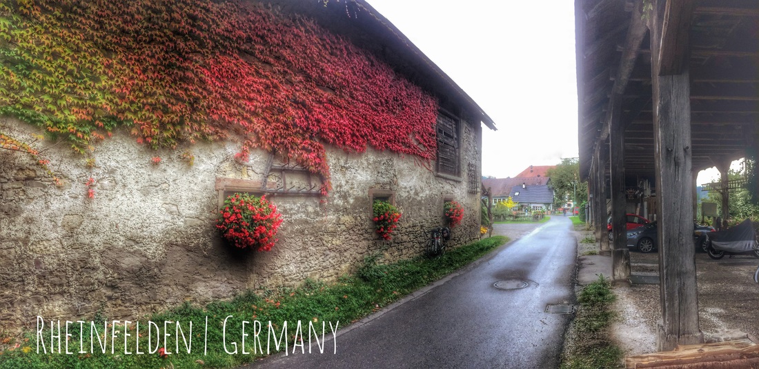 Perhaps the most uncooperative day, as far as light, for images that I experienced over the 16 day tour. Nonetheless, I managed to capture a couple of salvageable photos including this one taken in the village of Rheinfelden in Germany. Today's Route: https://www.strava.com/activities/744435501
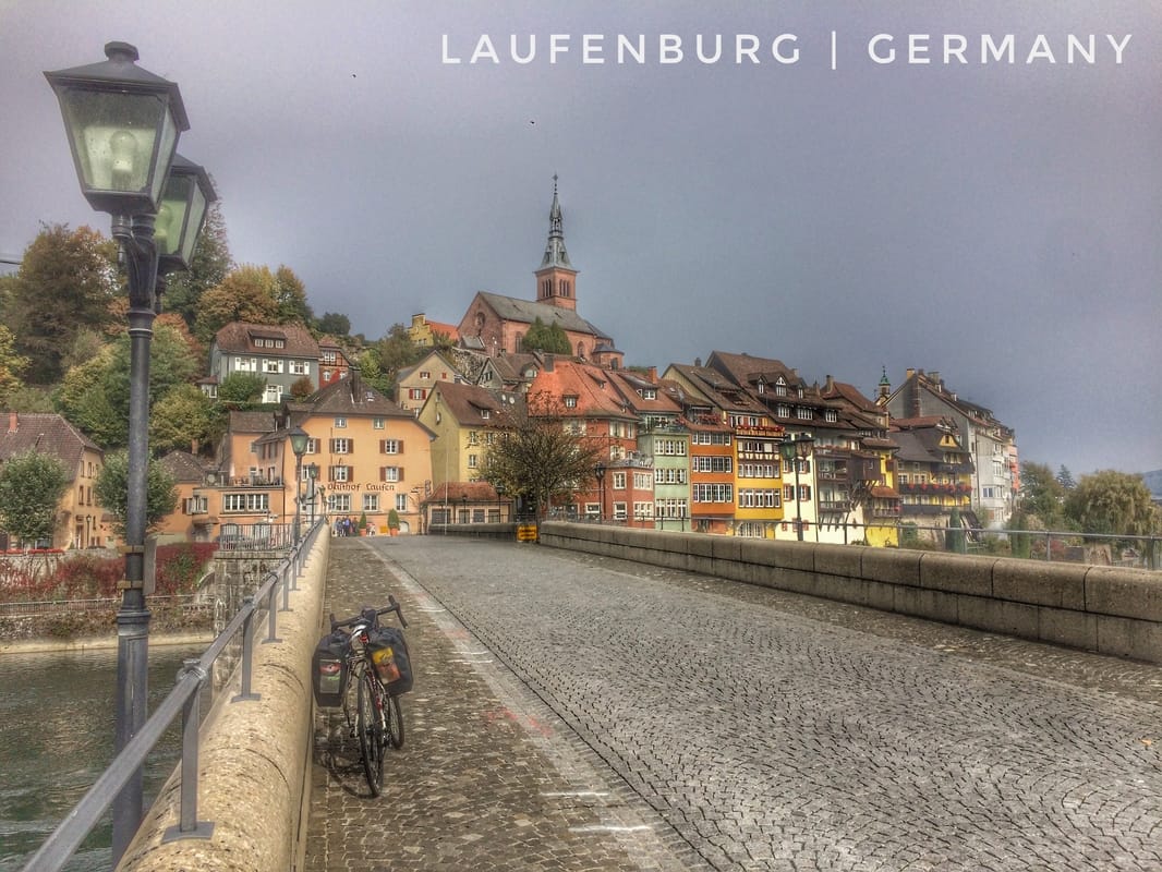
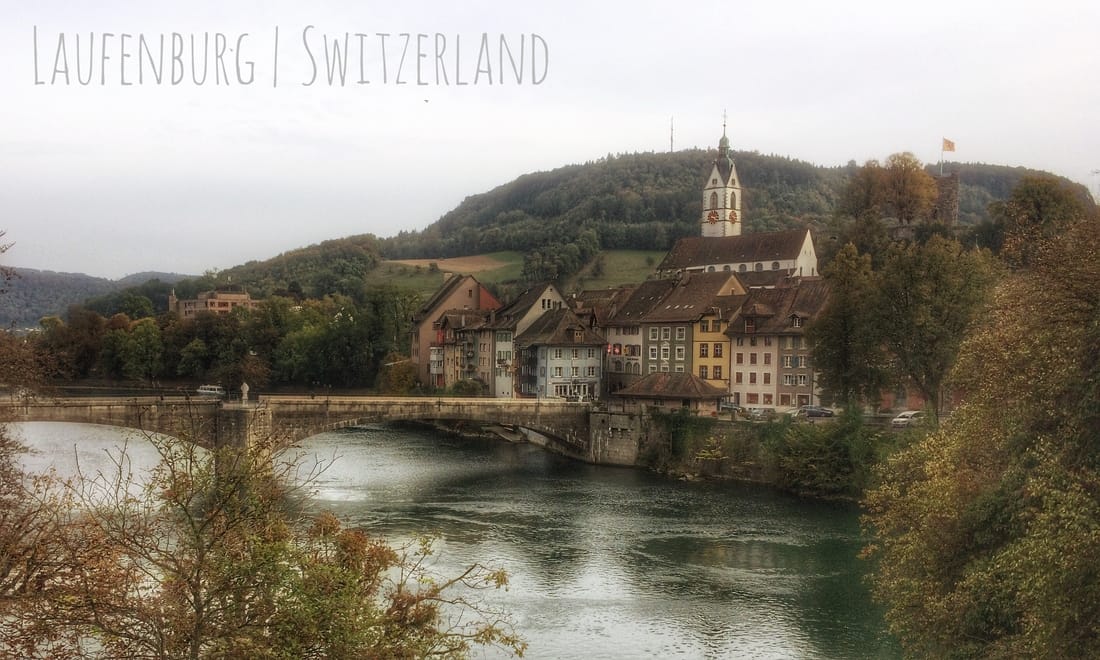
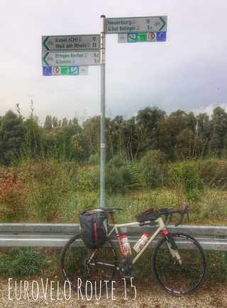 Signs marking the Rhine Cycle Route in this part of Germany. Signs marking the Rhine Cycle Route in this part of Germany. A long day as I followed the Rhine on the German (east) side, 129.9 miles (208 km) with a modest 1039 feet of climbing. That's my longest ride out of ten days, as far as I can recall, since leaving Hamburg. Despite the few ups, the distance combined with cool, wet, overcast weather was enough to wear me down by the time I arrived to my intended destination for the day, Offenburg, Germany. Offenburg is directly east of Strasbourg, where I stayed in France at the conclusion of day seven, on the opposite bank of the Rhine. At this implies, I rode for about 1.5 days on the west side of the Rhine ultimately concluding in Laufenburg, Switzerland. After today's effort, I'm back where I started after just one day of riding in the opposite direction, all close to, and often directly on, the east bank of the Rhine. On my way to Offenburg, I intentionally bypassed the famous town of Freiburg, Germany. This decision allowed me to avoid inevitable route finding challenges and in effect maintain an average 15-16 mph pace all the way to Offenburg. Along the way, other than a few exceptions, most notably the route I took to bypass Freiburg, I took full advantage of the well marked and cycle-friendly Rhine Cycle Route (EuroVelo Route #15). My priorities on this trip aside, Freiburg will be well worth visiting on a future cycle touring adventure. A small sample from Wikipedia leaves an appropriate impression: "[Freiburg] was strategically located at a junction of trade routes between the Mediterranean Sea and the North Sea regions, and the Rhine and Danube rivers. In 1200, Freiburg's population numbered approximately 6,000 people. At about that time, under the rule of Bertold V, the last Duke of Zähringen, the city began construction of its Freiburg Münster cathedral on the site of an older parish church." In the middle ages, "the need to find a scapegoat for calamities such as the Black Plague, which claimed 2,000 area residents (25% of the city population) in 1564, led to an escalation in witch-hunting that reached its peak in 1599. A plaque on the old city wall marks the spot where burnings were carried out." The word parish refers, in this context, to a territorial unit of the Catholic church. The foundation of the "older parish church" was no doubt part of a human presence in Freiburg dating back many more centuries beyond 1200 CE, and perhaps into antiquity (ancient times). Offenburg has it's own colorful history to offer the curious traveler: "Remainders of Roman settlements have been found within the city's territory. Offenburg was first mentioned in historical documents dating from 1148. [By] 1240 Offenburg had been declared a Free Imperial City [same as nearby Freiburg]. [Dreadfully,] in September 1689 the city - with the exception of two buildings - was totally destroyed [by naughty French troops] during the Nine Years War. [And a century later, following] Napoleon's dissolution of the Holy Roman Empire in 1803 and [the] reorganization of the German states, in 1803 Offenburg lost its status as a Free Imperial City and fell [instead] under the rule of the Grand Duchy of Baden." By this point on my trip, I was occasionally concerned, but not overly so, about the number of days I could, comfortably, allocate to the cycle tour given existing work commitments. I had this concern in mind when I set-off to Offenburg from Laufenburg, a nine hour ride covering about 130 miles, and the same when I made plans, in my mind, to depart Offenburg tomorrow morning without stopping to sample the city's exceptional history. Despite these conclusions, Offenburg and Freiburg nonetheless provided a delicious morsel to fuel my mental gymnastics even if the bulk of that inspiration, a main course, will have to wait for an adventure with different priorities. For what remains of this trip, my priority is to ride from somewhere in the Czech Republic to the River Elbe then follow the Elbe River Cycle Route back to Hamburg. I hope to return to Hamburg within about 16 days of my departure date (5 October). As the "somewhere in the Czech Republic" implies, I'm reconsidering my route to, and including, Cheb. I'll hatch those changes, if any, soon. The EuroVelo Route #15 on the German side of the Rhine is fast, for the most part well signed, and scenic. Unlike the same route on the French side, the Rhine Cycle Route in this part of Germany is often alongside the Rhine rather than alongside canals. My only complaint for the day, other than my own blunders that led to three cul-de-sacs (more below), is that I could have done with less riding on the tops of levées. From the vantage of a levée a solo rider has a lovely view of the river and adjacent wetlands but they also experience the full wrath of the wind, which was blowing into my face and over my left shoulder most of the day with moderate intensity. It was the wind that drove me, not mad, but towards alternate routes, some of which I cannot recommend. Despite more than sufficient signage and a GPS staring-up at me, today I still managed to ride myself into not one or two cul-de-sacs, but three! Each time, I was faced with the river or a canal on my left, the end of the road ahead of me, and a canal on my right. Each time, I had to turn back and repeat, in one case many miles, the ride back to where I'd gone awry. On the third and worst trial of them all, a attempted shortcut back to the main route resulted in a rendezvous with bait used to draw in pigs and the offending hide directly ahead of me. Fortunately, a man on a bike starkly contrasts with a pig on a hoof, and so perhaps, for this reason, I was not shot dead. However, for reassurance, I offered a few verbal "don't shoot, helloooo" requests from my RLT 9 Steel bicycle as I made my way past the hides inky shadows, no doubt in a verklempt state. By the time I recovered from the third cul-de-sac of the day, I was searching for wisdom from which I can offer this sage advice: when navigating within the network of river and canal along the Rhine stick to the main, well signed, route; taking shortcuts will almost always lead to disappointment and perhaps even a morbid conclusion. Cul-de-sacs and the inky shadows of a pig blind withstanding, I did survive to tell the tale of a memorable and enjoyable adventure today, the tenth day of my tour. I'm going to recall the day this way while my subconscious smooths over any rough edges. In the meantime, my eyes, wet and running most of the day because of the wind, will be getting some much needed rest in the space allocated to me within Susanne's lovely AirBnB which includes, for 56$, all the Illy Espresso I dare to drink (a fair bit in the morning), an espresso machine, and a secured basement for stashing my bike. From the city that witnessed the "first democratic demand" in what is now modern Germany, I offer you a Gute Nacht und freche Träume. 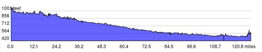 The days elevation profile courtesy of ridewithgps.com. 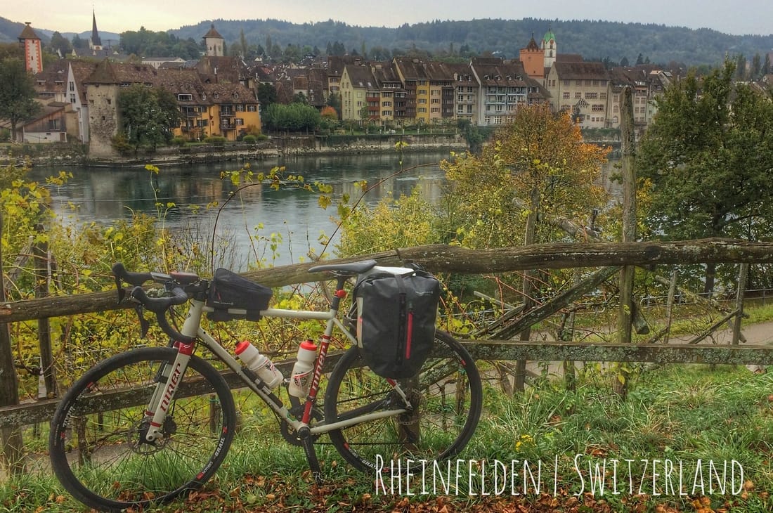 From the vantage point of Rheinfelden, Germany, on the east bank of the Rhine, the image is looking across the Rhine to Rheinfelden, Switzerland on the west side of the river. 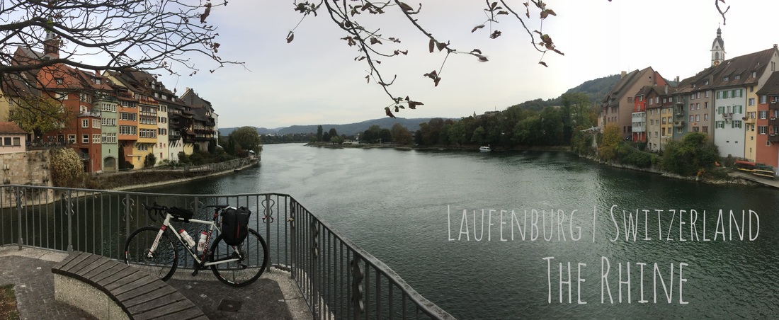 Today's Route: https://www.strava.com/activities/743349153   Each day unfolds as it wishes, and this morning was no exception. The day unfolded slowly starting with four Illy Espresso's made in the kitchen a few meters from my room, for which I paid 41$. My slow pace was motivated by the cold, likely the coldest morning so far, just 2.8 C (37 F) at 9 am; by the weather forecast, windy and overcast with rain possible throughout the day; and the stage of the trip, 1,333 kilometers (833 miles) in my legs since leaving Hamburg at the conclusion of yesterday, day eight. For this suite of reasons, I departed Srdjan's, a Serbian from Belgrade, at a few minutes after 10! The air was cold and thick with moisture from the night before, my glasses easily fogged-up if I wasn't careful, and my nose ran like the Rhine. As I implied, I wasn't sure where I was going when I rolled onto the tram tracks in front of the building containing Srdjan's flat, except for the first mile, a short section of bike trail that I could easily see on my OpenFeitsMap base layer. If you own a GPS and are not aware of these open-source maps, then I recommend checking them out for cycling in Europe. The cycle route detail is exceptional and, so far, 100% accurate. Much of my freelancing through the countryside would have been much more difficult, led to regrettable route choices, without these free maps. The base layer was so helpful that I made a donation to the open-source effort shortly after returning to Hamburg. Despite the weather, drizzle, cold, thick cloud cover, and a light wind, my planned mile serendipitously included a fascinating ride through old Basel starting with the "middle bridge", das Mittlerer Brücke or Mittlere Rheinbrücke, in the German language spoken by native Baslers: "The Mittlerer Brücke is the oldest crossing of the Rhine in Basel. The first bridge in this [location] was built in the first half of the 13th century," The original stone bridge, renovated many times throughout history of course, was replaced by an iron bridge in 1903 which remains to this day. Digging into a bit of history associated with this bridge led to some challenging translations, but enough of the details to get a sense of a shockingly morbid past: "The [stone] bridge ... served [throughout medieval history] as a [place for conducting executions] ... the death sentence was [typically] carried-out by drowning ... child-murderers, adulteresses and thieves [were] thrown into the river on their hands and feet. If they were still alive ... at ... Thomasturm, which is about 800 meters away, ... the then border, the ... death penalty was [dropped] and [they were] banished ... from the city instead. Resuscitation measures for the drowned ... had been known and spread throughout Europe since the early modern age. For this reason, too many condemned survived, so that drowning was replaced by beheading in 1634. [In] another form of [execution carried-out from the stone bridge the convict was] tied up and [tethered] to [the bridge], the convict [was then] flooded three times under the bridge." After pausing, mid-way across the Mittler Brücke, for a few photos, I covered the short distance to the opposite bank of the Rhine and, after missing the turn the first time around, turned-back and made a hard right and was then immediately faced with a steep, 18% plus, climb on a narrow cobble stone track. At this point, it was clear that I'd entered a popular tourist area, some were off their bikes, pushing towards the summit, a few more were chatting as they sauntered, hands-free up or down the Rittergasse. At the top of the short climb, I encountered a common feature of old European towns and villages, a constantly flowing water spigot with a bathtub like pool below the spout. I dodged the few tourists that happened to be sharing the less-than-ideal weather day with me, added another horrible suite of photos to my morning collection, and rode on to, my surprise, the historical Rathaus ("council house") and marketplatz. The council house dates "from the 16th century ... and is decorated with fine murals on the outer walls and on the walls of the inner court." The market place, including the Rathaus, conjured up an image of bygone days, when beggars and guilds were the norm and religion was the source of all knowledge. After exiting the marketplatz, I soon found myself descending a narrow, slippery, cobble-surfaced road back to the river. Along the way, I cycled past many more picturesque scenes of old Europe, including a stream that descended via a series of man-made water falls between houses down to the Rhine . All told, from the bridge to the descent, most of an hour, I enjoyed a wondrous mile. But it seems that everything comes with a cost, as it was in this case, because at the end of my serendipitous tour of old Basel I entered a very different scene, what we might call "modern" Basel. Industrial, smelly, trafficked, without cycle lanes or even much of a road shoulder, a place where lorries make the rules and cyclist focus on breathing and staying alive. It was quit a shock for a naive visitor from North America that was carrying with him images of a storybook land, including clean water, the smell of forests in the air, green hills, and the majestic Alps in the background. At the time, as I struggled to find an alternative route, each time returning to the main road and the traffic, I thought this was going to persist for much longer. But after roughly an hour, and following a few false starts on sections of, what turned out to be, short dirt tracks through the forest, I eventually found a dirt cycle route (one-lane road) along the river that went on for many kilometers. And it was worth the wait. I was not deep within the forest, in reality, but it felt that way and that's all that mattered as it allowed me to come down from an over aroused state-of-mind. That short ride through industrial Switzerland ultimately led me to fond memories of natural landscapes, the river and the forest, shags and other bird life commuting over the Rhine, images for reflection when I am old and withered. What I tolerated through "modern" Basel and adjacent communities is an example of something I've reflected on a few times on this trip: mistakes are not necessarily a bad thing, like choosing a route through industrial Switzerland; they can instead, if you allow them time to mature, lead to a serendipitous conclusion. Today, I considered ending my short ride through Switzerland early, crossing the river and turning north into Germany, but instead I persisted. The result was beautiful vistas along the Rhine and at the conclusion of my day, a place to explore and sleep in one of the prettiest villages I've been lucky enough to visit. My mistake was an awful route from about mile three to fifteen. But it worked-out well, very well. I'm planning to make more mistakes tomorrow! For my short day, and in celebration of reaching the southern extent of my little tour, shortly after rolling into Laufenburg I went to another restaurant! That's two in two days, null the previous seven days. And wow, so good, so good. Salad, pasta, and more. Plus an alcoholfrei beer. Prost! After lunch-dinner I asked the restaurateur about lodging and she knew of a BnB owner two doors down on the same little cobbled street in Laufenburg, Switzerland. A moment later she was off the phone and I had the last room for about 50 Euro. I'm living a privileged life this evening. Before I close I want to share some of the history of the twin villages of Laufenburg, a village split by the Rhine and overseen by two countries, Germany on the east bank and Switzerland on the west with a car-excluded bridge between them: "This strange situation dates back to the Napoleonic wars. Before that, both sides of the Rhine were Austrian territory. The former Austrian province was divided in two along the Rhine, the north Bank going to the Duchy of Baden, and the south bank to the Kanton of Aargau. Ever since then there have been two Laufenburgs." As the images, below, demonstrate, the villages offer, in their architecture and their placement on either bank of the Rhine, a storybook scene worthy of my North American naiveté. The German village of Laufenburg was first noted in 1207. Despite by far my shortest distance in nine days, it has nonetheless been a tough day at times, wind and cold, trucks, noise, and the smells of industry. But the result, the here and now that it all led to, is my own private Wonderland. I'll smile into sleep and look for more rabbit holes in the morning. Until then, I bid you Guten Nacht from Janet's beautiful Bed & Breakfast on the west bank of the Rhine where in 1792 the French Revolutionary Army established its base camp. 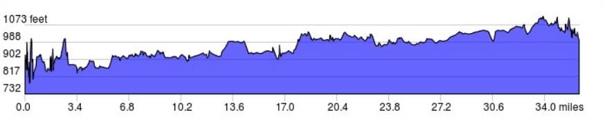 Elevation profile provided by ridewithgps.com. 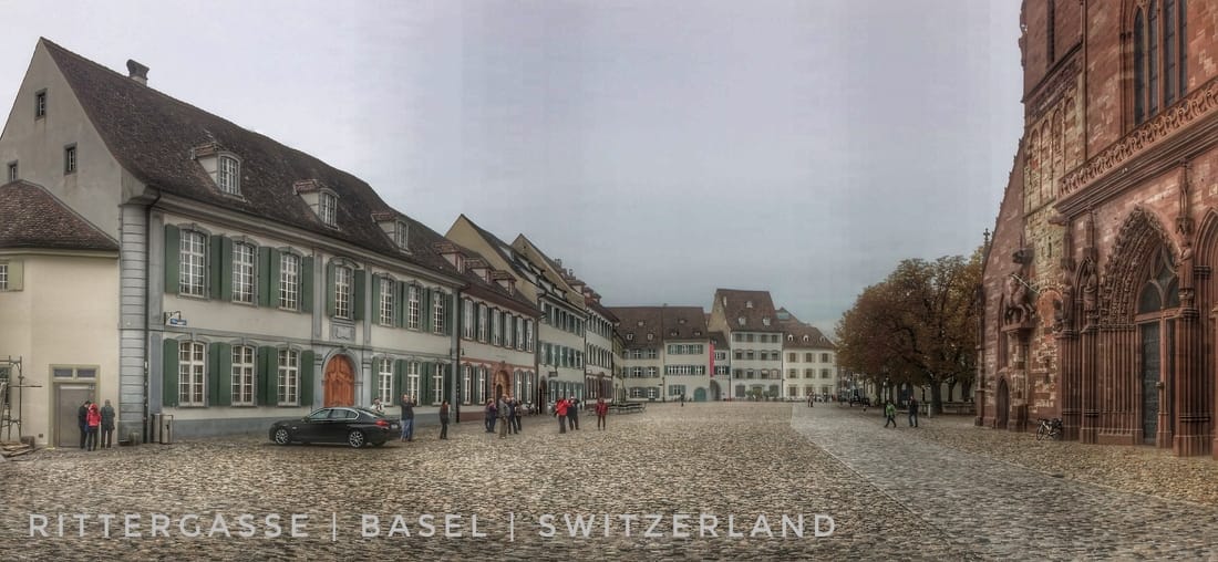
 Between the clouds and the town the Alps are on my horizon eight days after departing Hamburg. Today's Route: https://www.strava.com/activities/742499350
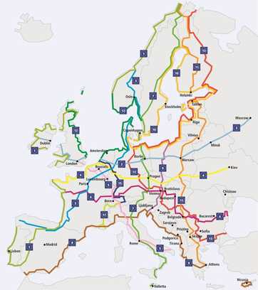 The fifteen Eurovelo Routes from www.eurovelo.org/routes/. The fifteen Eurovelo Routes from www.eurovelo.org/routes/. The EuroVelo 15, aka, Rhine Cycle Route, follows the Rhine from its source in the Swiss Alps to its end at the Nordsee in the Netherlands. As the number fifteen implies, there are other EuroVelo routes: as of October 2016, fifteen are either completed, like the Rhine Cycle Route, or in some stage of development, such as the EuroVelo 9. When the EuroVelo 9 is completed, cyclists will be able to ride from the East Sea in Poland all the way to the Adriatic in Italy; a distance of 1,930 kilometers (1,199 miles) all on a well-marked cycling route. The list of EuroVelo routes on this web page is truly enviable fodder for any contemplative cyclist. If you're addicted to your bike(s), then I advise that you check it out right away and start making your own plans to explore a portion of the over 70,000 kilometers (43,495 miles) of signed cycling routes. Put that in your dirty bike sock and eat it! Whilst sipping coffee this morning, I was thrilled when I discovered that the EuroVelo 15 was less than 200 meters from my room at Eric and Julie's AirBnB in Strasbourg. That proximity made the start of my day far simpler, or at least it should have anyway, than navigating through the city of Strasbourg in search of the famous bike path by the Rhine. Nonetheless, as I approached the city center, by this point already on the Rhine Cycle Route, I still managed to miss a few turns, each time requiring that I turn-around and relocate the route. Those errors withstanding, it took less than 30 minutes to exit the city where I was on my way to Switzerland via the Rhine Cycle Route on the French side of the river. As I exited town, I was aware of a famous church, Strasbourg Cathedral, easily visible at times, to the north, from the bike route. But I decided to ride on, perhaps on my next visit to Strasbourg I'll make my introduction to this exceptionally historic building: "At 142 metres (466 feet), it was the world's tallest building from 1647 to 1874 (227 years), when it was surpassed by St. Nikolai's Church, Hamburg. Today it is the sixth-tallest church in the world and the highest extant structure built entirely in the Middle Ages. [It was] described by Victor Hugo as a "gigantic and delicate marvel", and by Goethe as a "sublimely towering, wide-spreading tree of God." On the French side of the Rhine, as this implies the Rhine Cycle Route is available on both sides of the river, at times a moderate headwind shaved some of my speed. Otherwise, on varied surfaces including hard-packed dirt and pea gravel, I managed to keep a reasonable bike touring pace, average 15-16 mph (24-26 kph) but often 20-22 mph (32-35 kph), with a body that is now eight days into a long bike trip without a break. Three hours into the ride I passed through a small village, wandered around, was nearly run over by a kid on a scooter, and eventually found what I was looking for, a baguette! The last few days I've had one hanging out of a kit pocket or two, broken in half, for refueling on the go as I pedal across the countryside. They're excellent bike food, along with fresh apples, cherry tomatoes, and nuts. And when I stop cheese, sliced meats, and other easily carried foods have also been popular on the shop-as-I-go menu. Despite the #15 being complete, including signs, it's still tricky to follow in and out of human population centers, even small villages. That's led to many mistakes, including one that I decided not to recover from, instead I rode on, a decision that turned out to be serendipitous. Soon I was spinning through a forest, alone, just the bird chatter to keep me company. It was a nice break from route finding. I continued south on a very straight line for many miles, made-up some time along the way (recovered my average 15 mph pace for the day), and enjoyed a road, and cycle route, less traveled. My biggest surprise today was the absence, with rare exception, of the Rhine on the French portion of the Rhine Cycle Route that I followed from Strasbourg to Basel. Instead, the French route favors often paved (not exclusively) bike paths along a network of canals that parallel the Rhine. I was slightly disappointed by the absence of the famous river. Nonetheless, the route did not disappoint an adventure seeking cyclist and if I'd had more time there were plenty of opportunities for side trips, especially the famous Alsatian Wine Region including the self-proclaimed capital, Colmar, France: "[Colmar} considers itself to be the ... capitale des vins d'Alsace. The city is renowned for its well preserved old town, its numerous architectural landmarks and its museums." For a cyclist, an evening in the old town to sample the wine and a part of a day to make a quick tour is certainly an enviable objective. Hopefully, I'll get a second chance to sample the Alsace. Basel made itself known in typical urban fashion as it grew out of the woods and verge until it surrounded me on all sides, a wee bike rider in contrast. Basel is small relative to New York City or even Hamburg, but it's nonetheless a city by any measure, "urban" and all that the word implies. As has become my habit, I located a grocery store and purchased what I needed for an evening meal, breakfast, and snacks the next day (on-the-go bike food). Then I did something I've not done since I departed Hamburg, I went to restaurant! For this occasion I chose an Indian take-out option that also had stay-and-eat seating. I ordered an appetizer followd by two entrées, I could have eaten a third. My body celebrated each bite of the warm, spicy, food. Up until this foray into an Indian kitchen, warm food had been on the menu only one other time, at the conclusion of day two. I have some ideas about tomorrow but at this moment I'm still contemplating most of the details. Uncertainty aside, soon I must begin my northward migration towards Hamburg and Northern Germany. Following today's unplanned ca. 100 mile ride from Strasbourg south to Basel, I'm now over 500 miles, 800 km, from Hamburg by the shortest auto route. That confirms that I'll be riding on for some time, apparently, before I perform the last pedal revolution at the end of the tour. This evening my AirBnB host is a fellow from Belgrade, Serbia. Srdjan eventually met a Swiss lady, Mirijam, in Switzerland and never left. Srdjan kindly offered me a beer in the evening and we discussed, mostly he educated me, his experience living in Serbia, including the period from 1992 to 1995 when adjacent Bosnia and Herzegovina were at war and carrying-out awful, really unbelievable, war crimes. One comment that stuck was "the story told by the media was very misleading", paraphrased. In fact, he informed me that people, including himself, that wanted the real story to be told, eventually gave up and accepted that the media was not something that they could influence to the extent that was necessary to clean-up their misleading story. But wars aside, and instead, a comfortable place to stay for less than 30 Euro foremost, I agree with Katia, another guest of Srdjan's, "[that] Srdjan [and Mirijam's] house is simple ... cozy and charming. [Srdjan] is a lovely, helpful gentleman. Don't miss staying at [their] place." In the morning I'll have a go at operating Srdjan's espresso machine, perhaps the best AirBnB espresso so far? We will see, and see as well how the day unfolds ... in the morning I'll make some decisions about the next here and now. I bid you Guten Nacht from where I am sitting, feet up, a beer on my right, less than a handful of kilometers from a border, in the middle of the Rhine, shared by France, Germany, and Switzerland. If you set it free, life delivers marvelous in large doses. 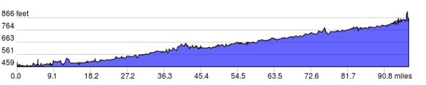 Elevation profile from my cycling day provided by ridewithgps.com. 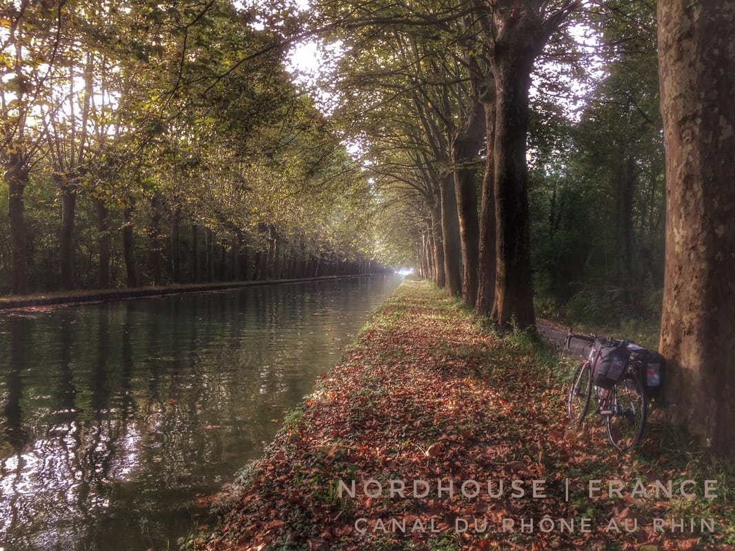 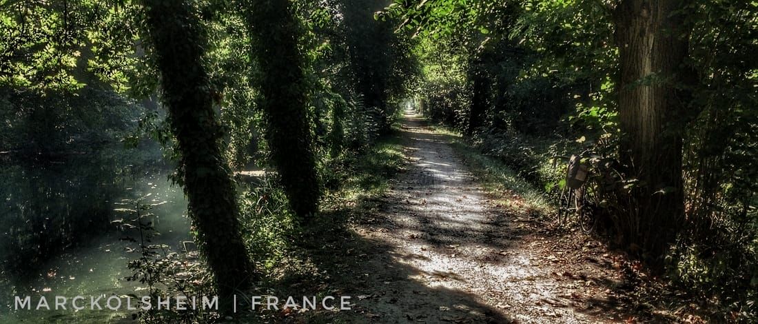 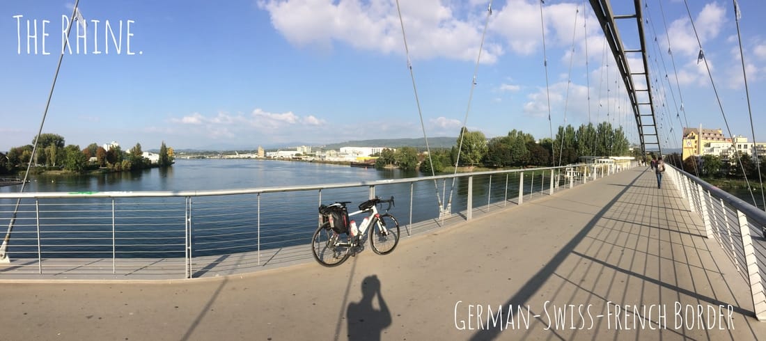 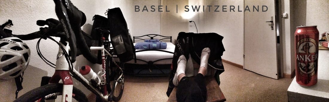 Another evening of comfortable and affordable lodging booked with the AirBnB app after 4 pm. Nearby, a grocery store and Indian food take-out, close to the city center, not bad for 41$.  Today's Route: https://www.strava.com/activities/741473291
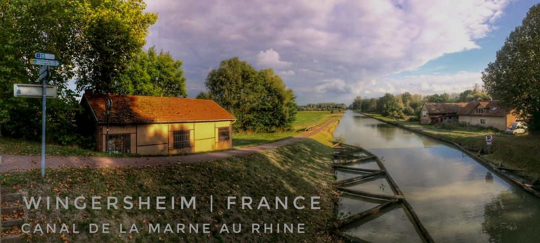
 Eric and Julie's AirBnb, Strasbourg, France. Eric and Julie's AirBnb, Strasbourg, France. I'm starting to forget how many days have passed since I left Hamburg. How about seven? And what a day it was. By the time I finished yesterday in Metz, France, I was already many kilometers off my planned route. I had freelanced my way from Belgium and about 1/3rd of the way across northeastern France towards Germany and the Alps. Today I continued, without a GPS trackline to guide me, to the Rhine and the French-German border. My average pace was a little better than 15 mph, including stops. Along the way, I covered 108 miles (172 km) not counting the few miles from the grocery store to Eric and Julie's AirBnB close to the city center of Strasbourg, France, a city of exceptional antiquity: "The human occupation of the environs of Strasbourg goes back many thousands of years. Neolithic, bronze age and iron age artifacts have [all] been uncovered by archeological excavations. [Strasbourg] was permanently settled by proto-Celts around 1300 BC." Long before I arrived to the ancient city of Strasbourg on the Rhine, the day started fast for my relatively heavy touring set-up, nearly 20 miles (32 km) in the first hour. But subsequently I pedaled into a significant headwind which persisted most of the way to Sarrebourg, a city about half the distance between Metz and Strasbourg. Adding insult to injury, the D999 and D27 were occasionally uncomfortable, you might say, for a cyclist. Despite light traffic most of the time, the few vehicles that did drive past, including lorries and tourist buses, showed very little concern for my safety. One bus in particular left me no more than a few inches as it zipped past in excess of, what felt like, 120 kph (75 mph). With no bike lane or road shoulder whatsoever, the incident with the bus gave rise to an exceptional state of shock that was shortly thereafter followed by a middle finger wave. Given the company on the road and the distance I wanted to cover today, on the ride from Metz to Sarrebourg I focused on staying alive while maintaining a steady pace. I stopped only when necessary to reassess my route which was mostly via dead reckoning using the horizon and the sun as my guide. I was expecting more wind and possibly even the foothills of the Alps, which I could occasionally see on the horizon, as I approached Sarrebourg but neither concern materialized. Instead, I made my way through a portion of the medium-sized city then made a right turn, to the south, and crossed the La Sarre River. Straight-on I arrived to and rode over a canal before I turned left onto, something close to, Rue de River, "river road". Finally, the river road led me to the same canal that I'd crossed, Canal de la Marne au Rhine, and soon thereafter I was celebrating a wonderful event that happened, for the most part, by chance (aka, serendipity). The wind and traffic I dealt with for ca. 68 miles (110 km) was quickly a distant memory as I pedaled my way along Canal de la Marne au Rhine. As the light improved, I slowed down for photos, by this time well into the afternoon. I had detected the Canal de la Marne au Rhine earlier in the day while studying Google map images and was planning to check it out once I reached Sarrebourg. However, my expectations were only half as good as what lay in store for me. The Canal de la Marne au Rhine, part of a network of canals that connect, e.g., the Rhine to the Moselle in Metz, allows boat traffic deep into northeast France. Shortly after locating the canal along the Rue de River, I was spinning comfortably on a (most of the time) paved bike path that, at the end of the day, delivered me to French villages overlooking Strasbourg and the River Rhine. The city and river below were magestic, but the small villages themselves were, for my senses, even more picturesque and memorable. Winding mostly down, down, down, along narrow, steep, cobble stone roads the last few kilometers before entering Strasbourg proper I was treated to an old Europe as much as anywhere else on my trip. I rolled into Strasbourg at about 5:30, found a grocery store and then my bed for the night at Eric and Julie's AirBnB. Looking out my window, as I type on my iPhone, I can see, 1/2 km away, the European Union Parliament building. Life is full of surprises, but certainly some days deliver more than others. In the evenings I'm wasted, nonetheless I'm surprised how well I continue to feel on the bike day after day. As of this moment, seven days into the tour, I've covered over 700 miles (1120 km) through Germany, Netherlands, Belgium, Luxembourg, and France. My shortest day has been about 70 miles, my longest close to 120. Since entering the Ardennes on day four, I've climbed and descended several thousand feet of elevation, including some very steep grades in excess of 18%. However, the excitement of arriving, as I have, to a River that, like Galileo, is nearly always referred to just by it's first name, "Rhine", quickly dissipated any consideration I might otherwise had allocated to reflecting on my fatigue. And there is the city itself, Strasbourg, a city with a history as impressive as any other in Europe. The name, "Rhine", has been adapted by many languages from the original Gaulish name Rēnos. The Rhine has been and remains so significant in Europe that it has it's own linear measurement, the "Rhine-Kilometer", "a scale introduced in 1939 which runs from the Old Rhine Bridge at [Lake] Constance (0 km) to Hoek van Holland (1036.20 km)." From antiquity, "The Rhine was not known to Herodotus and first enters the historical period in the 1st century BC in Roman-era geography. At that time, it formed the boundary between Gaul and Germania. Augustus ordered his general Drusus to establish 50 military camps along the Rhine, starting the Germanic Wars in 12 BC. At this time, the plain of the Lower Rhine was the territory of the Ubii. The first urban settlement, on the grounds of what is today the centre of Cologne, along the Rhine, was Oppidum Ubiorum, ... founded [by the Ubii] in 38 BC." And that's just the first few breaths when it comes to humanity and their comings and goings from the Rhine. It would literally take, it seems after a quick scroll through Wikipedia's Rhine page, minimum two full university courses to cover the entire history in detail. On the left bank of the Rhine, in what has been Germany in the recent past, is Strasbourg, a city with a tireless history. Artifacts unearthed in Strasbourg include relics of the Neolithic Period (ca. 10,200 to 4500-2200 BC), Bronze (ca. 3300 to 1200 BC) and Iron Ages (ca. 1200 BC to 600 BC). Nearing the conclusion of the third century BC, Strasbourg "developed into a Celtic township" before a long period of Roman rule: "The Romans under Nero Claudius Drusus established a military outpost belonging to the Germania Superior Roman province at Strasbourg's current location, and named it Argentoratum. (Hence the town is commonly called Argentina in medieval Latin) The name "Argentoratum" was first mentioned in 12 BC and the city celebrated its 2,000th birthday in 1988[!]" And following God(s), one would assume, displeasure with Rome, "In the fifth century Strasbourg was occupied successively by Alemanni, Huns, and Franks. In the ninth century it was commonly known as Strazburg in the local language, as documented in 842 by the Oaths of Strasbourg." And on and on the story goes until a lone, unexceptional, traveler glides down narrow streets through villages on his RLT9 Steel into Strasbourg on 11 October 2016. With so much already behind me and so many possibilities ahead, the question of 'how to proceed' seems foremost this evening as I prepare for sleep. Should I accept my "farthest south" as Strasbourg and turn north, tomorrow, on the Rhine Cycle Route? Or, should I instead turn south, on the French-side of the Rhine, and adventure my way to Basel, Switzerland. You might be able to guess what option I'm favoring. I will sleep on it, and decide in the morning over an americano or a second espresso. It's 89 miles, about 150 km, to Basel from Strasbourg. Well within the reach of a cyclist inspired by nearly every moment of the last seven days. Dormez bien et réveillez-vous avec une inspiration pour suivre vos rêves. 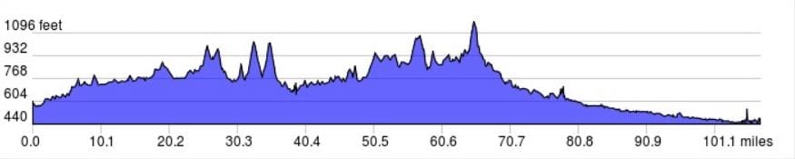 Today's elevation profile provided by ridewithgps.com. 
   Morning ride: https://www.strava.com/activities/740220048 Early afternoon: https://www.strava.com/activities/740311009 Late afternoon: https://www.strava.com/activities/740442406
A very chilly morning, about freezing at 9 am so I delayed another hour, chatted with Stéphanie, the BnB owner, enjoyed her French accent and drank more coffee. For the most part, today's weather was as anticipated, overcast sunrise to sunset. Yet, it never rained, a fact for which I'm grateful and will continue to be grateful for even when the sunshine is filtered by cloud cover. Cool temperatures, in the absence of rain, are excellent for cycling once the body warms-up. I was surprised to cover nearly 20 miles in the first hour on the road, which put me in France before noon despite my very late departure from the former château in Sampont. It was an exciting moment, arriving for the second time in my life to the country of my origin (in 2012 I visited the city of Paris for seven days) and the farthest country to the south that I set-out to visit in my original itinerary. With an impressive castle wall at the village doorstep, the moment was also dramatic, and therefore memorable forbye, as I came zipping into town along a fast descent that at once transitioned from forested slopes on either side of the road to a picture book scene from the middle age. Part of a larger Château de Cons-la-Grandville, the castle "was constructed for Dudon de Cons, son-in-law of the Comte de Chiny" in the 11th century (C.E., Common Era) and has since been rebuilt many times. Let me briefly recall the story of my Grandfather as it was told to me by letter from him in the last decade or so prior to his passing. Of course, without those letters in hand, which are stashed away at my fathers house in a box above the rafters of his garage, I'll also have to rely on memory which is, as Daniel Gilbert skillfully revealed, certainly not ideal. My Grandfather was born to Henri Breton, that much I recall for certain, and a woman, also of french decent, that is somewhere buried in my subconcious at the moment. Henri and his dashing wife, speculation awarded, arrived to Canada from a ship directly from France. This was sometime in the early part of the 20th century, not long before the Great Depression felt throughout the World. Although I don't recall my Grandfather actually stating that "it was the depression" that forced his parents to give him and his sister to adoption, it seems reasonable that this proximate and very significant event in history might have played a role. Speculation aside, he was without any doubt boarded onto a train somewhere in northern Maine, where the family resided at that time. At the end of the connections, many I suspect given the obscurity of northern Maine during that period of US history, my Grandfather aged roughly 2-3 years and his slightly older sister arrived to Cambridge, Massachusetts. Here he was initially cared for by Catholic nuns. Approaching and into his teenage years he would be placed in foster homes, many of these, often with dubious results. His life was apparently difficult throughout his early years until he was able to fend for himself and escape the Catholic church and the foster homes that they arranged for him. Along the way, it's easy to imagine what happened to my connection to France, the country of my Great Grandfather and Grandmother's origins, and so too the origin of my Grandfather and family that followed. Although I am an American with a French nose and not much else to connect me to France, I still cannot help but wonder, when I'm on French soil, about my families French roots. And for me, a guy that often spends far too much time in Wonderland, that was enough, castle at the bottom of a steep descent aside, to put a big smile on my face when I realized I had returned to the country from whence I stumbled three generations before possibly from a filthy ship, wearing filthy clothes, and grinning a smile that no one, from this century, would want to kiss! Metz, the French pronunciation sounds like the English word "mess", has an absurd, for its richness and breadth, history including an impressive cast of famous characters dating back to the 2nd millennium B.C.E. (Before Common Era). A small sample from Wikipedia conjures up an appropriate visualization: "Before the conquest of Gaul by Julius Caesar in 52 BC, it was the oppidum of the Celtic Mediomatrici tribe. [Once] integrated into the Roman Empire, Metz quickly became one of the principal towns of Gaul with a population of 40,000, until the barbarian depredations and its transfer to the Franks about the end of the 5th century [C.E.]. Between the 6th and 8th centuries, the city was the residence of the Merovingian kings of Austrasia." And that's just roughly half of the story. Why is it that any mention of the word Merovingian immediately takes me back to the fabulous character, by the same name, from the films The Matrix Reloaded and The Matrix Revolutions? Since I was just a click away from discovering what these Merovingians were all about I thought I would include a little of that history as well: The Merovingians "were a Salian Frankish dynasty that ruled the Franks for nearly 300 years in a region known as Francia in Latin, beginning in the middle of the 5th century. Their territory largely corresponded to ancient Gaul as well as the Roman provinces of Raetia, Germania Superior and the southern part of Germania. The Merovingian dynasty was founded by Childeric I (c. 457 – 481), the son of Merovech, leader of the Salian Franks, but it was his famous son Clovis I (481–511) who united all of Gaul under Merovingian rule." History and the fascinating stories that the term implies await me in all directions it seems, and the effect on the child that often looked out a window from 9 North Park Street in Franklin, Massachusetts, on the tip of his toes and wearing a onezee, is that he can hardly contain himself from riding over the next hill, to the next village, to anywhere his RLT 9 Steel and his legs are willing to take him on his Autumn Tour of (his plan anyway) six countries. It has already been a tour-de-force of unimagined encounters, with people from the here, now, and bygone. No doubt much more awaits in the days ahead before I complete the final pedal revolution that delivers me to where it all started at Bismarckstraße 77 in Hamburg. After five consecutive days riding over 100 miles, I thought I'd dial back my speed today, shoot for about 60-70 miles, and finish early, with enough time perhaps for a load of laundry which is spinning now. The road from the first French village to the big city of Metz, very similar in size and appearance to Hamburg, was often country road with only a few exceptions. The terrain was hilly, sometimes very steep, especially exiting villages, otherwise gently rolling most of the way. I met a 30-years past retired Frenchman, a sturdy, full-of-life cyclist named Herman (pronounce air-mon or just eh-mo), at the water spigot I photographed not far from Metz. He encouraged me to ride to Strasbourg, France rather than other possibilities that I had in mind and mentioned to him. Based on our exchange of ideas, all told about a 20 minute conversation, I'm going to do some thinking this evening, check some distances, etc, and perhaps hatch another revision to my already revised itinerary in the morning. My plan, as of yesterday, was follow the Moselle River Cycle Route from Metz to Koblenz, Germany. A beer opened and another on the docket, so no bonne nuit to you for about another two hours. Instead, I bid you a bonsoir, a good evening from Delphine's exceptional AirBnB in northeast France in the ubiquitously historic city of Metz, a city with links to the "political thinker Alexis de Tocqueville" among other notables. Vive la France! 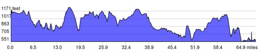 An elevation profile from the days cycling adventure across Belgium and France. 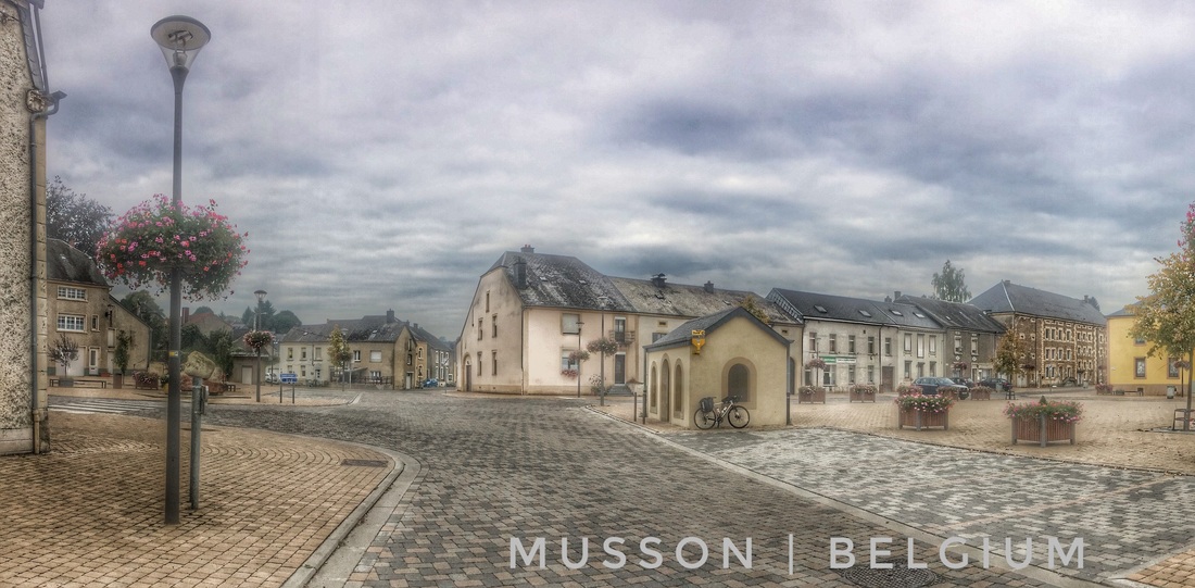 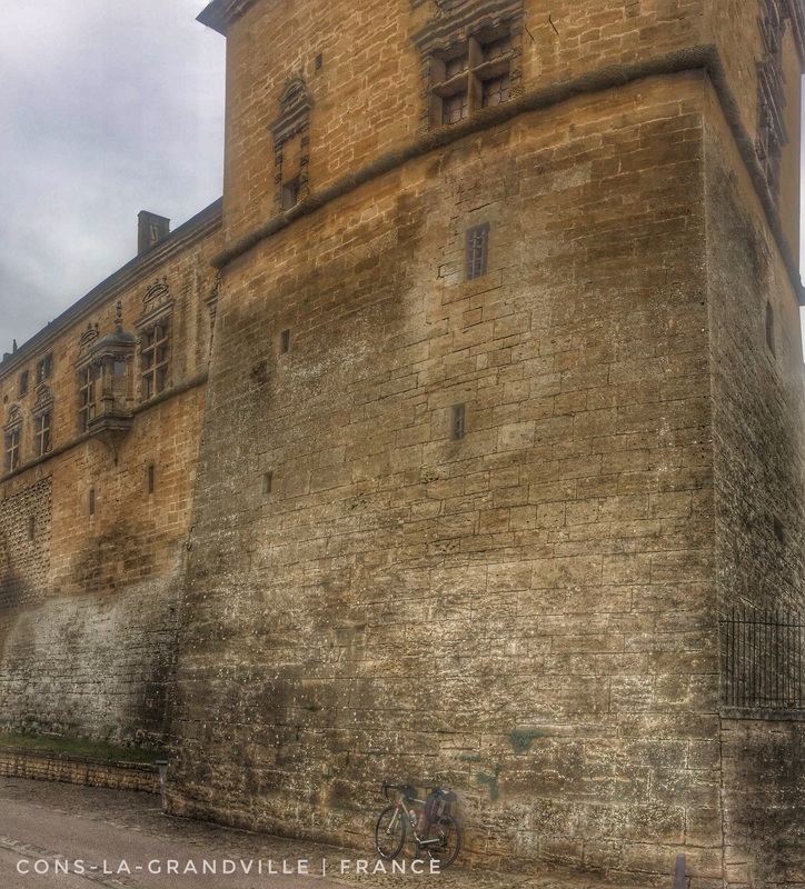  
  Today's Route: https://www.strava.com/activities/739527709
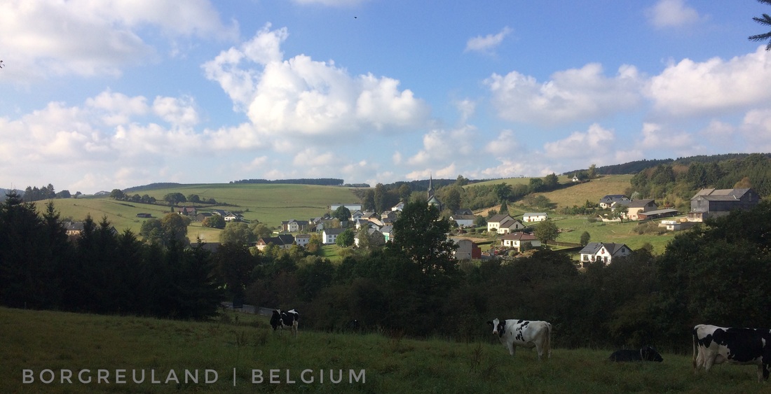
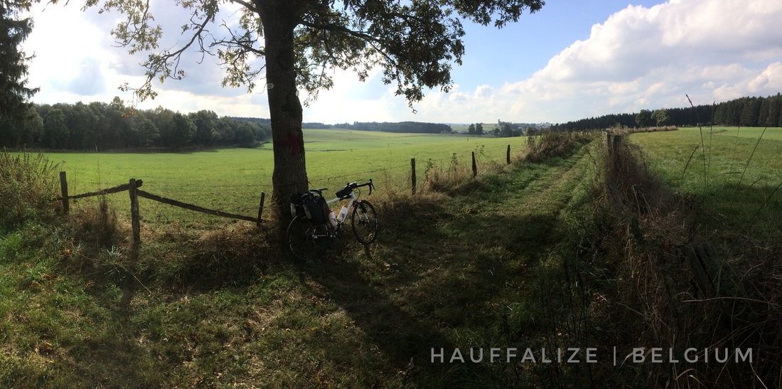
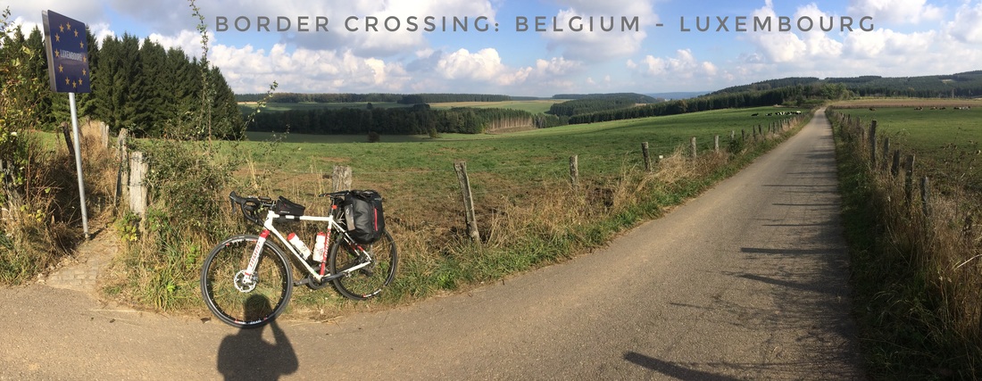
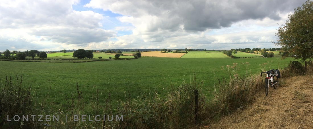
 Vennbahn Cycle Route, 125 km from Achen, Belgium to Troisvierges, Luxembourg Vennbahn Cycle Route, 125 km from Achen, Belgium to Troisvierges, Luxembourg Everyday has been special, full of surprises and memories, but today was even better than the previous four. As much as I enjoyed the cycling infrastructure in the Netherlands, the network of canals, villages, farms, and forests, the Ardennes of Belgium and Luxembourg delivered one stunning scene after another on my ride today. Perhaps the landscape high point of my autumn adventure? We will have to wait and see. A very cool (fresh) start this morning was unavoidable as I descended into the river valley below Carmen's le Cafe and BnB. I paid my bill just before I left, 61 euro. That covered a private room and bath in a funky, unique, inspired inn. As well as hot soup, bread, and more for dinner; an equally robust breakfast, and lunch for the road! It was, until this evening, by far my highest lodging cost in four days, but with all the extras it really was very reasonable. Within an hour or less of my departure the sun warmed my nearly frozen fingers and I was subsequently grinning my way down a paved bike path at full casual speed, about 20-22 mph. Even before solar radiation dispelled the numbness, I stopped for photos, including the header image from this post, to take advantage of morning light, mostly clear skies, and sunshine, the finest weather so far on the trip. I'm hoping for the same tomorrow. In the meantime, I've decided to deploy a 'wait and see' weather policy, whatever awaits my departure each morning is what I'll have to manage including brillaint sunshine, my fate this morning. My experience today on fast, auto- and lory-free cycle ways, that were once rail lines, has inspired me to make significant changes to my itinerary. Tomorrow, I'm planning to freelance my way to Metz, France, a city with a 3000 year history located at the confluence of the Moselle and the Seille Rivers, and then follow a famous, for its beauty, cycle route along the Moselle River. By "freelance" I'm referring to navigation by GPS without a planned route / GPS line to follow on the GPS screen, I'll navigate to Metz by dead-reckoning based on the sun and use the GPS to choose what seems to be the best route as I go. From Metz, the well marked Moselle River Cycle Route will take me north-northeast through France to Germany. From there, I'll follow the German-Luxembourg border, the river itself, north for many miles. Eventually, the river will turn east-northeast, my revised plan is to follow the Moselle River Cycle Route to its conclusion at Koblenz, Germany, "where in 55 BC Roman troops commanded by Julius Caesar reached the Rhine and built a bridge between Koblenz and Andernach." From Koblenz, I'm not sure at the moment. Perhaps south on the Rhine [River] Cycle Route then east, or east right-away freelancing my way to Cheb in the Czech Republic where I would then rejoin my original itinerary. The bike path that inspired me to re-think my itinerary, the Vennbahn Cycle Route, is one of Europe's longest cycle routes built almost entirely on a converted (raised) railway bed. The Cycle Way retains the name of the original rail line, "a former railway line that was built partly across what was then German territory by the Prussian state railways. It is now entirely in Belgium, because the [track and underlying subgrade], as well as the stations and other installations, were made provisional Belgian territory in 1919 (permanent in 1922) under an article of the Treaty of Versailles." The Vennbahn rail line remained in use into the 1980s. In the 1990s, the rail line was decommissioned and the track was removed along with other infrastructure changes necessary for transforming the raised rail bed into a Cycle Route. From NRW-Toursim Dot Com, "The Vennbahn [Cycle Route] leads from Aachen to Monschau and on to Belgium and Luxembourg. At 125 kilometres, it is one of Europe’s longest cycle paths that runs on disused railway lines. It crosses the borders between the three countries more than a dozen times". My experience on the Vennbahn Cycle Route came to fruition, in part, because of my chance encounter with Tom on Day 4. My original itinerary included part of Vennbahn, however without Tom's historical revelations and other thoughts about the route I may not have altered my itinerary as I've now decided to do. After Tom and I climbed nearly to the top of Belgium, he eventually led me down, down, down in elevation eventually to the easily recognizable Vennbahn Cycle Route near the village of Küchelscheid, Belgium where we enjoyed a coffee and a Belgian waffle together and I eventually, that evening, found lodging at Carmen's le Cafe and BnB. Küchelscheid touches Monschau, Germany, on its eastern border. Following Tom's last recommendation among many, I rode the cycle way (after the waffle) towards Achen, where the route begins, to Monschau. It was all that was needed to get me thinking about the possibility of following the same route south from Küchelscheid to its terminus in Troisvierges, Luxembourg, and soon I was revising my itinerary over beer and yummy food at Carmen's le Cafe. I'm knackered this evening, a common theme since about day 2, but nonetheless each day on the bike I feel good after a bit of a waking-up period during the first 30-45 minutes. So far I've enjoyed 100-120 miles (160-190 km) a day since leaving Hamburg five days ago. I wonder when my body will say that's enough? When that happens I'll consider a rest day! As I prepare to close my eyes, I am excited to wake up tomorrow and ride into France sometime in the early part of the morning, a special memory no doubt. In the meantime, I bid you a bonne nuit et au revoir pour le moment from Sampont, Belgium, a French-speaking "village in the Belgian town of Arlon located in [the] Walloon region in the province of Luxembourg." This evening, I'll sleep and dream on the third floor of a beautiful former château. My hosts, Stephanie and her Italian husband, speak fluent french, among other languages, despite being roughly 20 kilometers from the French border. 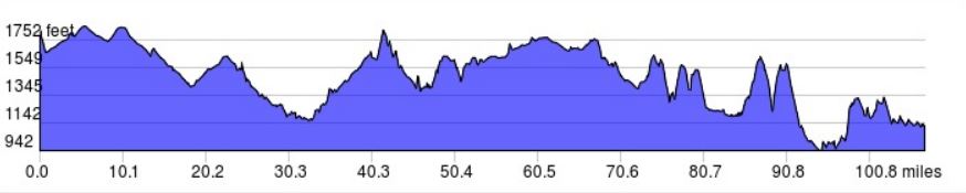 The elevation profile from today's adventure, day 5.
    Morning route: https://www.strava.com/activities/737896721 Afternoon: https://www.strava.com/activities/738370814
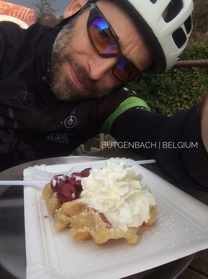 It was a treasure trove of adventure today as I made my way south through the Netherlands, never far from the German border and often only a few kilometers or less on either side of the border with Belgium. Because of that proximity, I added a new country to my life list before noon unbeknownst to me until perhaps the third or fourth crossing when I finally detected an EU border marker on the roadside - a circle of yellow stars around the country name on a blue background. My primary guide and companion this morning was Holland's system of interconnected canals, an efficient means of making one's way across the countryside, with few hills and fast, smooth, surfaces. It wasn't unusual, when the wind was behind me and it often was, to be comfortably spinning at 20-24 mph, about 32-38 kph, despite a bike and gear weighing-in at ca. 48 lbs (22 kg). Crossing the region on a carbon fiber bicycle with no gear and a tail wind would no doubt result in a pace worthy of envy! At Maastricht, essentially the very south of the Netherlands, about the half-way point for today's ride, and close to "the moment when the sun transits the celestial meridian" (Solar Noon, note the origins of the abbreviations, am and pm), I reunited with the River Meuse (Maas in Dutch) that I first encountered, on a ferry crossing, at Broekhuizen, late on day three as I approached the vllage of Baarlo. The River Meuse crosses a wide swath of Europe from it's origins on the Langres plateau not far from Dijon, France, and Geneva, Switzerland (foot of the Alps), to Drimmelen in the Netherlands where it enters the North Sea adjacent to the Rhine. Given it's proximity to the Rhine, running with it in parallel for hundreds of kilometers before both rivers turn left at Nijmegen, Netherlands, towards the Nordsee, it must be worthy of a "geological oddity" that the lesser known Meuse was never captured, over Planet Earth's recent geologic history, by the more famous, and larger, Rhine. A drive from Venlo, not far from Baarlo just inside of the Netherlands on the border with Germany, heading east to the Rhine at Düsseldorf requires just 1 hr 15 minutes to cover roughly 70 kilometers (44 miles). Along the way, based on the last three days of riding, I would anticipate that much of the countryside is flat, agricultural land, with remnant forest patches and small villages filling the spaces between. No doubt there is an interesting geological story behind how two rivers, each navigable well inside of the European continent, came to be so close but never touch across a space that seems to lack any significant geological obstructions. I hope to return to the area on another trip and discover more about its geological history including the evolution of the parallel Meuse-Rhine watersheds during the Pleistocene (aka, "ice age", previous 2,588,000 to 11,700 years) and Holocene (most recent 11,700 years) epochs. Not long after leaving the historcally significant city of Maastricht, I was beginning to get hints of the celebrated, picturesque and scenic, Ardennes, "a region of extensive forests, rough terrain, rolling hills and ridges formed by the geological features of the Ardennes mountain range and the Moselle and Meuse River basins". The arrival of the hilly and often steep Ardennes, including grades over 18%, was a singificant shock to my system after riding across a nearly pan-flat landscape for three days at relatively high speed. Not long before the real climbing began, I stopped for a brief lunch and took a few minutes to catch-up with Clarissa back in Hamburg. It's perhaps worth noting, here, that prior to departing Hamburg I replaced the US-based (Verizon) SIM card in my iPhone 5 with a card from the European carrier O2. Along with the card, I purchased a cellular data plan that crossed borders for about 40 Euro (when I returned from my trip O2 extended my plan for just 20 Euro per month). The data plan provided more than enough, seven gigabytes, to comfortably, no concern about going over my limit, perform all of the functions that I needed or desired in all of the countries that I would eventually visit on this trip. Those included searching for lodging using AirBnB, updating Facebook, and checking email among many other digital conveniences. I want to thank my friends back in Fort Collins, Colorado, Mitch Wood and Tori Royle, for giving me their lightly used iPhone 5 and mophie (hard protective case and battery), a very generous gift under any scenario. But given my social nature and the fact that I was riding solo for many hours every day, their gift contributed in a very big way, convenience and entertainment, to the tour. Certainly bagging lodging for 25-50 Euro after 4-pm each night would have been nearly impossible without the their gift, and there wouldn't have been day-to-day Facebook updates including photographs! Life is all about the here and now it seems, despite distractions. The Ardennes lived-up to reputation, delivering one hill after another through a scenic and beautiful landscape, often dominated by agricultural but sometimes by extensive forest. It was within one of those forest sections that two surprises were awaiting my arrival: 1) the longest climb of the day (ultimately, the longest of the trip); and 2) a friendship with a local rider named Tom that, like the Dutch and Belgians I'd met elsewhere, spoke clear, well practiced, English. After making our introduction and part-way up the climb, Tom pointed to the west, at just above eye-level, and said "that's the highest point in Belgium, about 700 meters." We were, at that time, pedaling through the forests of Parc naturel Hautes Fagnes-Eifel and Tom was pointing at Signal de Bortrange. Among the many historical and natural features of this Parc naturel is a unique microclimate and endemic subalpine flora and fauna community known locally as the High Fens, "The High Fens which were declared a nature reserve in 1957, are an upland area, a plateau region in the province of Liège, in the east of Belgium and adjoining parts of Germany, between the Ardennes and the Eifel highlands. The High Fens are the largest nature reserve or park in Belgium, with an area of 4,501.2 hectares (11,123 acres); it lies within the German-Belgian natural park Hohes Venn-Eifel (700 square kilometres (270 sq mi)), in the Ardennes. Its highest point, at 694 metres (2,277 ft) above sea level, is the Signal de Botrange near Eupen, and also the highest point in Belgium. The reserve is a rich ecological endowment of Belgium covered with alpine sphagnum raised bogs (not "fens" as the name would imply) both on the plateau and in the valley basin; the bogs, which are over 10,000 years old, with their unique subalpine flora, fauna and microclimate, are key to the conservation work of the park." As Tom and I were preparing to depart, and not long after enjoying a Belgian waffle together not far from Eupen, Tom encouraged me to visit Monschau, Germany before I left the area and it was excellent advice. A village on a small creek, castles above, medieval history all around, cobble stone roads and walkways, I discovered old Europe on a large scale despite the modest size of the village. If you're ever in this area don't miss the opportunity to visit this very much off the beaten path and historic village and adjacent region. Among the regions contributions to history we can include scenes from the Battle of the Bulge. a famous attempt by Nazi Germany late in WWII to break through the Allied forces and recover some of their losses including Monschau: "Adolf Hitler first officially outlined his surprise counter-offensive to his astonished generals on September 16, 1944. The assault's ambitious goal was to pierce the thinly held lines of the U.S. First Army between Monschau and Wasserbillig with Army Group B ... by the end of the first day, get the armor through the Ardennes by the end of the second day, reach the Meuse between Liège and Dinant by the third day, and seize Antwerp and the western bank of the Schelde estuary by the fourth day." The sum of my little adventure through the Ardennes, roughly half (50 miles, 80 km) of my ride for the day, delivered a respectable (Colorado standards) 4500 feet of climbing (Strava links above and the elevation chart below provide more details). Just as the sun was dipping over the last hill and the temperature was simultaneously plummeting, I managed to secure a room for the night at Carmen's Lé Cafe and BnB in Küchelscheid, Belgium. The village and cafe are so close to Germany that a person could possibly throw a baseball over the border, and the equivalent of a home run, hit towards the east, would certainly land in Deutchland. Belgian's often adopt their border language, and Küchelscheid is no exception. Carmen and others in the village speak fluent German, their preferred language. I doubt it will be 25-30$, but I'm also living a cycle touring dream and I wouldn't want to spoil that. Instead, I had two beers this evening, paired with a home cooked meal made by Carmen, to celebrate a wonderful day on two wheels. In anticipation of an adventureous day five, I bid you a Guten Nacht, this evening, from Küchelsheid, "a [wee little] village in the municipality of Bütgenbach in Eastern Belgium with [an impresive] 74 inhabitants (2014 [census])", and an Auf Wiedersehen until tomorrow. 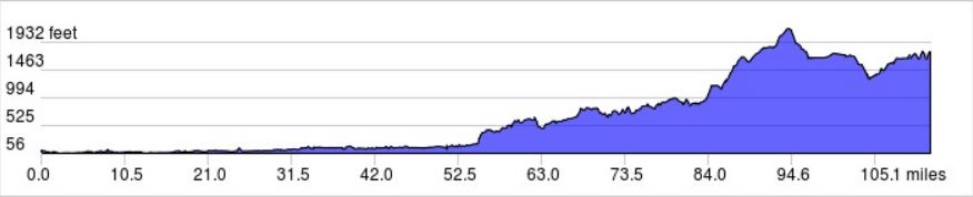 The days elevation profile including my arrival to the Belgian Ardennes at about mile 54. 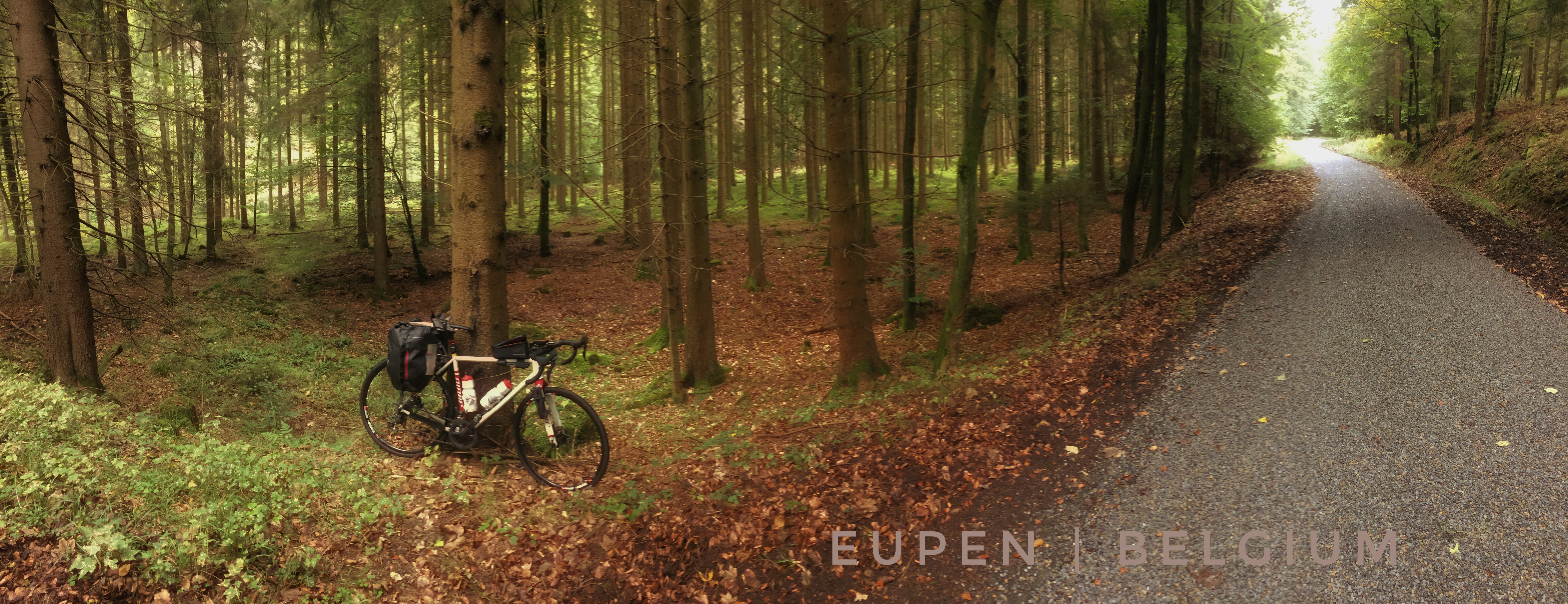
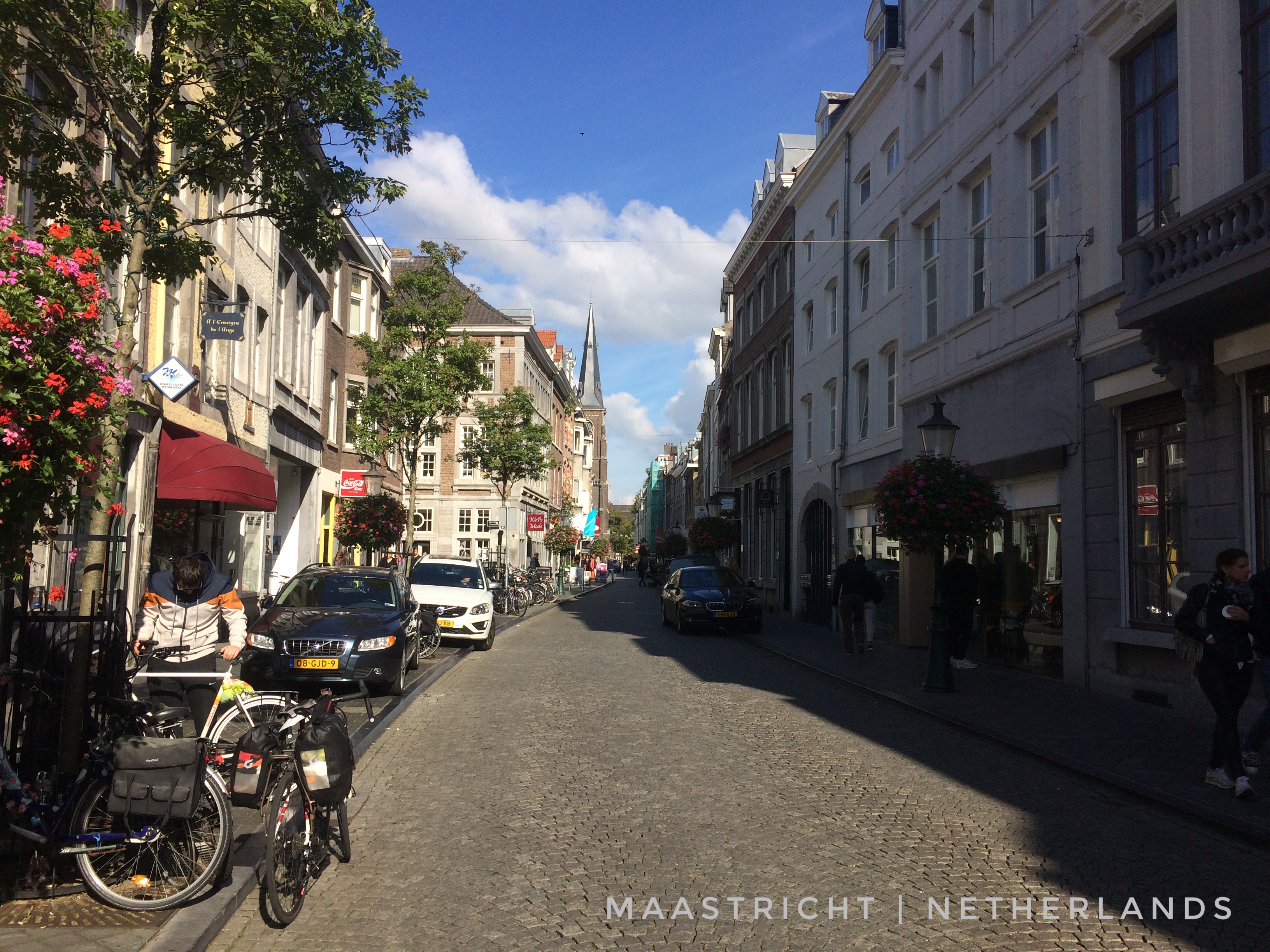
|
�
André BretonAdventure Guide, Mentor, Lifestyle Coach, Consultant, Endurance Athlete Categories
All
Archives
March 2021
|
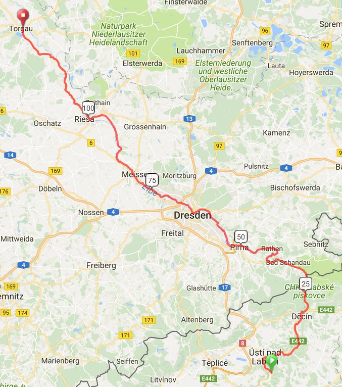
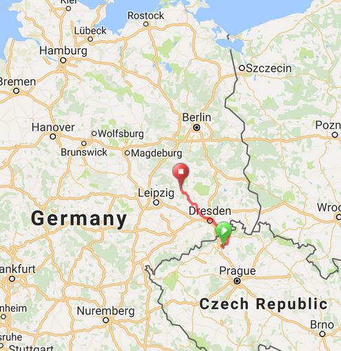
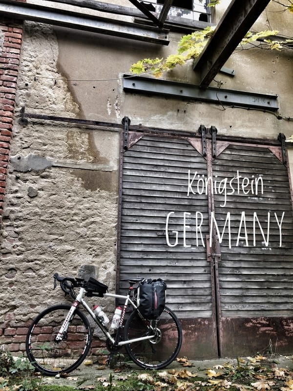
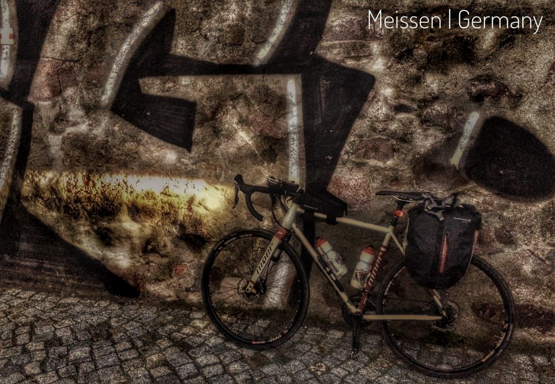
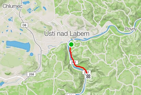
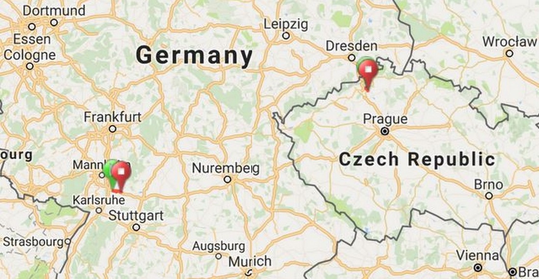
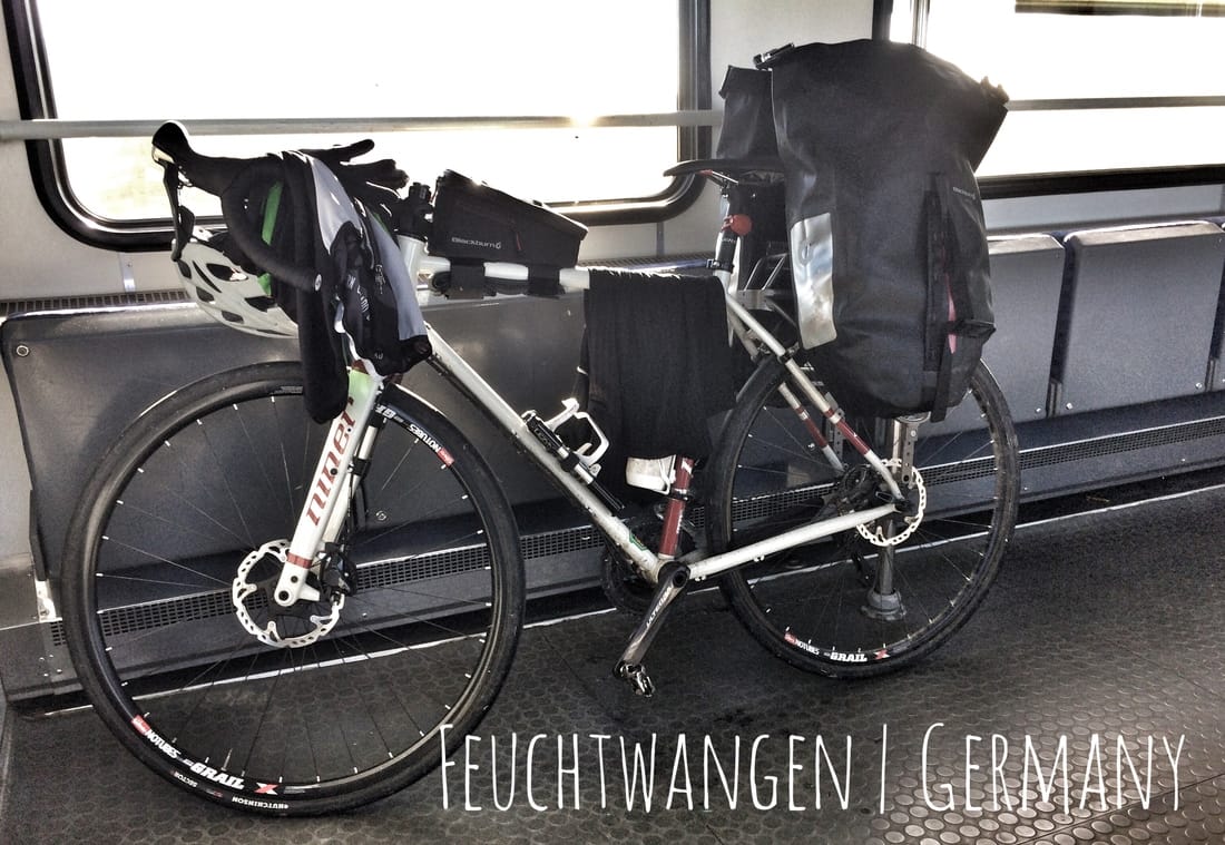
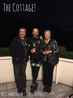
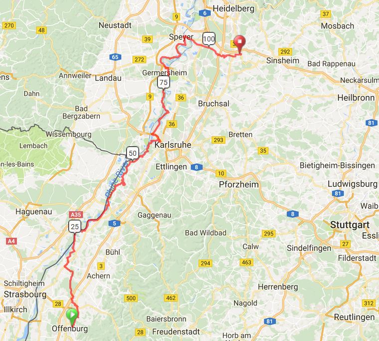
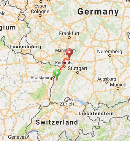
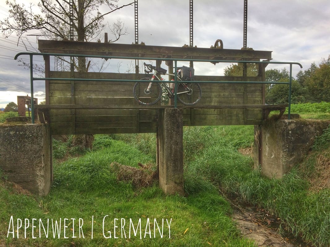
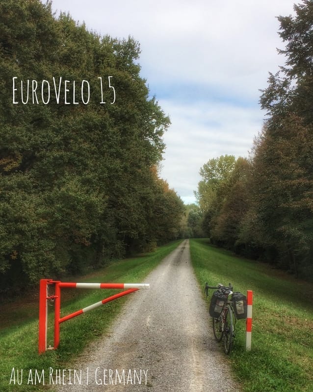
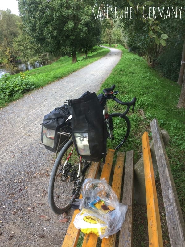
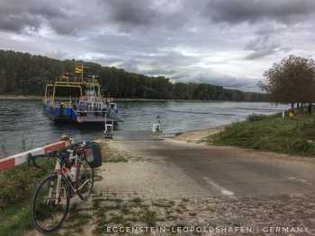
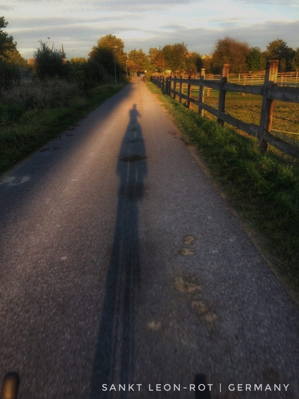
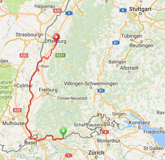
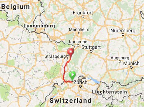
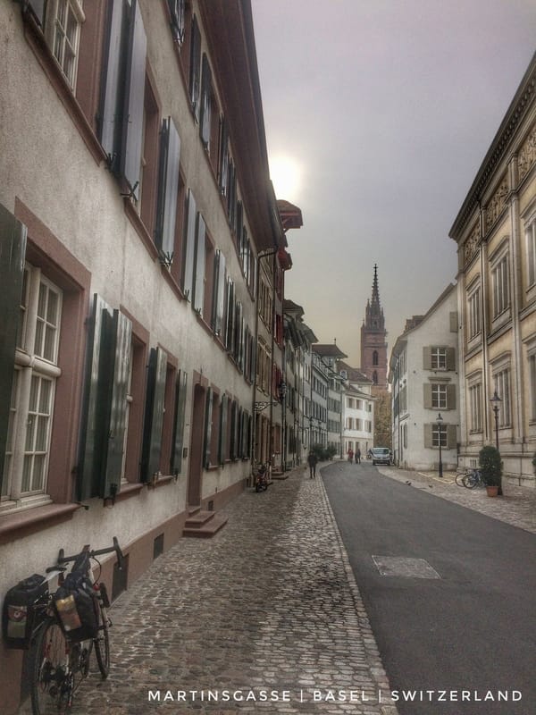
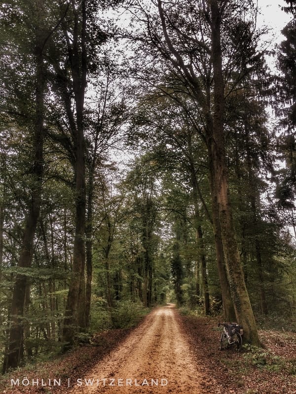
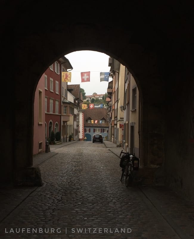
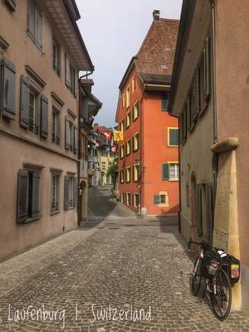
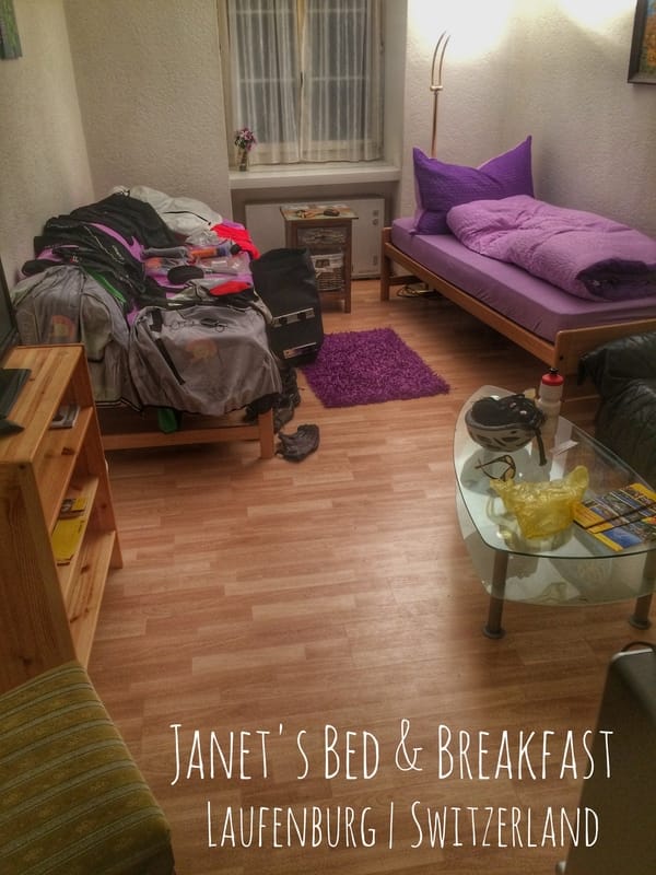
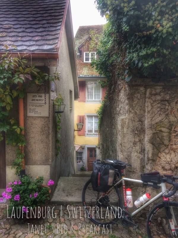
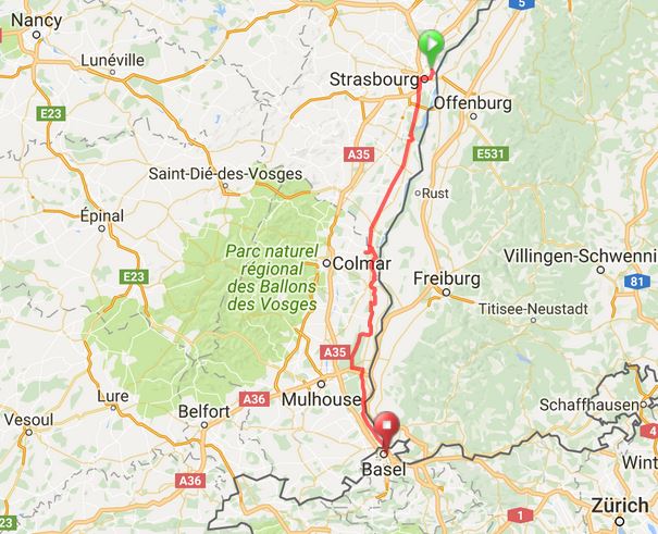
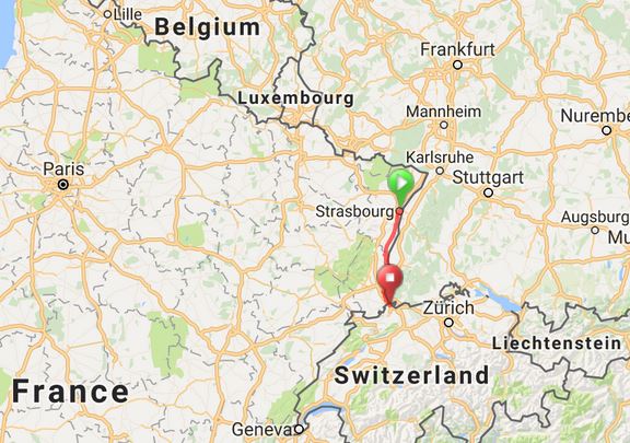
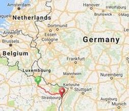
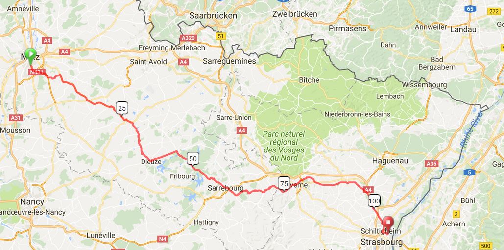
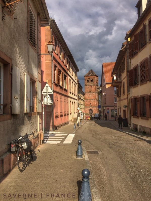
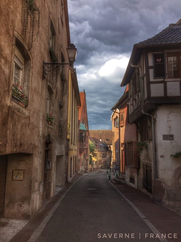
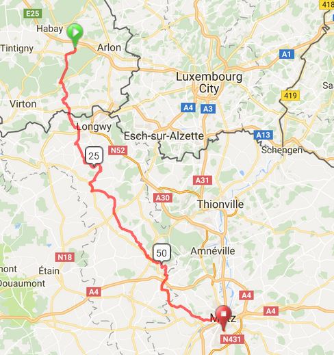
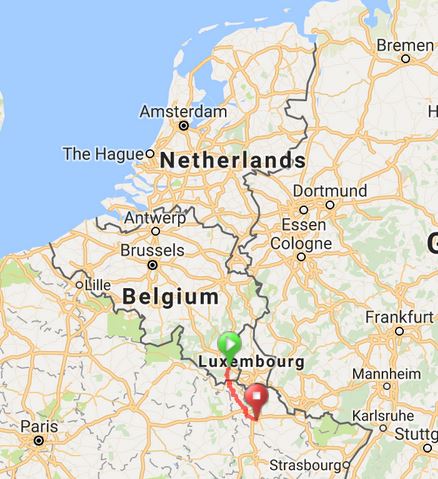
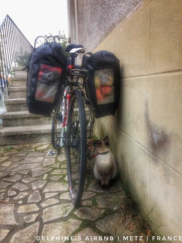
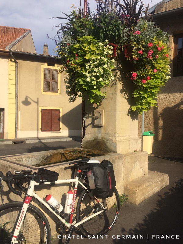
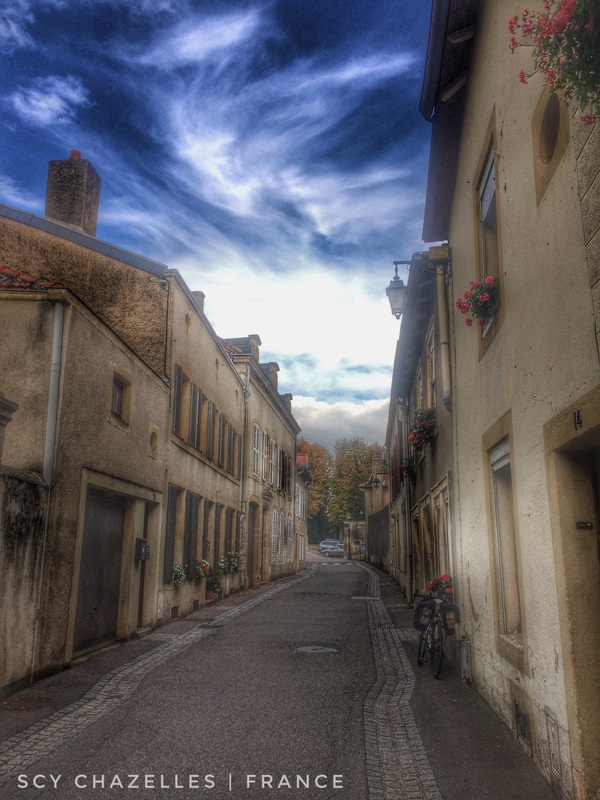
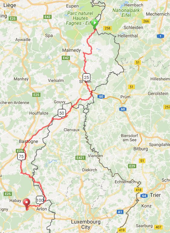
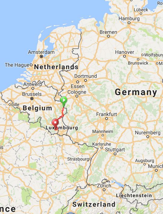
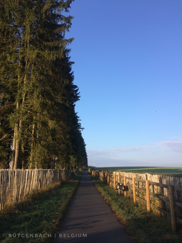
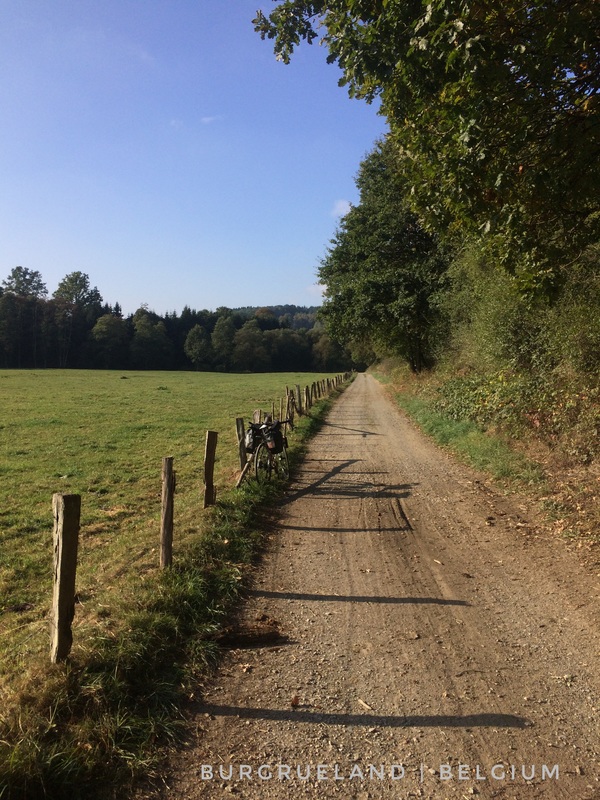
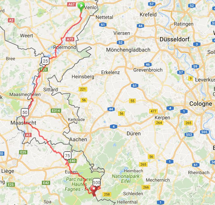
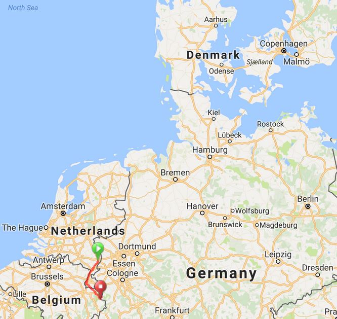
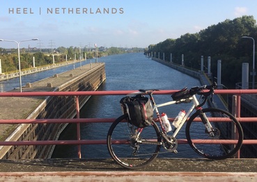
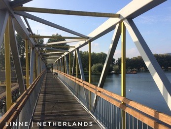
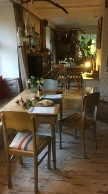
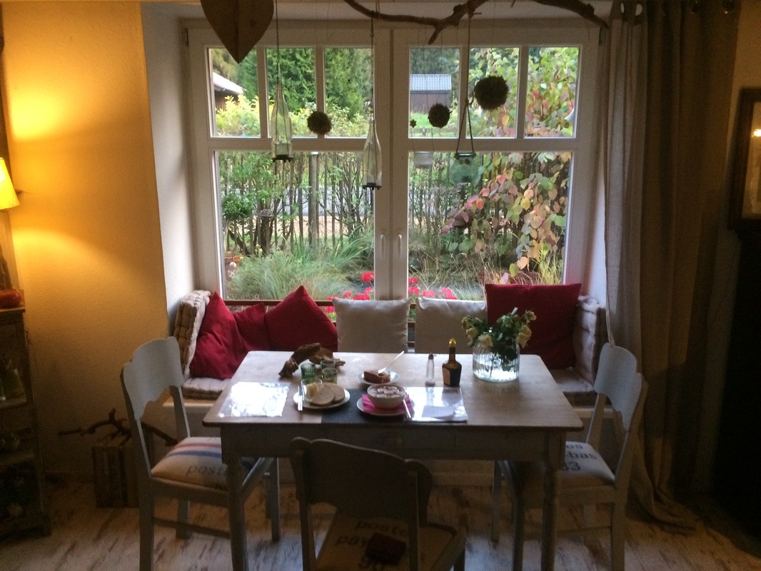
 RSS Feed
Quick Links |
© COPYRIGHT 2021. ALL RIGHTS RESERVED.
|