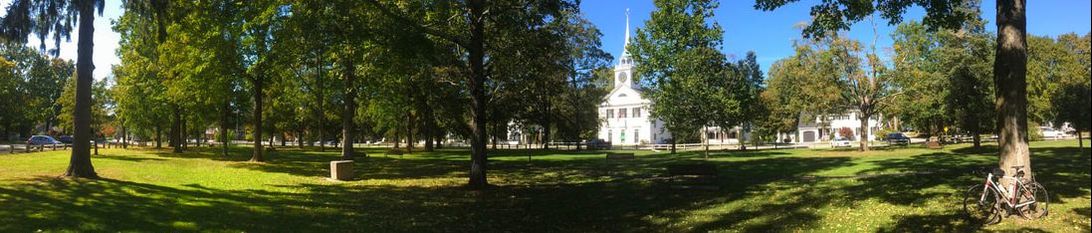
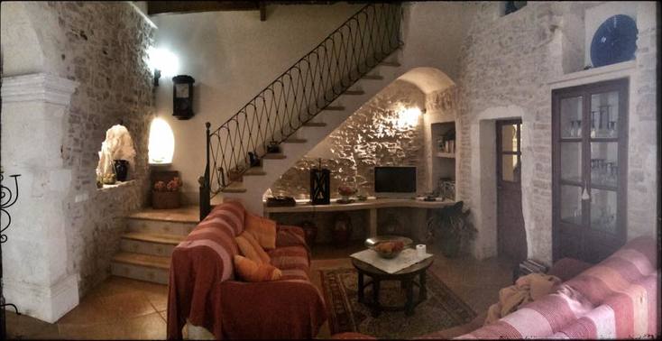
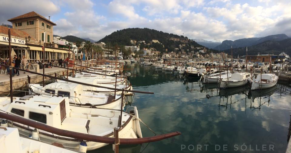
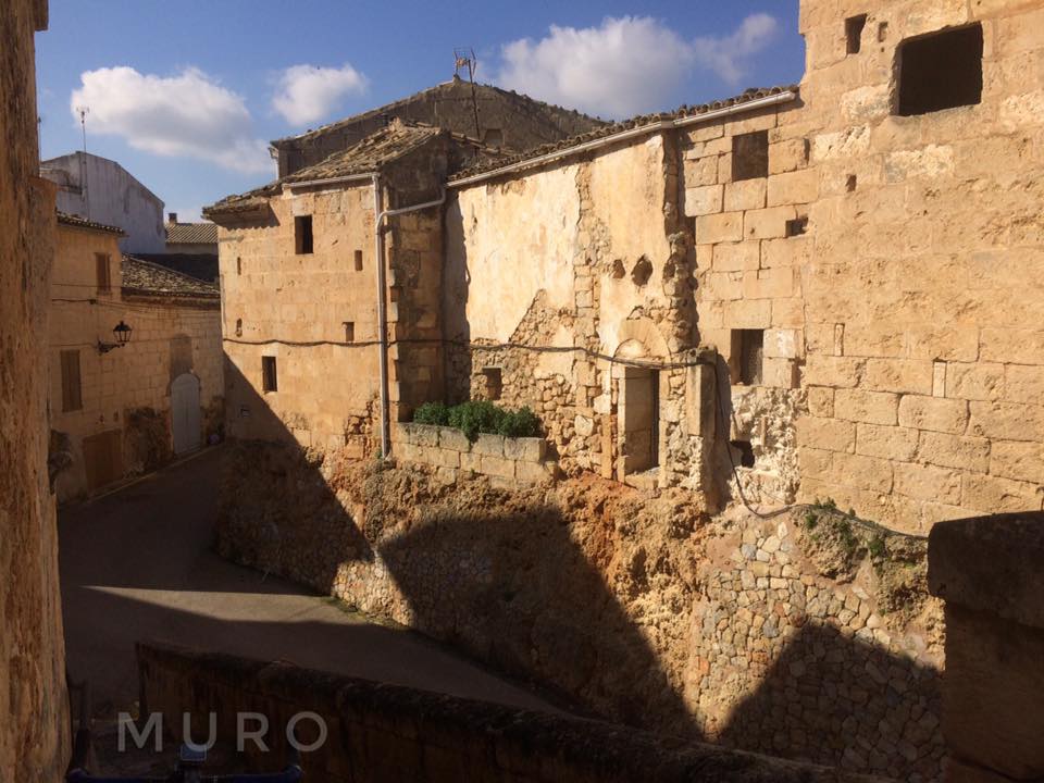
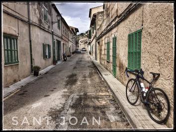
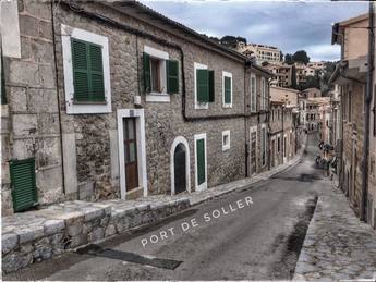
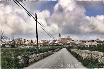
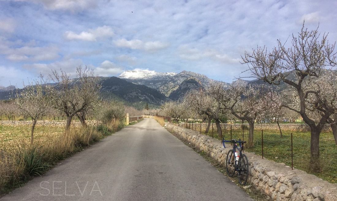
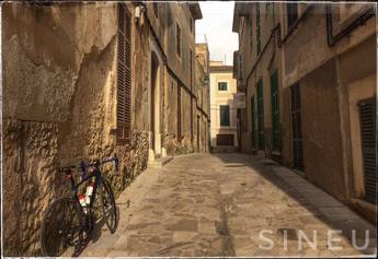
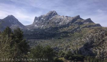
 The central park overlooking part of the village center of Amherst, New Hampshire. 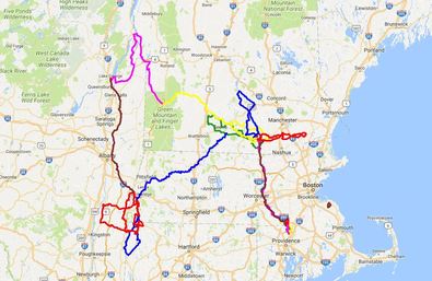 Tour of New England and New York, 9/5-10/8/2017. Tour of New England and New York, 9/5-10/8/2017. Summary: This blog entry is the first of three intended to capture my impressions, and more, from a cycling tour of New England and New York that I completed from 9/5 to 10/8/2017 amidst lots of days off the bike to spend quality time with friends and family. My primary goal for this three-part impressions series is to inspire others to explore the regions rural routes, quaint villages, and scenic landscapes by bicycle. In this entry, I recall impressions from a day of cycling through eleven historic villages in southern New Hampshire's picturesque hill country starting and ending at the Sky Bridge Cafe in downtown Wilton. The entry is written as if you, the reader, are following my route on a bicycle and I'm a voice in your head providing directions along the way including suggestions for satisfying your inevitable food and caffeine cravings. I've also inserted a touch of history as it relates to the land and the villages on the route. From Wilton and the Sky Bridge, my eleven-village tour proceeds west, clockwise (see map below), first to Temple then Peterborough, Harrisville, Nelson, Hancock, Bennington, Greenfield, Mont Vernon, Amherst, Milford, and ultimately back to Wilton and the Sky Bridge. With the exception of Peterborough and Milford, both "towns" by any measure legal or otherwise, the word "village" provides an appropriate visual cue for the other nine. Within the villages and the much larger town centers of Peterborough and Milford are some wonderful opportunities for the curious food and caffeine motivated traveler. Among them the Sky Bridge Cafe of course, but also the English-inspired Birchwood Inn and London Tavern in Temple, the Harrisville General Store, the Local Share by Plowshare Farm in Wilton, and the Union Coffee Company in Milford. Between the villages you'll find a bit of Alice's Wonderland, a patchwork landscape of hills, forests, and farmlands. I hope my blog entry will inspire you to explore, by bicycle, this relatively undiscovered region in New Hampshire. If you can't make the trip on a bicycle then carpool with a group of lucky friends and family! 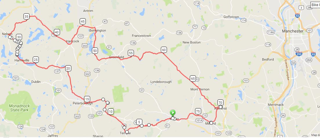 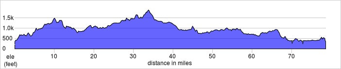 The route including the location of Wilton, NH, marked with a green circle, and elevation profile showing feet (left) and miles (bottom). Graphics courtesy of Ride With GPS (www.ridewithgps.com). Before delving into the ride, my impressions, and more, let me start-out with some details that will be helpful for anyone wanting to repeat this ride as I completed it, all eleven villages in a day including stops for photos, snacks, drip coffee (Harrisville General Store) and a latte (Union Coffee Company, Milford). In this opening section, I'll include details about road surfaces you'll find on the route and some tips to keep in mind including tire pressure and bike choice for maximizing the fun factor on dirt with minimal loss of efficiency on pavement. The route, including out-n-backs for coffee and town-center visits, is 78 miles (126 km). Along the way, you can expect to climb, according to Strava, about 5850 feet (1783 meters). My time on the saddle, moving time, was five hours two minutes. Elapsed time, including two stops for food and coffee, was six hours thirty-four minutes. Here's a link to the route on Strava where I go by the alias Lava Monkey. I used Ride With GPS to assemble and save my route in a format (GPX file) that could be read by my Garmin eTrex20 GPS device. Turns along the way were informed by previous rides I've done in the area. I favored roads-less-traveled and avoided, whenever possible, state-maintained "highways" such as the 101 and 31. As their designation implies, these routes are the primary corridor for high-speed traffic including freight. I'd advise staying off of them especially the noisy, busy 101, an alternative route connecting Milford, Wilton, and Peterborough. Among the roads-less-traveled, I favored paved routes mostly, but not exclusively, for this tour because I knew I would be advertising and recommending the ride to a wide-readership on my blog. On other rides I've done through southern New Hampshire's hill country (see links at the end of the blog), I favored a higher percentage of mixed-surfaces including dirt roads and rail trails (bike paths built on former rail beds). My eleven village tour is close to 90% paved vs. non-paved, so I'd advise tire pressures that favor paved roads with only modest softening for the few dirt roads that you'll encounter. With the proper bike, "dirt" roads, sometimes referred to as "gravel" roads, a highly varied road surface, can add immensely to a cycle tour. With modern "hybrid", alternatively "gravel", bikes and the features they offer, such as tubeless tires and steel frames, these surfaces can be ridden safely and comfortably at much higher speeds than a road bike with 90-120 psi tire pressures front and rear. When preparing my Niner RLT 9 Steel gravel bike (50-36 rings, 32-11 cassette), the bike I used on this ride, for non-paved surface such as gravel roads, cobble stone, and non-technical single track, I inflate my tubeless Hutchinson Sector 28 mm tires to 85 psi rear / 75-80 psi front. Over a calendar year, my body weight varies from about 150 (race fit) to 160 (off-season) pounds (68-72 kg). You'll want to factor in your own body weight when softening your tires. Too low and you could easily damage your rim or pinch a tube if you're not rolling tubeless. There is also the trade-off to keep in mind between decreasing efficiency on the paved roads with gains, as you drop tire pressure, in efficiency and safety on the mixed-surfaces. Unless you know a garage code in Wilton or another town nearby, where you can bunk for the night as I did, then you'll likely drive into Wilton center with your bike on a rack. You'll find ample parking in the town center. Given that you'll be gone most of the day I advise parking off the main street. The Sky Bridge Cafe is close to the west edge of downtown, a short spin from any parking option. Depending on which day and time you decide to set-out on this tour of eleven villages, or any other ride that starts in Wilton (see suggestions below for more routes), you may find that the Sky Bridge is either closed or not yet open the morning that you arrive. An excellent alternative is the Local Share by Plowshare Farm, quality drip coffee and espresso, organic baked goods, locally made art, and even local produce when in season. To find the Local Share cross the street from Sky Bridge and take a left, a few doors down, across from the historically significant and locally celebrated Wilton Town Hall Theater, you'll find the Local Share. If you drove in then you likely arrived off the 101 from Milford. On your way, you may have noticed that the roads were essentially flat as you made your way from interstates to the 101 eventually to Milford and then Wilton. You were driving across a former, mostly flat, outwash plain comprised of sands and gravels left behind by receding glaciers, ca. 11,000 years ago (from the most recent cold period of the ongoing Quaternary Glaciation) Alternatively, if you came from the west on the 101 then you came through hills associated with the extensive and geologically ancient Appalachian Mountains, a landscape feature easily seen from space whose origins date back ca. 480 million years to the so-called Age of the Fishes, well before the evolution of reptiles and mammals. From Peterborough heading east towards Wilton, the 101 climbs up-and-over a section of Temple Mountain (2,045 ft (623 m)). Like all of the hills in the region, the bedrock of Temple Mountain is mostly metamorphosed schist and shale, rock layers that record the former existence of a sea of an antiquity even older than the Appalachians. As this overview of the geography of southern New Hampshire implies, from Wilton heading north, towards Greenfield, west back towards Peterborough and Keene, or south towards the village of Temple you can expect to encounter a region dominated by hills and valleys and the watersheds that divide them including those drained by the Souhegan and Contoocook Rivers, each a tributary of the much larger Merrimack River. Some of the hills are significant such as Mount Monadnock (3,165 ft (965 m)), which is part of the divide between the Connecticut and Merrimack River watersheds, and the already mentioned Temple Mountain. However, don't underestimate the smaller, lesser known hills. My eleven-village tour samples not exclusively, but nearly so, this region of hills and valleys found south of the more widely known White Mountains of central New Hampshire. From Sky Bridge or the Local Share, with plenty of caffeinated cycling fuel in your body, saddle-up and point your whip west. Just after the Sky Bridge Cafe, take a left. At this point, you're very close to the confluence of the Souhegan River, a tributary of the regionally significant Merrimack River and the locally valued Stony Brook. Cross the bridge over the Souhegan and take the first right. Here you'll begin your ascent into southern New Hampshire's hill country. A few hours later, as you approach Amherst, you'll roll-out of the same hills onto the former, glacial, outwash plain on which sits Amherst, Milford, and the eastern edge of Wilton among other towns and villages in the area. As you begin to ascend from the banks of the Souhegan River, grades will initially approach 15% but the majority of the climb, over about 3.5 miles including false flats and short descents, is far less steep. At a casual pace I climbed to the top in about 18 minutes. You'll gain a modest ca. 550 feet on this climb. Despite your proximity to the busy 101, just to the south, you'll already be getting hints of what lay ahead in southern New Hampshire's hill country. From the summit, you'll drop-down to the 101, turn left at the intersection, coast a few tenths of a mile, then make a right onto a country road. Over the next ca. 1.5 miles you'll gain another 400 feet in two back-to-back climbs. The second is impressive, for its steepness from the vantage of a bike saddle, especially with the initial climb already in your legs. From the top, you'll descend comfortably, possibly on a section of dirt road but I can't recall for sure, to the village of Temple, the second village on the tour. Temple was first settled in 1758. This early in your tour it wouldn't be advisable to drop-into the Birchwood Inn and London Tavern for a pint. But I would advise that you take a few photos and make plans to return to the village when you can stay longer. Scroll through the photos of the rooms available at the Birchwood Inn, they are impressive, cozy, welcoming, and a short walk to a "proper" British Imperial pint in the adjoining London Tavern. Temple is perhaps best known for the New England Glassworks Company (more commonly referred to as "Temple Glassworks"). The furnace and associated infrastructure from the factory were operational from just 1780 to 1783. Glassworks forged in Temple during this time are highly sought-after collectibles. From the village of Temple you'll pick-up state highway route 45 and head north. Not to worry, this short section of highway, less than six miles, does not attract high speed wackos like the 101. However, you will have to climb out of town, up-and-over the western slopes of nearby Mount Howard. Settle-in, this is hill country after all, they'll be much more climbing ahead. As you approach the 101, at the top of a steep descent where you can see the highway below, take a left onto a gem of a dirt road, smooth, wide, lightly traveled. It's a false flat most of the way to the next junction with the 101. When you get there, cross the highway (with care) and make a left into the cycle lane. This is the most dangerous part of the ride because you'll be sharing a busy road with high-speed motor-vehicle traffic. Stay as far right as possible as you ascend this part of Temple Mountain. The climb is less than a mile, about 5-6 % grade on average. The exit point, a right turn, off this cycling-unfriendly road is less than a half mile from the summit. When you reach the right turn off the 101, remember to return to normal breathing. I assure you, this short tour of the 101 is worth the risk for the opportunity to tour the villages and hill country west and north of Wilton. From the right turn off the 101, you'll enjoy a fast, flowy, paved road for a handful of miles before turning left onto a dirt track. Unlike the previous dirt section, the day I rode this section I encountered moderately deep ruts from water erosion as well as small patches of loose sand and gravel. Be prepared to ride your road or gravel whip like a mountain bike at times. If you're like me then you'll enjoy the challenge of riding this section at a sensible speed, but not too sensible. Note, part way down the initial descent off the paved road you'll come to a sharp left, take care not to overshoot the corner. To recap so far, from Wilton center to Temple you'll ride ca. seven miles with 1000 feet of climbing; then another ca. nine miles with 775 feet of climbing from Temple to Peterborough center. Peterborough is a popular destination for visitors and locals and the downtown area, primarily for tourists, is the center of that activity. Busyness aside, Peterborough offers a variety of shops set in an attractive New-England-style setting of bygone days. You won't be able to settle-in to every village on this tour, including the popular town centers of Peterborough and Milford, but you should at least do a roll through of the main tourist loop for future trip planning. If you're following my route and intend to complete the full eleven-village tour then it'll will be too early for lunch when you arrive to Peterborough. Regardless of your priorities, at some point you should stop-into Twelve Pine for a multitude of delicious sandwiches, salads, and other options. You might also enjoy Little Duck Organics, a grocer, or Aesop's Table, a wonderful combo bookshop and cafe. Be sure to save some time for my first recommended coffee stop at the Harrisville General Store. From Peterborough, you'll ascend the west bank of the Contoocook River onto a modest climb as you make your way out of the downtown area. Not far from the top of the climb, you'll make a right off the main road back into the forest. You're now on your way to Harrisville and the coffee-stop that I mentioned. As you make your way, you'll ride along narrow, lightly traveled, paved routes through rural, picturesque, hills and farmlands. Amidst the landscape scenes will be plenty of old stone walls to send your mind wandering back into New England's recent past when European settler's and their harness animals laboriously transformed continuous forests into patchwork farms. Although they'll be much more to see ahead, the section between Peterborough and Harrisville is certainly as scenic and peaceful as any other on the tour. Take your time, allow the natural smells and sounds to settle-in. Along the way, you'll encounter no hill climbs of any significance and no dirt sections (on my route). Shortly before climbing into the village of Harrisville, you'll ride for a few miles along the shoreline of Skatutakee Lake, the source of Nabanusit Brook. The Nabanusit converges with the Contoocook River not far from downtown Peterborough. We'll revisit the Contoocook one more time in the village of Bennington. At the end of Hancock Road, which parallels the north shore of the Skatukakee Lake, you'll turn right (north) onto Main Street in Harrisville. With less than a half-mile to cover before my first, suggested, coffee and food stop, I encourage you to unleash the athlete inside you and pedal hard up the 100 foot climb into town! You'll see the short climb into the village shortly after making the right turn off Hancock Road. The Harrisville General Store is on the left at the top of the climb. Many of the old mills from the town's earliest European settlement are on the right side of the road as you come into the village. Between the centers of Peterborough and Harrisville you'll pedal about 12 miles and climb a modest 1000 feet. In Harrisville, you'll be 27 miles into the route with 2700 feet of climbing already behind you. Stash your bike somewhere in front, next to, or perhaps even behind the General Store, there is no need to lock it in this part of the World. Once you're inside, allow your eyes to adjust to the bountiful food and drink options that surround you. Stare wide-eyed into the glass cases at both hardy and sweet options. Breath in the smell of quality drip coffee and imagine the satisfaction of a bottomless cup for a few dollars. Once you've performed a thorough-ish inventory of your options head to the counter and start ordering. If you're lucky you'll encounter a man with a strange ascent, that's the owner. I was told his dialectic roots sprouted in Zimbabwe. However, don't be dismayed if a lady or a non-funny speaking man greets you, I found only genuine smiles in this little shop perched above and beside "a unique, well preserved, 19th-century mill town" (more at Wikipedia). In fairness to those that performed the preservation, "a unique, well preserved, 19th-century mill town" really doesn't do the extent of the towns preservation justice. Coffee-in-hand from the porch of the General Store, so much has been preserved that a spandex-clad (or otherwise) visitor can easily hearken back to an era when "work", referring to the term as it applies to Physics, was produced exclusively in this and other mill towns by the "force", more physics, of gravity pushing water downhill. You'll absolutely want to come back for a foot tour of this town, including a visit to the original Harrisville train depot and the Cheshire Mills. In the meantime, check-out this Virtual Tour of Harrisville Village. Next-up on my clockwise tour of eleven villages in southern New Hampshire's hill country is the exceptionally sleepy village of Nelson, New Hampshire. It's so sleepy in fact that unless there is a contradance underway in the village town hall, a tradition dating back 200 years according to the locals, you could easily roll past without realizing you'd been there. As you make your way to Nelson you'll be reabsorbed by the land- and sound-scapes of southern New Hampshire's hills and valleys. The ride to Nelson from Harrisville won't take you long, it's only about five miles with 550 feet of climbing. Along the way you'll roll past Tolman Pond where, apparently, one of New England's first ski hills was established in the 1920s. At the junction of Nelson and Old Stoddard Road take a left into the village-center of Nelson for nostalgia and photos. When you're finished, return (back-track) to the junction and proceed east on Old Stoddard. My memory suggests that this is initially a smooth, no ruts and other inconveniences for tires and schedules, dirt road. After a short climb out of Nelson, you'll descend about four miles to state-highway 123 where you'll turn right towards Hancock, the next village on the tour. You'll follow the 123 for about six miles, nearly all descending, at which point you'll encounter a large white church and a post office on the left, both signs that you've entered one of New Hampshire's historic villages. Total climbing on this section is just ca. 580 feet, most of it on the initial climb out of Nelson that I mentioned. As any American might guess, the namesake of Hancock is the man that signed the Declaration of Independence with fifty-five other delegates to the Continental Congress. And namesakes withstanding, this short quote from Wikipedia paints a picture that should motivate you to visit and perhaps return again to the quaint village of Hancock, "Almost every building on Main Street in downtown ... is listed on the National Register of Historic Places as part of the Hancock Village Historic District. Hancock's Meetinghouse is home to Paul Revere's #236 bell, which chimes on the hour, day and night. The town does not have paved sidewalks, [instead] gravel paths [lead] from home to home." Hancock was first settled, by European invaders, in 1764. When you're ready to ride-on from Hancock, follow state-highway 137 out of town. Neither route 123 nor 137 present any concerns as far as traffic and proximity to fast moving vehicles. Neither road is heavily used and those that do use the road don't seem be late for their dinner reservation, which too often seems to be much more important than safety concerns for a nearby cyclist. Follow the 137 for ca. one mile then turn left onto Antrim Road. From this junction you're only 3.5 miles, with about 330 feet of climbing, from Bennington, the next historic village on my clockwise tour from Wilton and back again. If you've been scribbling down numbers and arithmetic then you may have noticed that "feet of climbing" per mile cycled has been declining in the last few miles of my description. That's because as you make your way east from Nelson you'll be riding out of southern New Hampshire's hills and into the region of the former outwash plain that I mentioned earlier in this blog entry. You'll descend off the last hill onto sands and gravels distributed by flowing glacial melt water, ca. 11,000 years ago, and later covered-up by invading plants, such as White Pine (Pinus strobus), as you approach Amherst. On Antrim Road (named for a village to the north) you'll find yourself in a space that should be familiar to you by now, the smells and sounds of southern New Hampshire's hill country. Ride on and enjoy the solitude. The village of Bennington is located at The Great Falls of the Contoocook River, the same river we encountered to the south in Peterborough. The Great Falls drop 70 feet in 1.2 miles (more details at Wikipedia). Attracted by the Great Falls, industrialists and their mills were already established in this town by 1782 not long after the conclusion of the American Civil War (1861-1865). Because I wanted to visit Bennington, a village north of both Hancock and Greenfield, I wasn't able to include a wonderful feature of the region known as the Hancock-Greenfield Bridge. On your future visits to the area, many I hope once you discover or perhaps rediscover, as I did, what you've been missing, I suggest making the bridge a part of one of your itineraries. The bridge lies about half-way, on a roughly east-west line, between the two villages in its namesake. All of the details that you'll need, are available at the Hancock-Greenfield Bridge Wikipedia page. From Bennington, my route heads south and then east to the village of Greenfield, about six miles with 400 feet of climbing on paved country roads. Amidst it's list of current and historical factoids, one fact, an accomplishment in this case, about Greenfield truly stands-out in my humble opinion. From Wikipedia, "Greenfield is home to the Yankee Siege, considered the most powerful ... trebuchet in the world. [The Yankee Siege] has participated in the annual World Championship Punkin' Chunkin' Contest in Sussex County, Delaware since 2004." Also from Wikipedia, "A trebuchet is a type of siege engine which uses a swinging arm to throw a projectile at the enemy." No doubt there is much more to see, eat, and drink in Greenfield, a town established in 1753 in part because of the distance to the nearest church and school and the "Monadnock hills" along the way, but don't let that stop you if your preference is to seek-out the "most powerful" pumpkin thrower, aka, the Yankee Siege! Once you're satisfied with your visit to Greenfield, roll east out of town on the main street. You'll spend only a minute or two on state-highway 31 before making a left turn onto a friendly cycling alternative. Enjoy the next six miles as you continue east towards the oddly named road "2nd New Hampshire Turnpike S". At the turnpike, a mellow road despite its name, turn right. The turnpike will take you directly into Mont Vernon, village number nine on my tour of eleven. Mont Vernon really is spelled without the "u" as in "Mount". But spelling aside, which they got wrong relative to its namesake, the town founders were apparently fond of George Washington and so they chose the name of his country residence, a plantation in Virginia, for the name of their town shortly after 1803 following a dispute with residents of nearby Amherst. There was a time when Mont Vernon was a favorite for travelers coming-up from the south, especially members of privileged societies from Boston. Hotels from that time, including the Grand Hotel, must have been a sight to behold, each of them sparing no detail for their elite guests. But sadly, none of them survived to the present (more details at Wikipedia). However, you can still view images of these old hotels on display in a museum on the second floor of the Town Hall, courtesy of the Mont Vernon Historical Society. If you need a snack before continuing on to Amherst, consider a quick stop at the Mont Vernon General Store, you'll roll past it, on the right, as you leave the village. Less than a mile south of town turn left on Amherst Road and follow this just three miles to the village center of the same name. Amherst, for white settlers, began as a land grant to soldiers that participated in King Phillip's War (1675-78), a war brought to Metacom (aka, "King Phillip"), then the leader of the Wampanoag Confederacy, by selfish puritans among others. An accurate telling of history aside, it's nonetheless fascinating to think that this part of New Hampshire was settled by soldiers from so far back in American history. At that time, New England remained a dangerous frontier for both natives and settlers. For an excellent, historically accurate, and unbiased account of the settlement of New England, including wars and other skirmishes, I strongly recommend Mayflower: the story of courage, community, and war, a book by Nathaniel Philbrick. Amherst has a wonderful central park, with a ring road around it, that is perfect for a short break, especially to take advantage of shade trees if you happen to ride on a warm day. The same park also provides an excellent vantage for capturing images of the park itself with historic buildings in the background. If you're feeling peckish, then I recommend a visit to Moulton's Cafe, on Main Street, they are apparently New Hampshire's original "soup bar" (see their webpage for more details). You'll find plenty more to eat at this location including a handsome menu of fresh sandwiches, baked goods, and groceries. When you're satisfied with your Amherst visit then pick the route back up and continue, just three miles on flat roads, to the last village on the tour. Hopefully, you'll have some time, before riding the six miles back to downtown Wilton, to drop-into the Union Coffee Company for your favorite espresso-based wake-me-up. They serve an excellent latte in a proper cup, visualize a soup bowl with a handle. Like Peterborough, Milford has a lot to offer the curious traveler. No doubt, if you need something you'll find it somewhere around the central oval (a ring road) found in this busy yet attractive, old New England-styled town. Milford's namesake was a mill, perhaps one of the mills still standing, built close to a ford over the Souhegan River, the same river we encountered not far from the Sky Bridge Cafe, in Wilton. Despite it's size relative to sleepy Amherst, Milford actually separated from Amherst, not vice versa, in 1794. I encourage everyone to visit Milford's Wikipedia page for a more thorough read of this communities rich history. For example, prior to the emancipation proclamation (1863) and the conclusion of the American Civil War (1861-1865), "Milford was a stop on the Underground Railroad for escaped slaves". With whatever gas you have left in the tank, supplemented by a caffeinated beverage from the Union Coffee House, from Milford head north from the ring road across the same bridge you came in on, over the Souhegan River, and turn left, to the west. From here you'll follow the Souhegan on a gently rolling, lightly trafficked, paved road. At the junction of North River and Purgatory Road take note of Fitch's Corner Farm Stand, you may want to return for fresh veggies on your way home. Take a left onto Purgatory Road then take your second right back onto North River Road and enjoy the last few miles back to where you started earlier in the day, downtown Wilton. If you were able to postpone your inevitable rendezvous with a hearty meal then you really should sample some of Jorge's, the owner of the Sky Bridge Cafe, locally famous paella. And although his espresso machine is modest by industry standards, Jorge's talent for preparing an espresso will nonetheless impress you and your taste buds. Depending on when you arrive to the Sky Bridge you may be able to sit in the shade, outdoors, with your feet up. Regardless of where you land when you step off your bike, be sure to let all that you've accomplished settle-in before you return to your busy life. Once you're back home and drifting-off into a well earned sleep, I anticipate that you'll dream about the hill country of southern New Hampshire; and when you wake, you'll consider plans for your next trip to Wilton for a day or part of a day of exploring the hills, valleys, and villages nearby. Strava links to other rides in the area from the Lava Monkey, https://www.strava.com/activities/1184213358 https://www.strava.com/activities/1185596383 https://www.strava.com/activities/1187223189 https://www.strava.com/activities/1188751977 Native American name translations and other details from Wikipedia, Souhegan River: Algonquin, "waiting and watching place." Prior to European settlement, salmon, alewives, sturgeon, and eels all migrated to and from the river. The name for this river reflects a time when Native American's sat and waited, with nets across the river, to capture fish. Today, these fisheries are either gone (e.g., Salmon) or greatly diminished (e.g., American Eel), Merrimack River: Algonquin, "the place of strong current." Contoocook River: Abenaki, Pennacook Tribe, "place of the river near pines." Skatutakee Lake: No translation available. Nabanusit Brook: No translation available. Wampanoag: "People of the Dawn." For questions about this tour and any other inquiries please send me an email from my webpage. I'd enjoy corresponding with you. 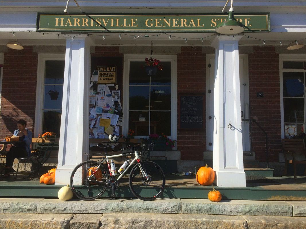 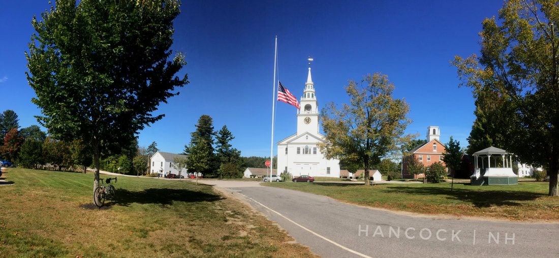 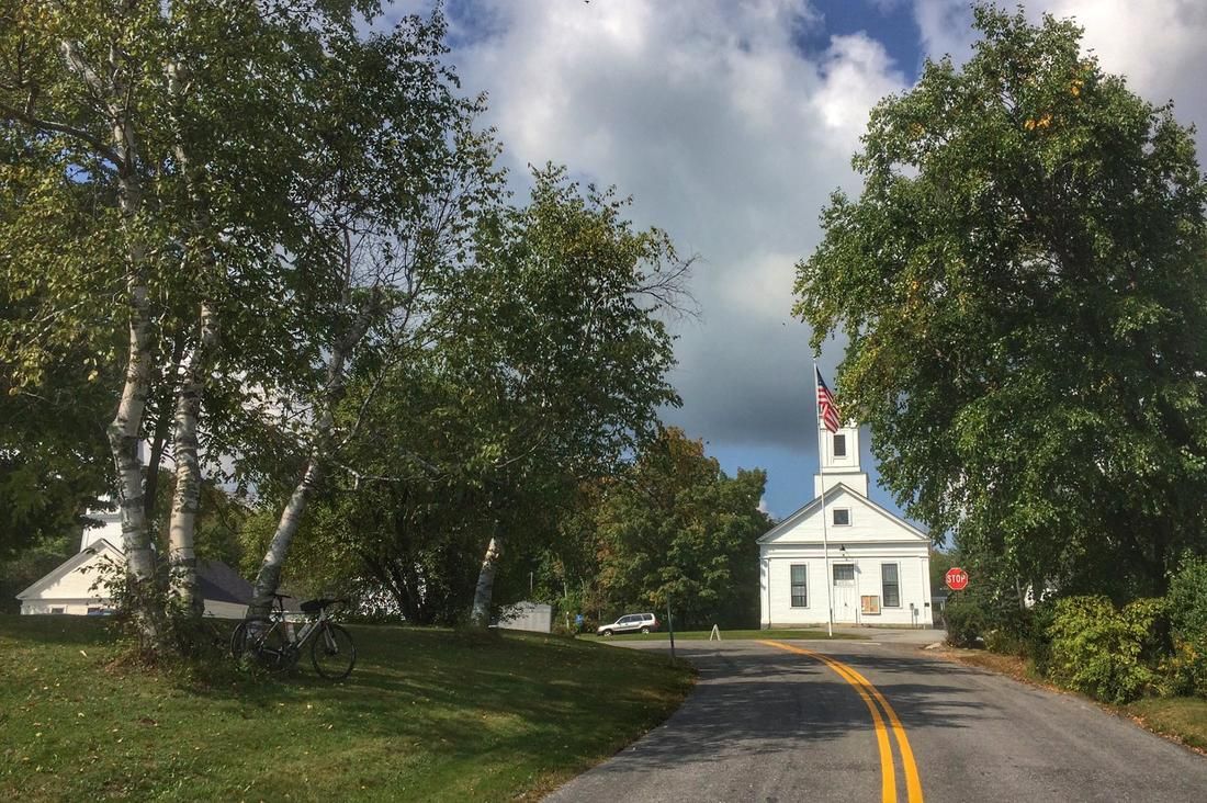 Approaching the village center of Temple, New Hampshire. 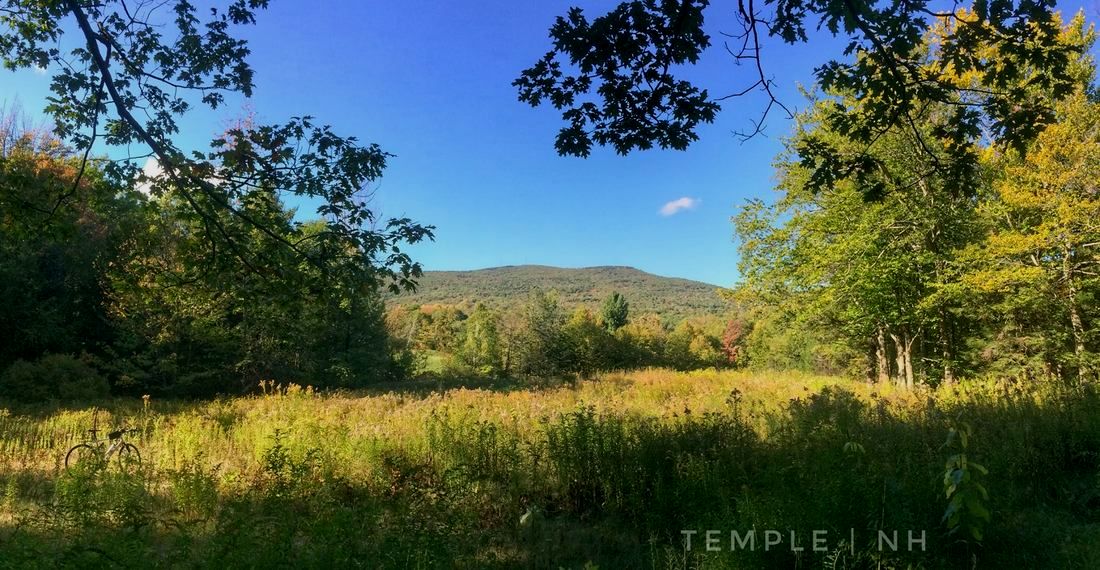 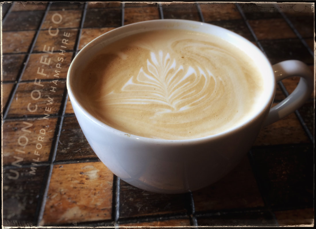 La vie est meilleure avec un cappuccino ou un latte dans une pincée. Summary: In this three-part blog-entry I recall my pre- and post-racing experiences at the 2017 editions of the Original Growler (Gunnison, Colorado), Salida Big Friggin Loop (Salida and Buena Vista, Colorado), and the Fat Tire 40 (Crested Butte, Colorado). I also share my motivations for entering the Fat Tire 40, a chance to race amidst an exceptional outdoor community with an exceptional mountain biking history and also very close to a community with the same priorities just down the hill in Gunnison, Colorado. Highlights include a first place finish overall in the ultra-endurance Salida Big Friggin Loop! ORIGINAL GROWLER: 28 May 2017, Gunnison, Colorado 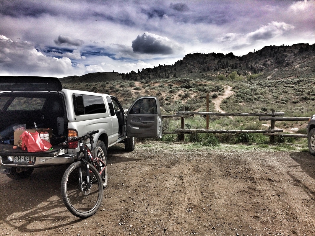 The conclusion of two days of pre-riding and sessioning on the new 2017 Growler Course about one week before the event. 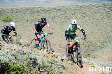 Photo courtesy of Matt Burt photography, 2017 Full Growler, 28 May. Photo courtesy of Matt Burt photography, 2017 Full Growler, 28 May. For the 2017 edition of the Original Growler, half (32 mile) and full (64 mile) routes, Gunnison Trails introduced a new course with even more single track than years before at the expense of (mostly dirt) road sections. Single-track has never been in short supply in this race. The addition of even more, including the technical, rocky, Graceland Trails, ensured that the experience would leave a long-lasting, positive, impression even among the most experienced participants. I had a productive week leading-up to the event, as far as race prep on and off my Niner Bikes Jet 9 RDO. As in the past, this year I was registered for the Full Growler, about 64 miles of racing at Hartman Rock's Recreation Area, scheduled for 28 May. Prep encompassed three days in Gunnison including a visit with a friend, KAO Dave, at the clean, green, and friendly, Gunnison KOA. On the first full day, I rode the entire course (two laps) at (mostly) endurance pace starting from the main parking area at Hartman Rocks. The following day I used my 2002 Toyota Tacoma to access convenient entry-points to session the three most difficult sections of the course along Skull Pass, Josie's, and Rattlesnake Trails. No doubt, training and living at elevation for three days in Gunnison (7700 feet, 2350 meters) was beneficial. And rather than return to Fort Collins after my pre-ride / session work, I instead accommodated additional high-elevation acclimatization by staying in Salida (7100 feet, 2165 meters) for five days prior to the race. Saturday, about mid-day, I returned via Monarch Pass to Gunnison from Salida. I want to thank two friends for their support, Andrew Mackie (Executive Director, Central Colorado Conservancy) for allowing me to camp-out in his living room from Monday-Friday and runner extraordinaire Ellen Silva for crewing for me on short notice including a quick visit on Saturday to transfer bottles, food, and strategy. Ellen was in town to crew for her freakishly fast (aka, "pro") boyfriend that was also competing in the Full Growler. She was very generous to wait close to 30 minutes for me to finish after her primary responsibility crossed the line, he finished 5th overall by the way, legit. A neutral start from town got underway, following a Leadville 100-style shotgun blast, at 7 AM, Sunday morning. Just before the gun went off the pros, among others, were shedding arm warmers and vests. It's noteworthy, based on my experience, that some of these very experienced racers were visibly shaking because of the morning temperature, reportedly 30 F (-1 C) or possibly even cooler, at least one report suggested 28 F. A few degrees aside, it was certainly a cold start even for late May in Gunnison, Colorado. Unlike my neighbors on the starting line, I retained my arm warmers and vest, ultimately I was able to hand-up my vest to a volunteer as I exited Skull Pass on lap one. I held onto the arm warmers to the finish, so often I forget to ditch them when I have the chance, such as when I stopped briefly to resupply water from Ellen before starting lap two. I felt good on the roll-out and stayed close to the police escort, just one bike between me and the bumper, close enough to the elite racers that I was able to listen-in on their conversation, a privilege that I wasn't able to retain for long. When the group reached the right turn onto the dirt at Hartman Rocks I was quickly dropped by the top fifteen or so riders as they raced towards the base of Kill Hill. With an average and max grade of 8% and 22%, respectively, Kill Hill is an effective obstruction for spreading-out the pack. At the top of Kill Hill, the race continued for about 1.5 miles on deeply rutted jeep road before descending onto the first section of single-track, Josho's Trail. My ascent up Kill Hill was slower than my race performances in both 2015 and 2016, 4:34 min:sec versus 4:16 and 4:12, respectively. I didn't feel bad, it's possible I wasn't as warmed-up as years past, perhaps because I've become more efficient at staying out of the wind in a peloton. Despite my slower time up Kill Hill, on the fire road I passed far more than passed me. This set me up, at the intersection with Josho's, to descend onto the single-track with a comfortable space ahead and behind. However, I quickly rolled-up on a group of about five riders as we started the first single-track ascent. No doubt I lost some time getting around these initial riders, perhaps enough to decide my race fate, the 1 minute 24 seconds that I would eventually concede when I rolled over the finish line in 2nd place among 40-49 amateur males (geared). Traffic aside, as I descended and then ascended Josho's, I settled-into an uncomfortable, endurance-tempo pace that I knew I could sustain for many hours with sufficient food and water. Whether or not that pace was faster or slower than previous years is difficult to say, perhaps impossible. My gut suggests I was slightly behind my pace from 2016 and possibly 2015, consistent with my times and overall placement (14th, 17th, 21st overall in 2015, 2016, 2017). Considering I lived for six months over the winter at sea-level, my performance even at the end of May was probably still being affected by an incomplete acclimatization to high elevation (ca. above 7000 feet). But living preferences and acclimatization aside, for the most part I felt strong throughout the race and for that I'm grateful. I'm also grateful that I pedaled away from a high-speed crash that I experienced on the descent of Skull Pass (lap two). On lap two, following a fast descent (only 9 seconds off my PR) of the Graceland Trails, I rolled-up on the wheel of a racer, Andrew Feeney, that would ultimately finish three places ahead of me overall (inside of the top 20). More significantly, before reaching the finish line he'd pass two racers from my age class, one pro, and one amateur, the amateur would finish #1 in the male 40-49 class, which was my goal for the day consistent with my first place, age 40-49 (amateur, geared), finishes in 2015 and 2016. It's always easy, in hindsight, to question what you "should have" and "could have" done, in a race or any other situation that comes to mind. But as all of us eventually learn, as we age, perhaps supplemented by the fabulous book Stumbling on Happiness (2006) by Daniel Gilbert, "should have" and "could have" thinking is replete with pitfalls and misconceptions. Respecting these caveats, I nonetheless cannot help concluding that I wish I'd dug deeper. Over the roughly four miles that remained in the 64 mile endurance challenge, I wonder, looking back, if I had the resources to take back what remained of the four minutes that Wesley Sandoval, #1 finisher in my age class, had taken from me on lap one, and then a bit more. Instead, I watched as Andrew rode away from my wheel shortly after we connected to a short piece of jeep road. As I topped the next hill, by this point on my own, I watched Andrew approach two racers as all three approached the single-track known as Top of the World. Based on finish times, Andrew likely passed them on that section or as he climbed The Ridge. In 2015, unknowingly, I passed my last age 40-49 competitor during lap two on The Ridge, and subsequently crossed the finish line 36 seconds ahead of that individual. My fate was different in 2017, 1 min 24 seconds off the back of Wesley, but that's racing, and #2, despite being the "first loser" as my former coach Alex Hagman once joked, is certainly something to celebrate! 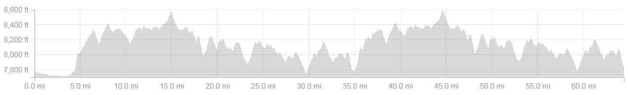 2017 Full Growler elevation profile courtesy of Strava, the first five miles is a neutral roll-out from downtown Gunnison to Hartman Rock's Recreation Area. SALIDA BIG FRIGGIN LOOP: 10 June 2017, Salida, Colorado 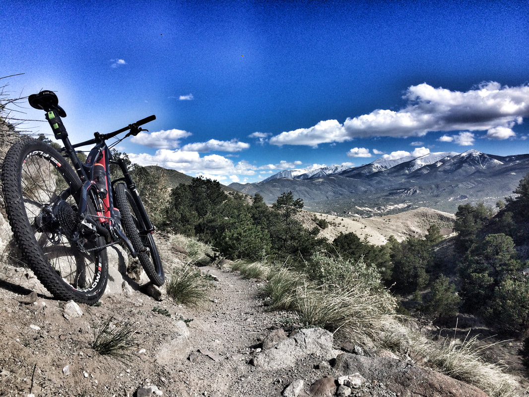 An image taken (days before the race) in the Arkansas Hills, part of the trail system included in the Salida Big Friggin Loop. There's a lot that's tough about the self-supported (no aid stations, no course markings, etc) Salida Big Friggin Loop (SBFL). An event, like many others (perhaps all) from the Colorado Endurance Series, that's been described as ultra-endurance. As this implies, the SBFL is considered a step above, i.e., harder than, events that fall under the endurance category including the popular Leadville Trail 100 mountain bike race. But rumors and opinions aside, whether or not the SBFL is "ultra-" versus within the "normal" range of endurance-style brutal is probably best decided by a participant that's competed in both events. That's what I signed-up for in 2016 (both events), in 2017 I returned to the SBFL (but not the Leadville 100) for a second time with a goal to win the event overall. This would be my first, premeditated attempt, at actually winning a bike race, part of an amazing, personal and athletic journey from 2013-14, "just finish without being run-over"; to 2015-2016, "see if you can win your age class"; to 2017, "lets see if you can win the whole thing!" In my first rendezvous with the Salida Big Friggin Loop. despite gong off-course for about 21 minutes, I finished 2nd overall just a few seconds ahead of the third place finisher. Ahead of me, by a convincing ca. 45 minute margin, was my good friend and mentor, Ben Parman (aka, "the Parmanator"). In 2017, I wanted to return to the event with the knowledge of the course that I had stock-piled in 2016. I also wanted to deploy a more aggressive, and hopefully effective, water and food strategy. Going into the 2017 race, I felt that if I could keep the air in my tires, stay on course, maintain an uncomfortable endurance-tempo pace throughout, and eat and drink sufficiently, then I had a chance to cross the line first overall. As far as nutrition, plan and implementation, I consumed an original GU gel (not Roctane, too expensive) or Organic Honey Stinger Waffle every ca. 45 minutes. If my stomach was feeling a little too sweet then I went with the waffle, if it was feeling content, neutral, then I went with the gel. Importantly, I started eating right-away including a gel a few minutes before the neutral roll-out from town. At the 2017 SBFL, I raced for 10 hours and 2 minutes, so that's roughly thirteen feeds, combined gels and waffles. As far as calories consumed, my guess is I ate about nine gels and four waffles (total 13 feeds). GU gels are about 100 calories each, waffles about 140 calories, 9x100 + 4x140 = ca. 1460 calories consumed during the race. As of 2016, I've been using only water, no dissolvable mix of any kind, in my Subculture Cyclery (Salida, CO) bottles. For hydration, I started with two 26-oz water bottles which were, in hindsight, not enough for the first 50 miles of the race, Salida to Buena Vista, via the Colorado Trail below Mounts Shavano, Antero, and Princeton. The summits of all three of these peaks exceed 14,000 feet, part of a stunning alpine backdrop that rises majestically from the floor of the Arkansas Valley (Collegiate Peaks Wilderness). If, in the future, I line-up at this event for a third time, I'll certainly stash a water bottle somewhere between Mount Shavano and the base of the Mount Princeton climb. I feel that the only mistake I made, as far as hydration, was not stashing a bottle in this section. The two bottles that I carried from Salida were essentially finished by the time I was part-way up the difficult Mount Princeton climb, a paved and dirt road climb that reconnects racers to the Colorado Trail. Not dehydrated but definitely parched, I was finally able to resupply water at the local tennis courts east of downtown Buena Vista (BV). In roughly two minutes, I drank 20 ounces or more and then refilled my two 26-oz bottles. From here, I ascended to Trout Creek Pass, about mile 68 on the course, before descending to my first, 24-oz, water stash roughly two miles away. The day before the race, as I'd done in 2016, I spent some time stashing water on the back-40 miles of the race course. After a longer descent and some climbing, roughly twelve miles from Trout Creek Pass, I arrived to my main stash, two bottles + six original GU gels stuffed into a water bottle. Much later, at about mile 98 out of 108, I picked up my last 26-oz bottle before the final, significant, dirt road climb. Because of that last 26-oz stash, I had access to water during the hottest part of the day as I navigated (up and down) about 10 miles of single-track through the Arkansas Hills, eventually to the same location in downtown Salida where the race started at 6:30 in the morning, Cafe Dawn. The neutral roll-out (not enforced but generally followed) ends when the pavement turns to dirt whilst ascending from Salida to about 10,000 feet on the slopes of Mount Shavano. Unlike 2016, I decided to keep this section of the race reasonable, not going too deep, but at the same time trying to keep the fastest riders within sight all the way to Blank's Cabin, the start of the Colorado Trail section. I met my goal and felt good on the climb. When I reached Blank's I entered the woods among the top four or five. Subsequently, I was quickly caught and passed before a significant hike-a-bike on a rocky, loose, and steep ascent. But at the top, I quickly regained that difference and rode on to the next wheel. I was probably a little too hot on the throttle after that ascent, but in hindsight I must not have gone too deep either because of how well I was able to maintain my pace late in the race. I caught the lead rider well before the descent into the Mount Princeton Valley, Part-way up the asphalt section of the Mt. Princeton climb the same rider came into view below, but I'd see him for the last time as I approached the Colorado Trail on the upper slopes of Mount Princeton. Throughout the day, even as I was approaching the finish line at Cafe Dawn, I was looking over my shoulder. Many miles before the finish, a look over my shoulder at Chubb Park, not far from the famous South Park, gave me a lot of encouragement towards the conclusion that I might be far ahead, perhaps enough to hold onto the win. Nonetheless, I remained vigilant and on the pedals throughout the day. Because of careful planning, food and hydration, and perhaps backing-off on the opening climb, I suffered much less along Aspen Ridge, ca. miles 94-98, than in 2016 when I was barely able to rotate my pedals on what seemed like endless climbs and far-too-short descents between. For sure, I was hurting in 2017 through Aspen Ridge but it was a hurt that I could withstand without descending into mental anguish and a desperately slow, grinding, cadence. Knowing where I was, how much climbing was ahead, etc, was also a huge advantage relative to my previous experience. At the top of Aspen Ridge, it seemed, based on what I hadn't seen behind me at Chubb Park or elsewhere, that the race was mine to win or lose, all I had to do to achieve the former was maintain a reasonable pace to the finish, enough to stay out front without seriously risking a crash. I wouldn't say I dropped Cottonwood Trail with extreme caution, but I certainly backed-off my fastest pace, especially when approaching rocks that could have easily been my tires undoing. Following that descent, a section that I enjoyed despite how many miles I'd raced that day, I rolled-out of the Arkansas Hills to the palatial view of the Arkansas Valley, Arkansas River, and Salida, below. Soon thereafter, I crossed the train tracks adjacent to town, navigated a fence opening, crossed the F-Street bridge, made a right, and finally, dodged traffic at the last street crossing before rolling to the finish. When I began bike racing back in April 2013, three years after I'd purchased an entry-level mountain bike, my first bicycle since I was about 16 years old, I did not anticipate that I'd eventually find my way to bike racing, doing well as a bike racer, and certainly not winning an ultra-endurance mountain bike event. I'm grateful that chance navigated my journey to cycling and all that the sport has taught me along the way. No doubt, no matter what comes or goes in my life, a small part of that journey, winning the SBFL overall, will remain a fond and often replayed memory. Note, I also won (overall) the FoCo 102 earlier this year, so technically the SBFL was my second overall victory as an amateur, endurance, mountain bike racer. Unlike the SBFL, the focus of the FoCo 102 for the majority of competitors is mainly social, hence my decision to focus, as my first win, more on the SBFL than the near-equal in difficulty FoCo 102. All that said, perhaps I should focus more on the 102 as my first victory? Preferences aside, there is no doubt that my overall win at the 2017 edition of the FoCo 102 will remain, like the SBFL, a highlight of my racing accomplishments and as such, a fond memory. I want to thank Road 34 for developing, organizing, and hosting the FoCo 102, Lastly, I want to encourage any of my readers that might be living in or close to Fort Collins, Colorado, to add the FoCo 102 to their bucket list AND to sign-up for events, such as 40 in the Fort, that will be part of the upcoming, July 21-23, Tooth or Consequences Mountain Bike Festival. Local races are easy to attend, easy on our budget, and most important, they are easy on Planet Earth: far less fuel and other non-renewables are consumed to support our cycling passion when we race locally. Also, if we don't support our local events then those will eventually go away, a sad conclusion. Go online and sign-up today, and tell your friends to do the same. I'll see you out there. 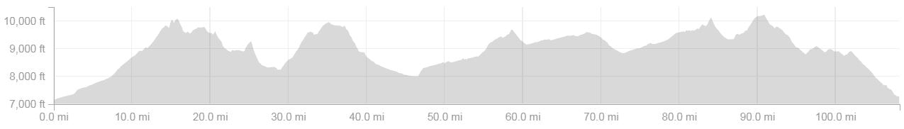 2017 Salida Big Friggin Loop elevation profile courtesy of Strava, the initial climb ascends from downtown Salida, Colorado, to the upper slopes of Mt. Shavano, part of the Collegiate Peaks. FAT TIRE 40: 24 June, Crested Butte, Colorado 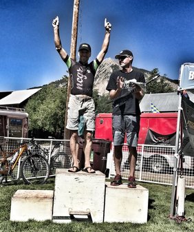 Crested Butte, Colorado, widely known for epic, high-alpine scenery, is equally well known for it's mountain biking community, including a very accomplished cohort of pro and elite-amateur racers. And not too far away, a few miles down hill on the only paved road that joins the two celebrated mountain towns, Gunnison is home to an equally respected community of mountain bikers that fill the spectrum from social to high-octane rockets. Early in my mountain biking adventures, well before I initiated training and racing, a friend, Phil Street, generously invited me to visit him in Crested Butte. That was my first visit to the extraordinary backdrops surrounding the town, often referred to as simply "CB". Pretty quick, I was hooked on the views and what I sensed were the priorities of the town, which seemed to favor proximity to nature and outdoor recreation as a good life's highest priorities. Of course, if you favor both then you will likely be very good, given hours of practice, at whatever sport(s) you favor. When mountain biking came into being, in ca. the 1970's, Crested Butte and nearby Gunnison, where people share the same priorities, quickly developed and expanded the sport (Crested Butte may even be the origin of the sport itself, more details). Eventually, both towns would become famous for their feats on mountain bikes, both professional and amateur. Before I departed CB on that initial trip, Phil led me on two rides from town. Despite my pace, well off his wheel most of the time, Phil encouraged me throughout. From CB we traveled down to Gunnison, spent a day riding at Hartman Rocks, where I would years later win my age class for the first time as an amateur, and then drove out to Fruita and Loma for more mountain biking adventures. The whole trip was a breathtaking eye-opener to the scenic splendor of Colorado and areas regarded as some of the very best in the United States for mountain biking. I took it all in, cherished it, and dreamed about the future including returning to Crested Butte. Years later, as I improved as a racer and interacted more with the mountain biking community, I found myself thinking about what it would mean to me to race amidst the communities of cyclists that I'd come to respect, starting from those initial trips with Phillip, in the highest regard. Early-on, I satisfied that curiosity, in part, by competing in the Original Growler in Gunnison, Colorado, for the first time in 2014; and then returning to the Growler in 2015 and 2016, both years I finished first among age 40-49, amateur, competitors (geared). As these details reveal, I accomplished my wish to compete in Gunnison early in my racing career. Along the way, each time I returned to Gunnison, I remembered my similar bucket-list dream to race among the elite up the hill, in nearby Crested Butte. One week before the event was scheduled to start, a teammate mentioned that she was planning to attend the Fat Tire 40 in Crested Butte, part of Crested Butte Bike Week, and she thought that I should come along and throw-down amidst the local and visiting, elite-amateur, mountain bikers. I don't usually race events as short as 40 miles, more typically I favor (and my finish placements do as well) much longer events (65-100 miles). But this was CB and I was eager, as I outlined above, to take part in an event in that valley. My schedule also was open on this weekend (June 24th), that too contributed to what happened next, a hasty decision, all in a day, to sign-up! A comfortable 8 am start and neutral roll-out opened the 2017 edition of the Fat Tire 40. So comfortable that I was even able to weigh-in on a conversation with the fastest guys in the race, including number two finisher of the day Bryan Dillon, USA Pro Team Topeak-Ergon. As I'd done earlier in the year at the Growler, I stayed within the top few racers directly behind the neutral pace vehicle, that is until the car pulled-away and the pro and nearly-a-pro group increased their pace. Following that surge, I dropped, very quickly, to about mid-pack. Along the way, I tried not to think too much about it. Instead, I tried to focus on smooth, efficient, pedaling. Before the race transitioned from pavement to single-track, by now within Mount Crested Butte above CB, I'd made up some ground including a last minute 3-person pass just before my tires made contact with the dirt. By the way, for this event I used the same tires (by now the rear showed significant wear) as the SBFL, Vittoria Saguaro 2.20 front and rear. Overall, I was impressed by their performance in both events, the non-aggressive tread pattern provided noticeably more grip than the tire I traditionally use for training and racing on dirt, Specialized Fast Trak Control 2.1-2.2. However, I'm not convinced that either tire is what I'll commit to moving forward. For the 15 July 2017 edition of the Durango Dirty Century, I'll be rolling with a Maxxis 2.2 Ikon EXO (rear) and 2.2 Ardent Race EXO (front). When racing in a valley with the reputation of CB, no one should be surprised when the trail gets technical. Right away, the opening single-track (Upper Loop to Upper Upper) became festooned with rocks and roots, occasionally broken by short, anaerobic climbs, and longer sections of flow where the aspen trees closed-in and threatened to catch your handlebars. At times like these, when the trail gets technical, I'm fortunate to be from Fort Collins where the trails are often the same. The opening trail allowed me to pass many more competitors. By the time I reached the first section of dirt, I was warmed-up and feeling confident. From Upper Upper the course transitioned to dirt road for a few miles before connecting to the Strand Hill (dirt) road climb. I settled-in as I monitored riders that were coming from behind, when I needed to I picked-up my pace to maintain the gap. The back-side of Strand Hill is a fast descent on mostly, non-technical, single-track. However, just before the exit above the same road, and nearly the same point, where the Strand Hill climb began, is a narrow, steep, washed-out gully in place of where a trail once descended. When I came face-to-face with this unanticipated gulch I was carrying a lot of speed. I tried to shave some of that whilst redirecting the bikes trajectory towards a deeply entrenched trail between two walls of stone. I'm not sure where I failed, but the next moment I was on my feet, the bike was laying between the walls, and I was focused on my right ring-finger. Somehow I'd dislocated the primary knuckle. Later, a teammate with medical expertise, advised that I might have also broken the finger and damaged a tendon. Back to the trail, I felt that I could ride on. I straightened my handlebars, not quite enough in hindsight, and remounted. For about 10 minutes my finger caused me a lot of pain. But as I approached the ascent that would lead to Deer Creek most of the pain subsided and I was able to refocus on the usual endurance-tempo discomforts. Most of 20 minutes went by as I climbed the dirt road up to the Deer Creek Trailhead. From that point, another hour passed as I climbed and then descended Deer Creek through what must be one of Colorado's most spectacular, scenic, landscapes. On either side of the trail, wildflowers, dominated by mule's ear and lupine, inspired vast meadows with their colors as they held fast to steep slopes above and below the trail. Above this wildflower extravaganza, in the alpine zone, I could see deep pockets of late season snow interlaced with extensive talus slope and exposed bedrock cliffs. Below a green forest filled the valleys down to pastures and homesteads. In the same view, Crested Butte's namesake rose from the valley floor in majestic fashion. Despite all of this scenery, I managed to stay inside my endurance-tempo pain cave. And the descent down the back-side of Deer Creek was fast and fun (other than when I reached out to catch a slip and smacked my sore finger). At the bottom of Deer Creek the course returned to gravel, busy Gothic Road. From here, I descended, whenever possible, in the super tuck on my top tube. Along the way I passed at least one more competitor, maybe two. And also, crossed paths briefly with my NCGR teammate, Bill Bottom. He was kindly hauling water bottles up for friends and teammates. Unfortunately, I passed him (opposite directions) with such haste that I missed the chance to get a bottle. At the base of Mount Crested Butte the course returned to single track, and soon the final ascent before the final drop back to Crested Butte and a short road section into town. More than anywhere else on the course, I suffered on the Lower and Upper Meander climbs. I had gone into this race carrying a margin of fatigue more than I would have wanted, ideally, and I think that margin began to take affect on this climb. Nonetheless, I eventually climbed over the top, under idle ski lifts, and began the descent. Right away, my next competitor was directly ahead of me, but as I opened my suspension my rear tire suddenly deflated. As we often do in a race, I tried to ignore my fate, and rolled on for about a minute before stopping to assess the damage. I wasn't carrying CO2 cartridges, only an exceptional hand pump from Lezyne Engineered Design. After searching for a side-wall tear, I didn't find one, I went to work partially re-inflating the tire. Unfortunately, that initial re-inflate didn't last long and I was off the bike a second time, swearing a bit, and trying once more to re-inflate without installing a tube. This one held, not completely but enough to get me to the finish line. At this point in the race, the final miles, it's a pity that I had to stop twice and, in between, shave so much speed to avoid damaging my rear hoop, I think I could have passed, certainly one, and maybe even a couple more competitors on that descent and ride to town. I was feeling good and my descending instincts were firing efficiently after the opening 35 miles of racing in technical terrain. Of course, it could have been much worse, not only the tire incident but also my high-speed crash. So for these reasons, I'm grateful that I even finished, let alone in first place overall among amateurs aged 40-49. Even better perhaps, I finished second among all amateurs and just six minutes off the wheel of the first place amateur finisher. Adding to my accomplishments, I was 19th overall out of 122 including the freakishly fast pros. Getting back to my early experiences and bucket lists, racing in the Fat Tire 40 delivered what I'd anticipated all along, a very special day of racing, a fond memory, and plenty of inspiration for the future; a mangled finger, deflated tire, and other mishaps withstanding, it's all part of the process and part of racing.  2017 Fat Tire 40 elevation profile courtesy of Strava, the initial 1-2 miles is a neutral roll-out through downtown Crested Butte. 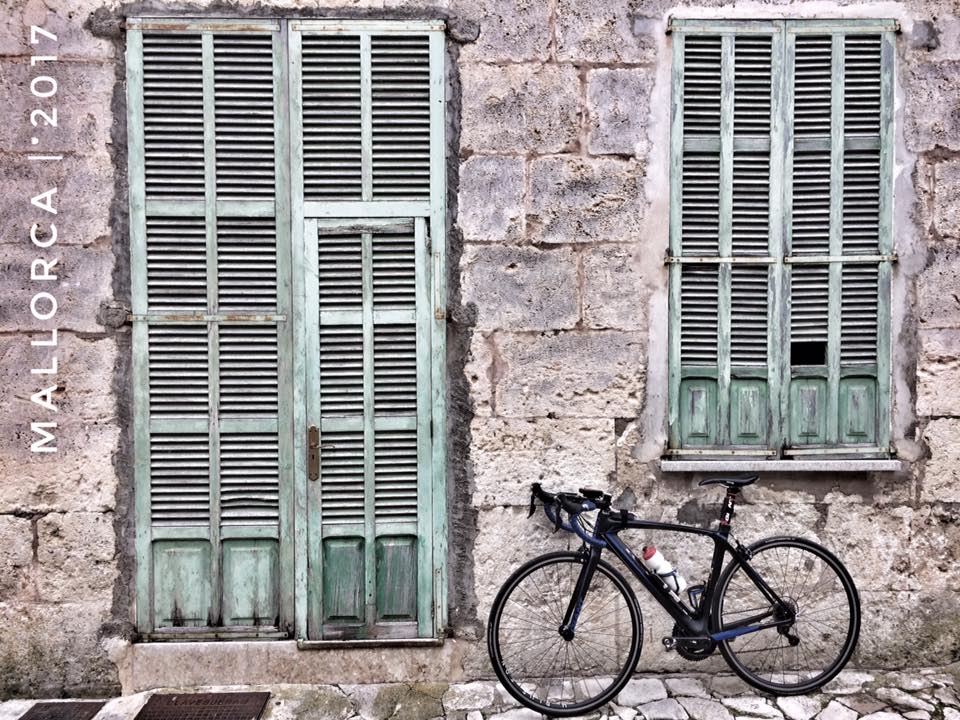 Below I recall the development of my decision to travel from Hamburg, Germany, my winter residence, to the island of Mallorca, Spain, to initiate training for the 2017 endurance, mountain bike, racing season. This is followed by my thoughts and a few of my experiences on the island over the 26 days that I based my cycling, personal, and business life out of the Village of Santa Margalida in a house built during the lifetime of Galileo Galilee in the 17th-century. In my next blog entry, I'll discuss my experiences from August 2016 to April 2017 self-coaching for the first time since I initiated non-recreational cycling (training and racing) on April 1st, 2013. 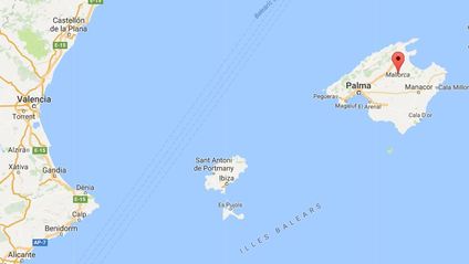 From my winter base camp perspective, gazing-out the window from the third floor of an old brownstone on the Bismarckstrassa in Hamburg, Germany, it has been easy for my mind to slip comfortably into day-dreams framed by relatively nearby places where a motivated cyclist could, sensibly, spend part of the winter. I recall being afflicted by these dreamscapes shortly after I arrived to Hamburg for the first time, in September 2015. However, foremost in this evolution of an idea were days spent wandering on my Giant TCR Composite 1.0 road bike through the picturesque countryside of northern Germany. Despite this early contemplation, crystallization and the courage to go where I had not gone myself, despite an obvious and well beaten path pioneered by countless European cyclists, did not make it's debut until part-way through my second and most recent stint in Deutschland. From that point, however, my arrival at a 17th century doorstep in the modest, remote, and generally sleepy, retirement village of Santa Margalida, on the island of Mallorca, Spain, moved along with some haste; and in hindsight I anticipate 'no regrets' forthcoming, only very special memories to celebrate and inspire. After nearly five months residing in a city known to Charlemagne, "King of the Franks from 768, King of the Lombards from 774 and Emperor of the Romans from 800" (Wikipedia), I boarded a local air-carrier on 3 February, 2017; from Hamburg, a few hours later, I landed in Mallorca or Majorca. Spelling preference aside, shortly after arriving I picked-up a scheduled rental car which I rarely used but nevertheless retained for the entire month of February for less than 100 Euro, no doubt one of the benefits of visiting the Mediterranean island, located about 320 kilometers (ca. 200 miles) east of Valencia on the Spanish mainland, during a month when the majority of European cyclists felt the island was too cool and too wet for their pleasure. Regarding those goose bumps and wet fannies, respectively, I'd conclude, in contrast, that I suffered almost not throughout my stay, from cold, or wet, conditions. Much more prominent was the wind, an atmospheric disturbance reliably detected any month of the year on Mallorca. But that too was easily forgotten, on most days, a few notables withstanding, and thus certainly not an omnipresent deductible that had to be factored out of my otherwise unfettered, often gleeful, cycling happiness. Thanks to modern conveniences, namely a cell phone paired with a carrier (O2) providing EU-wide access to the internet with a whopping 7 GB of data for just 40 Euro a month (when I returned to Germany they dropped the monthly rate to just 20 Euro), navigational and other challenges I encountered in Spain were easily overcome in the usual way, tapping and sliding across the various made-for-smart-phone interfaces. Those conveniences allowed me to quickly locate my home for the next month in Santa Margalida which I booked through AirBnB for about 1200 Euro all inclusive (ca. 1350 USD, 25 nights). Here's the link to the property which I would recommend without any hesitation, the property and the managers, including the home owner, were fabulous. Below I've shared a few photos of the property including the view from the 3rd-floor rooftop sitting and dining area. Keep in mind, if you contact Mateu (owner) and Natalie (property manager) about renting this property, that the rate I received was off-season. You may have to pay more per night to rent the Galileo House but the conveniences (location) and experiences (the village and the house) will easily make-up for the cost. The morning following my arrival, 4 February, training officially began for what would be, and only the universe knew then and now, my 2017 season as a amateur, endurance mountain bike, racer and athlete. Armed with a route I'd built using software familiar to me from my European Tour in October 2016, ridewithgps.com, and my Garmin eTrex GPS, I rolled downhill from the Galileo House into wonderland. By the way, I nicknamed the house after Galileo because the structure was built in the 17th century, the century when Galileo published his best known contributions to Science, such as The Assayer (1623). As I rode into the countryside on a typical, mostly sunny, comfortable, no doubt breezy (can't recall) day I mentally pinched myself several times to ensure that I was in fact not daydreaming and still somewhere far to the north in the German countryside. What lay before me was a place with similarities to other places I'd visited but it was still a picture of it's own. Dominated by limestone bedrock that was formed during the Cretaceous when most of central Europe was under a warm, tropical, inland sea, that same limestone remains prominent in all of the architecture noteworthy on the island, including walls, houses, churches, etc. It also dominates the sites between, from stony fields to remnant crags of a foregone continues layer of stone that was once a soft, gooey mud, at the bottom of a nearly forgotten sea (by all but a few geologists and curiosity seekers like myself). The only exceptions to this limestone predominance were formations, granitic and metamorphic types, that I encountered in the Tramuntana Mountains. The Tramuntana present a towering northeast-southwest trending series of summits and valleys that stretch the full length of the island, from Palma to Cap de Formentor. Most of the island is below those mountains and consists of a gently rolling landscape. On the valley floors within and below the mountains, agriculture including potato crops and other vegetables in the lowland valleys and mostly (it seemed) olive production up high are the norm including extensive orchards arranged on ancient terraced slopes. Citrus down low was also common as was much more than I was able to identify whilst whizzing past on my bicycle saddle. Fortunately, each week I visited the local, Santa Margalida, market, a few blocks from the Galileo House, I discovered the full extent of food types that were grown or raised on the island. And for just a few Euro, I struggled to haul all that my eyes desired, it seemed, back to the Galileo House. On my first ride (4 February) I quickly arrived at the village of Muro, about seven kilometers from Santa Margalida. Later on I'd find my way, by chance or planning, to many more of these seemingly ancient towns peppered everywhere on the lowlands, well spaced and defined by agricultural lands. The many images below hopefully capture the feel and the age of these communities. I was often distracted as I rolled through each one, several of them many times over the month I resided on the island, enough so that it was not unusual to miss a turn and then decide to, or not, forge ahead into a new piece of what seemed like my own, private, and splendid cycling infrastructure over the initial 2-3 weeks that I was on the island. After that initial period, it became clear that many more cyclists were arriving each day and by March the island might be accommodating more bikes than cars, something that the locals claimed was true at the peak of the tourist season on the island, a tourist season obviously dominated by cyclists. So-much-so that some hotels on the island hosted not just one, but two fully stocked bike shops! Long ago I discovered that anything is possible in wonderland, nonetheless that little detail, bike shops integrated into hotels, still sends me into the depths of my childhood with all of the naive satisfaction that the description implies. From this point twenty-six days vanished but not without delivering more adventures than any other 26 day period in my life. Whether I was training in the lowlands, below the mountains, or navigating above views of the Mediterranean Sea, partially concealed by peaks rising to as high as 1445 meters (ca. 4740 feet), Puig Major, I was always stitched into a reality that inspired me to consider, almost exclusively, the good parts of life including adventures that I might otherwise have not considered but were now firmly entrenched in my day-to-day dreamscape. Before I reluctantly departed the island, along with my girlfriend, Clarissa Knorr, I exercised my body and my Giant TCR Comp 1 a distance covering 1896 kilometers (1178 miles). My biggest week was 655 kilometers (407 miles); my biggest ride was just over 324 kilometers (201.5 miles) including 4681 meters (15,358 feet) of elevation gain (that was a personal record by the way, distance and climbing). From the perspective of a cyclist opening-up their season of training and racing, Mallorca couldn't be much better, no doubt it is one of the very best options for so-called "spring" training in Europe. Whatever is needed, as far as terrain, flats, short and long climbs, etc, the island delivers in bountiful diversity. And for those travelers that are primarily interested in culture, history, and a slower pace, the island also delivers in copious portions, including tombs that date back to the 7th-century BCE. For sure, anyone that makes their way to this splendid little Spanish island will come away glad that they gave way to the wanderlust inside them.
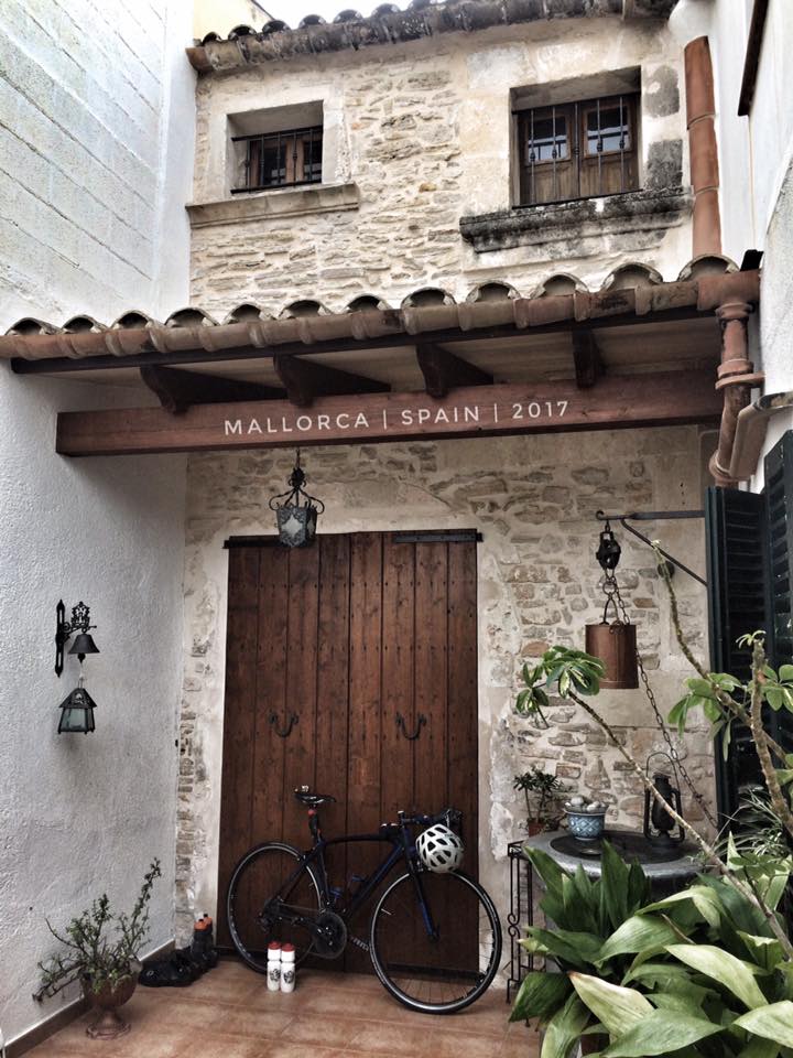
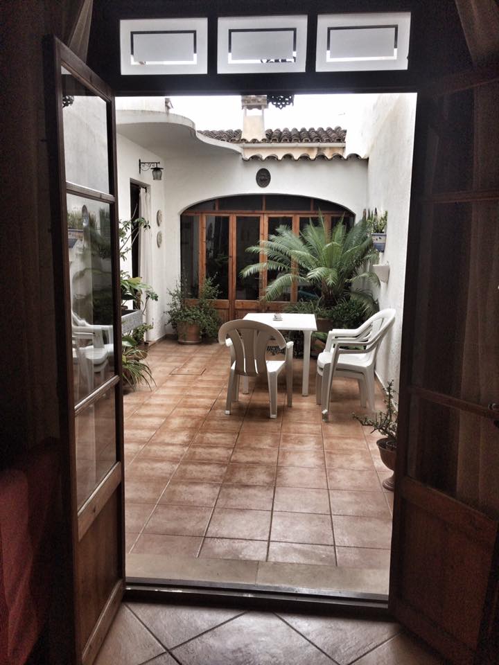
 Galileo House, Santa Margalida, Majorca, Spain. 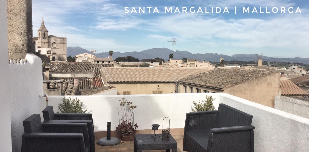 Galileo House, Santa Margalida, Majorca, Spain. 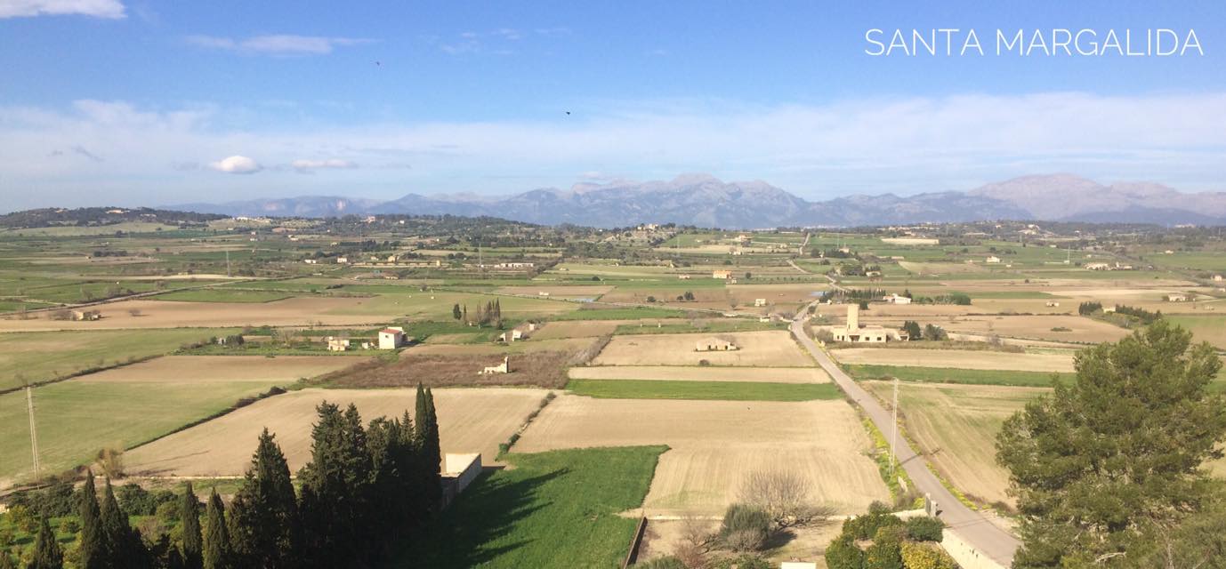 The view looking north from the main church in Santa Margalida towards the Tramuntana Mountains.
   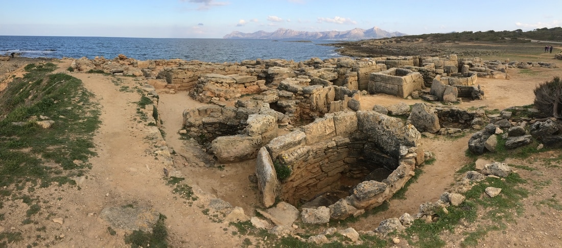 Tombs dating from the 7th Century BC to 1 AD that were built for ca. 300 people. You can easily view these tombs by taking a short walk from the southern end of Son Serra de Marina on the east shore of Majorca. |
�
André BretonAdventure Guide, Mentor, Lifestyle Coach, Consultant, Endurance Athlete Categories
All
Archives
March 2021
|
 RSS Feed
Quick Links |
© COPYRIGHT 2021. ALL RIGHTS RESERVED.
|